Cliquez sur la photo pour zoomer
Prix : 15,00 €TTC
18-2019, tome 116, 4, p.681-704 - Robin Brigand, Yves Billaud Lhabitat Néolithique final de Beau Phare à Aiguebelette-le-Lac (Savoie) : nouvelles approches méthodologiques de la planimétrie dun village littoral de larc alpin
L'habitat Néolithique final de Beau Phare à Aiguebelette-le-Lac (Savoie)
Nouvelles approches méthodologiques de la planimétrie d'un village littoral de l'arc alpin
Robin Brigand, Yves Billaud
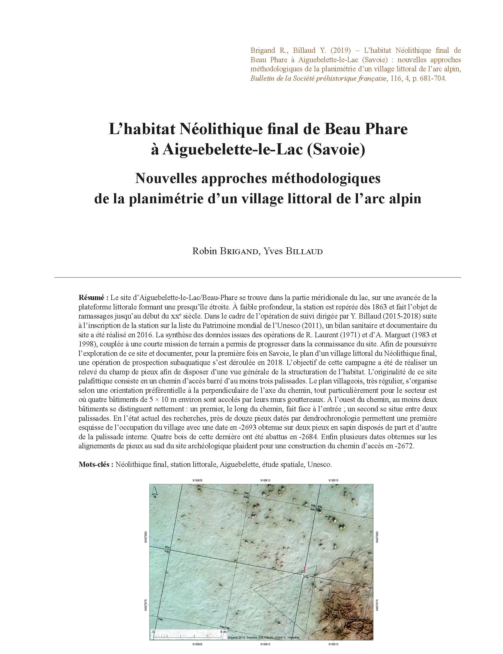
Résumé : Le site d'Aiguebelette-le-Lac/Beau-Phare se trouve dans la partie méridionale du lac, sur une avancée de la plateforme littorale formant une presqu'île étroite. A faible profondeur, la station est repérée dès 1863 et fait l'objet de ramassages jusqu'au début du XXe siècle. Dans le cadre de l'opération de suivi dirigée par Y. Billaud (2015-2018) suite à l'inscription de la station sur la liste du Patrimoine mondial de l'Unesco (2011), un bilan sanitaire et documentaire du site a été réalisé en 2016. La synthèse des données issues des opérations de R. Laurent (1971) et d'A. Marguet (1983 et 1998), couplée à une courte mission de terrain a permis de progresser dans la connaissance du site. Afin de poursuivre l'exploration de ce site et documenter, pour la première fois en Savoie, le plan d'un village littoral du Néolithique final, une opération de prospection subaquatique s'est déroulée en 2018. L'objectif de cette campagne a été de réaliser un relevé du champ de pieux afin de disposer d'une vue générale de la structuration de l'habitat. L'originalité de ce site palafittique consiste en un chemin d'accès barré d'au moins trois palissades. Le plan villageois, très régulier, s'organise selon une orientation préférentielle à la perpendiculaire de l'axe du chemin, tout particulièrement pour le secteur est où quatre bâtiments de 5 × 10 m environ sont accolés par leurs murs gouttereaux. A l'ouest du chemin, au moins deux bâtiments se distinguent nettement : un premier, le long du chemin, fait face à l'entrée ; un second se situe entre deux palissades. En l'état actuel des recherches, près de douze pieux datés par dendrochronologie permettent une première esquisse de l'occupation du village avec une date en -2693 obtenue sur deux pieux en sapin disposés de part et d'autre de la palissade interne. Quatre bois de cette dernière ont été abattus en -2684. Enfin plusieurs dates obtenues sur les alignements de pieux au sud du site archéologique plaident pour une construction du chemin d'accès en -2672.
Mots-clés : Néolithique final, station littorale, Aiguebelette, étude spatiale, Unesco.
Abstract: The site of Aiguebelette-le-Lac / Beau-Phare is one of two final Neolithic settlement sites on Lake Aiguebelette. It is located in the southern part of the lake, on an extension of the shore platform, which forms a small peninsula to the north of Lépin Castel. Situated in shallow water (between 0.5 and 2 m in depth), the site was first identified in 1863 and was a focus for artefact collecting until the beginning of the 20th century. Following the inclusion of the site on the Unesco list of World Heritage Sites in 2011, Y. Billaud undertook the direction of a monitoring project, which included a condition assessment and bibliographic survey of the site conducted in 2016. A review of data produced by R. Laurent (1971) and A. Marguet (1983 and 1998), coupled with a short fieldwork campaign, significantly advanced our knowledge of the site. The extent of the site was established and an entrance path, which traversed three palisades, was identified and mapped. An area of 100 m² at the centre of the site was surveyed, bringing the total area recorded to 230 m².
As part of the continuing exploration of the site, an underwater survey was carried out in 2018. The aim of this campaign was to plot the surviving timber piles in order to obtain an overview of the layout of the village. Prior to the recording of the piles, a 3600 m² grid was laid out. Depending on the area of the site and the density of piles, each 10x10 m square was subdivided into four intermediate units, each measuring 25 m². Some 1401 piles were plotted within an area 2600 m², which brings the number of recorded piles to 1670 out of a total of about 3000 for the entire site. The survey report throws considerable new light on the layout of the site. The gently curving access trackway crosses the village and extends as far as the northern extremity of the peninsula. It is formed by two parallel rows of piles, positioned some 1.6 to 2 m apart. The line of the path has been traced over a distance of about 90 m. Located to the east of the central axis of the peninsula, the trackway slopes gently upwards (0.7%) as far as the inner palisade before rising more steeply at the entrance to the village. It is formed of almost 290 piles, which are predominantly small in diameter and protrude only slightly above the sediments. The most evident entrance to the village is located on the axis of this trackway. It is formed of two rows of contiguous piles, which form a narrow bottleneck measuring less than 1 m in width. Some dendrochronological dates suggest it was built with trees felled in -2672.
At least three palisades have been identified, representing several phases of building and re-building. The outer palisade forms the first enclosing element, which would have been encountered by approaching the site from the south. On the western side of the trackway, a single line of posts can be observed while to the east three roughly parallel lines are visible. The middle palisade features a marked dissymmetry between the sections to the east and west of the trackway. On the western side, it is composed of 24 piles spread out over a length of about 25 m. To the east of the trackway, its morphology is similar over a length of about 7 m: it is composed of densely spaced piles, which are medium size and very eroded. The line of the inner palisade is difficult to discern apart from an initial section at the east and a second section corresponding to the topographical ???centre??? the 1998 survey. Four piles belong to trees felled in -2684. The two segments of this palisade are typologically similar to the middle palisade: they are composed of piles of various dimensions, but always quite small, which are positioned very close together (less than about 0,5 m apart). The easternmost section is interesting because it does not form a straight line but instead but appears to form a dog-leg to the south-west where we observe five aligned piles. At this point, the gap in the palisade resembles an entrance and is precisely located in the continuity of a south-west/north-east orientated circulation area.
The layout of the village is very regular with most buildings orientated perpendicularly to the axis of the pathway, particularly in the eastern sector. To the west of the access path, we can distinguish four buildings. The westernmost of these is perhaps the most easily identifiable; the small building, measuring 4 m by 6 m and orientated east/west, is composed of relatively large piles. The roof and foundation piles, intended to support the roof ridge and sill beams, are generally over 12 cm in diameter and, based on field observations and the heights of the surviving cones, appear to be of hard wood. Located a short distance to the north-east, we observe a second similar building. Also orientated east/west, this small building (4 x 7 m) is formed of three rows of posts; it too is supported on relatively large piles.
An enigmatic building lies in the southern part of the village, between the inner and middle palisades. Measuring about 5 by 8 m, it is directly adjacent to the pathway and the three rows of posts that delimit it are orientated north/south. The posts located at the extremities of the three rows are paired and have a diameter of more than 14 cm. The small number of piles to support the sill beams, and the absence of posts to support the cross-pieces, suggest that this building lacked a raised floor, or indeed any type of floor, and may have been open-sided. Its dimensions, its location adjacent to the pathway and its architecture do not suggest a domestic structure. While its exact function remains unknown, we could hypothesise that it acted as an area for the storage and drying of timber, or perhaps as a workshop or warehouse.
The largest building in the western sector is located at the centre of the site, facing the entrance within a space marked by a very high concentration of piles. Measuring about 5 by 10 m, this building is formed of three north-south orien tated rows of piles. The eastern and western rows are formed of six groups of posts that delimit five bays. The posts are generally quite substantial (between 17 and 20 cm) and are of hardwood with very well-preserved erosion cones. At the centre of the structure, the row of posts intended to support the roof ridge is clearly identifiable, particularly in the southern part of the building where they are arranged in pairs.
In contrast to the central building, the roof ridges of the other buildings in the sector are orientated perpendicular to the axis of the pathway. The buildings are thus arranged adjacent to each other with their long sides orientated east-west thereby reducing their exposure to the prevailing wind which blows down the Epine Mountain. Nine rows of piles, positioned 1.5 to 2.5 m apart, are visible and their high density probably reflects the permanence of occupation at this spot, with considerable evidence for repairs and extensions. The architectural reconstruction of these buildings is somewhat trickier. The traditional widespread model of buildings composed of three rows of weight-bearing posts would allow us to envisage three buildings measuring about 4 by 12 m.
For the first time in Savoie and Haute Savoie, we have been able to obtain the partial plan of a lakeside village dating to the third millennium BCE. The extensive topographical survey covering an area of 2500 m² has yielded concrete evidence regarding the organization of the village and the structuring of its principal constituent planimetric elements. The unique and rich nature of the site stems from its probable short duration, which allows us to identify the general layout of the habitation areas and storage areas.
Keywords: Late Neolithic, pile dwelling settlement, Aiguebelette, spatial analysis, Unesco.
Autres articles de "Bulletin de la Société préhistorique française 2019"
21-2019, tome 116, 4, p.743-774 - Christophe Croutsch, Willy Tegel, Estelle Rault Les puits de l âge du Bronze du Parc d Activités du Pays dErstein (Bas-Rhin, Alsace) : des analyses dendroarchéologiques à l étude de loccupation du sol
Les puits de l'âge du Bronze du Parc d'Activités du Pays d'Erstein (Bas-Rhin, Alsace) Des analyses dendroarchéologiques à l'étude de l'occupation du sol
Christophe Croutsch, Willy Tegel, Estelle Rault
Résumé : Entre 2006 et 2014, les opérations d'archéologie préventive réalisées dans le cadre du projet du Parc d'Activités du Pays d'Erstein ont permis d'explorer une superficie de 55 ha. Les décapages ont mis au jour plus de trois-cent structures datées de l'âge du Bronze : fosses, silos, vases-silos, grandes fosses polylobées associés à des puits à eau. Les occupations s'étendent du Néolithique final/Bronze ancien à l'étape moyenne du Bronze final. L'une des particularités du site est d'avoir livré des puits à eau avec des bois gorgés d'eau conservés à leur base.
Huit puits ont livré des restes de cuvelage en bois. Trois principaux types de structures ont été observés : les captages cylindriques, les cuvelages quadrangulaires en blockbau et les cuvelages assemblés avec des planches plantées verticalement.
Quatre-cent-soixante-cinq bois gorgés ont été échantillonnés et analysés. Cent-treize bois ont pu être datés. La synchronisation des séries sur les courbes régionales de référence du chêne a permis la construction de trois courbes moyennes : la première courbe a pu être calée entre 2354 et 2215 av. J.-C. ; la deuxième entre 2131 et 1571 av. J.-C. ; et la troisième courbe entre 1320 et 1002 av. J.-C. La longévité des puits est de l'ordre de quelques années à plusieurs décennies. Mais dans la plupart des cas, il s'agit de structures pérennes parfois utilisées sur plusieurs générations.
Grâce aux nombreuses dates dendrochronologiques, le site du Parc d'Activités du Pays d'Erstein offre l???occasion de suivre le rythme des occupations et des déplacements des habitats avec une résolution chronologique inhabituelle pour un site terrestre. Au cours de l???âge du Bronze, on observe une forte stabilité des modes d'occupation du sol caractérisés par la présence de petits établissements mobiles régulièrement déplacés et relocalisés à l'intérieur de leur terroir. Ce système semble bien en place dès le Bronze ancien et se maintient jusqu'au Bronze final.
Mots-clés : âge du Bronze, Alsace, puits, occupation du sol, dendrochronologie, dendrologie, roue en bois.
Abstract: Between 2006 and 2014, several preventive archaeological surveys of an area of 55 ha were carried out before the development of the Parc d???Activités du Pays d???Erstein. The excavations brought to light more than three hundred, mainly domestic, features (e.g. pits, silos, storage vessels, large pits associated with wells) dating to the Bronze Age. The excavation also revealed periods of human activity during the Late Neolithic/Early Bronze Age (Late Beaker Culture/Bz A1) transition, the Middle Bronze Age (Bz A2-B1 then Bz C) and the Late Bronze Age (Bz D and Ha A2-B1).
One of the particularities of the site is the excellent preservation of wood in the waterlogged conditions of the wells. These included eight linings, built from logs or hollowed tree trunks. Construction pits used to dig the wells contained three types of well linings that reached the ground water level: tube linings using hollowed out trunk sections, vertically planted planks and chest-like well linings using timber logs. The latter construction types were found in the same pit. Three linings consisted of hollow trunks probably using old trees. The chest-like linings used logs cut in half, whole logs or planks. The planks were split out of trunks in a radial or tangential direction. Only one lining used vertically planted planks (slabs).
The exceptionally well-preserved timbers allowed sampling and analyses of 465 waterlogged wooden finds. In total 411 wood samples were anatomically identified including eight species. Oak (Quercus sp.) dominated the species assemblage, followed by maple (Acer sp.), hazel (Corylus sp.) and beech (Fagus sp.). For the purpose of dendrochronological dating only oak timbers with more than 20 tree rings were analysed and it was possible to date 113 timbers. In 48 samples the outermost ring beneath the bark (waney edge) was preserved, allowing the determination of the felling year of the used trees. Moreover, the cross dating of the 113 tree-ring width series enabled the development of three site chronologies, which could be absolutely dated based on high visual and statistical agreement with different regional oak master chronologies. The first chronology includes 12 series and covers the period 2354???2215 BC, the second is based on 40 series covering the period 2131???1571 BC, and the third with 62 series could be synchronised between 1320 and 1002 BC.
The use period of the wells varies considerably from only a few years to several decades and in the case of wells that are regularly reused the period of use could be considerably longer. For some of the wells it has been possible to estimate the minimum duration of use and in many cases, these long-lived structures were used for several generations.
Owing to the high quantity and quality of dendrochronological data, the archaeological site of the the Parc d???Activités du Pays d???Erstein offers new insights into settlement dynamics and occupation periods with an unusually precise chronological resolution for a land based site.
The first occupation phase with about twenty structures located in the north and in the middle of the excavated area dates back to the Late Neolithic/Early Bronze Age. The well dating to this first phase contains timbers dating to 2231 and 2215 BC. After a hiatus of several centuries, a second settlement phase dates to between 1750 and 1715 BC, doc umented by only a few oak planks from the bottom of a well. A later settlement phase dating to between the end of the 17th century and first half of the 16th century BC is located to the north of the site where two wells were dug around 1615 BC. The few features of this phase can be attributed to Middle Bronze B1. For the following phase of the Middle Bronze Age C2 only a few features were found and excavated, but no wells are dated to this phase.
The settlement dating to the second half of the 13th century and the first half of the 12th century BC has several poles. Three wooden well linings date to between 1241 and 1208 BC and one earlier well was restored during this period (1237 BC). About ten features were excavated from this 75 years long phase of the Late Bronze Age.
The last phase covers the 11th century and the first half of the 10th century BC with features found all over the excavation area. Four wells date to this phase covering an 80-year period from 1078 to 1002 BC and were probably in use from the last quarter of the 11th century up until the first half of the 11th century BC. The 70 or so domestic features dating to the middle of the Late Bronze Age indicate a densely occupied settlement.
During the Bronze Age, the presence of small mobile settlements or homesteads that regularly moved and relocated within their territory, characterises stable land use patterns. This system seems, as the example of the Parc d'Activités du Pays d'Erstein shows, to be in place probably from the Early Bronze Age and maintained until the Late Bronze Age.
Keywords: Bronze Age, Alsace, well, land use, dendrochronology, dendrology, cartwheel.
20-2019, tome 116, 4, p.725-742 - Audrey Blanchard, Annabelle Dufournet, Geoffrey Leblé, avec la collaboration de Mohamed Sassi et Alexandre Polinski Un ensemble funéraire du Campaniforme / Bronze ancien : le site des « Touches » à Plénée-Jugon (Côtes
Un ensemble funéraire du Campaniforme / Bronze ancien
Le site des « Touches » à Plénée-Jugon (Côtes-d'Armor)
Audrey Blanchard, Annabelle Dufournet, Geoffrey Leblé,
avec la collaboration de Mohamed Sassi et Alexandre Polinski
Résumé : La fouille menée sur le site des « Touches » à Plénée-Jugon (Côtes-d'Armor) au printemps 2015 a permis de mettre au jour un ensemble funéraire composé de 13 sépultures. Situé sur un replat en milieu de pente, il se développe sur 170 m² en limite orientale de l'emprise. Les structures funéraires sont des fosses de formes quadrangulaires aux angles arrondis, orientées nord-ouest/sud-est ou ouest-sud-ouest/est-nord-est. Si aucun reste osseux n'est conservé sur ce terrain peu propice, les nombreuses pierres découvertes dans les comblements permettent de proposer l'existence de plusieurs dispositifs : coffre de bois mobile, planches, coffrage, système de marquage au sol. Le mobilier est rare et majoritairement en position secondaire. Un récipient céramique atteste d'au moins un geste intentionnel de dépôt asso cié à une sépulture. Les datations par le radiocarbone (oscillant de 2600 à 1600 cal BC) tout comme les caractéristiques typo technologique du mobilier ne permettent qu'une large attribution de cet ensemble au Campaniforme et/ou à l'âge du Bronze ancien.
Mots-clés : Campaniforme, âge du Bronze ancien, ensemble funéraire, Bretagne, architectures funéraires.
Abstract: The site of « Les Touches » is located to the north-west of Plénée-Jugon (Côtes-d'Armor), about 30 km south-east of Saint-Brieuc. The archaeological excavation was carried out in spring 2015 before the realignment of the RD59 by the Conseil Général des Côtes-d'Armor. The excavation, which covered an area of 9 000 m², was cen tered on the late prehistoric features that were discovered south of the road project during trial trenches carried out by A.-L. Hamon in 2013. The site dates to the second half of the Late Iron Age and to Early Antiquity. It also includes a small funerary group dating to the beginning of the Metal Ages.
The funerary group is located on the eastern edge of the excavation in a small flat area in the middle of a slope, approximately 300 m to the northeast of an Early Bronze Age settlement identified during a previous operation. At an altitude of 77 m NGF, it overlooks the Quiloury Valley. It consists of 13 funerary features in an area of approximately 170 m². As it stands, the extent of this group remains unknown; it is possible that it continues beyond the boundaries of the excavation. A pit (FS) and several post holes (PO) were found in the vicinity of the burials (SP). The pit FS1639, con taining an arciform cord urn from the Early Bronze Age 2, could be linked to the small funerary complex as it cuts the tomb SP1124 . The post holes did not provide any datable material or elements linking them to the burials. Similarly, no ditches or mounds were identified. More broadly, no other Early Bronze Age feature was found on the excavation.
The burials are housed in quadrangular pits with rounded corners. Their orientations vary from north-west/south-east to west-south-west/east-north-east. Their dimensions vary from 1.36 m x 0.76 m for the smallest (SP1120) to 3.64 m x 1.90 m for the largest (SP1121). The cuts have a rounded profile with a flat bottom that is more or less even and vertical or subvertical sides. The burials are 0.17 m (SP1128) to 0.62 m deep (SP1121). However, none of the skeletal material is preserved, which is typical for this northern part of Brittany with its acidic soils. The funerary architectures that include stone and wood are diverse. Micromorphological analyses also suggest the use of earth. There are several types of burial: mobile perishable material containers set by stones in SP1119 and SP1120, mobile perishable material containers made of wood lined with clay and set by stones for SP1122 and SP1126, wooden or stone frame for SP1115 and SP1139 or a funerary chamber for SP1121. Other constructions, notably in stone, mark the burials (piling of blocks on the surface, possible small cairns, etc.).
Funerary goods are rare. A quadrangular container found in SP1139 is the only evidence of an intentional deposit. The artefacts consist of small pottery and lithic fragments found in secondary deposition contexts. The finds date to the Bell Beaker period and/or the Early Bronze Age. Thirteen radiocarbon dates from eleven features range from 2600 to 1600 cal BC. However, these dates can be brought into question as the charcoal samples come from secondary deposition contexts. It seems that the earliest burials date to the end of the Bell Beaker period and the group developed during the Early Bronze Age.
Small funerary groups dating to the Early Bronze Age such as 'Les Touches' are rare in Brittany and the Armorican Massif. This area is better known for its tumuli, built using earth and stone that cover one or several burials. They are sometimes organized into funerary groups directly linked to a family farm or a village. It is therefore tempting to link the site of 'Les Touches' with the settlement discovered at the Gouviard quarry located 300 m to the southeast. The dates obtained on the latter, from 2290-2051 cal BC, are comparable to those proposed for the funerary complex.
Such burial groups are not, however, unprecedented for the Bell Beaker period/Early Bronze Age, as similar sites have been documented in eastern and southern France. 'Les Touches' contributes to a better perception of the funerary prac tices of the end of the Neolithic and the beginning of the Bronze Age in the Armorican Massif.
Keywords: Bell-Beaker, Bronze Age, grave, funeral complex, Bretagne, funerary architecture.
19-2019, tome 116, 4, p.705-724 - Bruno Boulestin Faut-il en finir avec la sépulture collective (et sinon quen faire) ?
Faut-il en finir avec la sépulture collective (et sinon qu'en faire) ?
Bruno Boulestin
Résumé : Depuis les années 1960, l'appellation de sépulture collective est d'un emploi commun en archéologie. Elle a pourtant suscité de nombreuses discussions, notamment parce qu'elle est aussi utilisée pour désigner des structures et des fonctionnements observés en ethnographie et qu'il existe de ce fait une tendance permanente pour lui accorder une signification sociale de plus en plus grande. Cela amène à se poser deux questions : pouvons-nous conserver sous sa forme actuelle la terminologie employée ou devons-nous la modifier ? Et, surtout, pouvons-nous continuer à utiliser le même concept à la fois en archéologie et en ethnologie, et si oui à quelles conditions ?
En définissant correctement l'unité analytique de référence qu'est la sépulture, puis en examinant les différentes manières possibles d'y réunir des morts, on peut finalement montrer que la terminologie française actuelle se rapportant à la sépulture collective est tout à fait opérationnelle en archéologie comme en ethnologie et est transposable d'une discipline à une autre dès lors que l'on évite absolument d'intégrer une fonction sociale dans les définitions. On peut toutefois apporter quelques ajustements à ces dernières pour lever certaines ambiguïtés et en assurer la cohérence, ainsi que quelques précisions d'utilisation.
Par ailleurs, l'opposition classique entre la sépulture multiple et la sépulture collective apparaît fondamentale, parce qu'elle permet de dégager un comportement mortuaire particulier et de conjecturer que toutes les sépultures collectives archéologiques ont été établies pour réunir des individus liés par la parenté.
Mots-clés : sépulture collective, sépulture multiple, sépulture plurielle, rassemblement des morts, parenté, terminologie.
Abstract: The expression "collective burial" has been in use among archaeologists since the 19th century, but has become increasingly successful particularly from the 1960's, along with the development in France of the research on Neolithic funerary ensembles and of funerary archaeology. Soon enough, parallel questioning about what was (or what should be) a collective burial arose, and its definition has evolved and been discussed many a time. In particular, since archaeologists make use of that term to describe also by analogy features and operations observed in ethnography, they tend to embed more and more functional aspects in its definition: at the beginning, "collective" was a purely descriptive term, later it referred to a functioning, and finally was recently regarded as describing a social function. This leads to two questions: should the terminology in use be kept in its present form or does it need to be modified? And above all, can the same concept be used in both archaeology and ethnology, and if so, under which conditions?
Answers to these questions begin with an accurate definition of a reference analytical unit. Obviously that unit is the burial, though it is necessary to specify at first that it corresponds always to a volume, and then that this is the smallest possible and non-movable volume (in other words an immovable asset) containing the body. On this basis, one can generally establish that there are only two possible main ways to group the dead, either by gathering the burials in a larger volume or in the same space, or by gathering the dead themselves in the same burial. The latter choice matches exactly the French archaeological definition of the plural burial (a burial containing at least two people), and it is safe to say that this definition can be applied to ethnology as well. Identifying a plural burial in archaeology is not always obvious, since finding two dead people in the same place is not enough evidence. One has to assume that the space in which they were placed was intended as a single volume, and that they were deposited during a unitary use (in other words during a same phase of use), hence conveying the will to bring them together. If there is any doubt regarding one or the other aspect, it becomes impossible to speak of plural burial, and one can only mention a set of individuals. Moreover, specifying that space as a burial requires another condition: there must be enough arguments to think that the gathering of the dead results indeed from a funerary practice. If not, the term gathering (of individuals) can be used, whereas the terms deposit or deposition, which must be used with great care, should be avoided.
There are many possible ways to classify the types of plural burials encountered in ethnohistory; the most relevant though is to divide them into two main categories: those that are used only once, and those that are used several times. The former perfectly match the French archaeological definition of a multiple burial, whereas the latter tally exactly with the collective burials, although in this case precisely it is necessary to slightly adjust the classic definition in order to clarify some ambiguities. This is also the occasion to embed in the definition the archaeologically imperative notion of demonstrability. Consequently, the multiple burial can be defined as a burial gathering at least two persons and for which it can be demonstrated that the dead were all deposited at the same moment; a collective burial is a burial with at least two individuals, for which it can be proved, on the contrary, that the dead were not deposited on one single occasion. It can be more or less difficult in archaeology to make the distinction between multiple and collective, and materially interpreting the field data is always necessary. Whenever it is not possible to do so, or when it is impossible to decide, one must stick to the expression ???plural burial???.
Finally, the current French terminology regarding the collective burial is perfectly functional, provided a few precau tions are taken: 1) the reference analytical space must be perfectly identified; 2) the concepts behind each term, and what they imply practically, must be clearly specified; 3) a social function must never be included in the definitions. With some adjustments and some specifications regarding the use of these definitions, we can totally go on using this terminology, all the more so since it can be transposed from one field to the other, and thus used both in archaeology and ethnology. Moreover, the distinction between multiple burial and collective burial is fundamental, since it enables us to infer a specific mortuary behaviour. Whereas the multiple burials are created to gather people having various relationships with one another, and who necessarily died or were killed on this occasion, the collective burials are always established to gather related people, even though some of them are not dead yet. There is no known exception to this reason in ethnology, so it seems safe to assume that all the archaeological collective burials were created to gather family-related people.
From this point, the conceptual and terminological basis at our disposal is thus perfectly fit to try and go further in our interpretations. In the future, it will be necessary to try and understand why in some societies graves are gathered in cemeteries, whereas in others it is the dead that are gathered in the graves. We will also have to attempt to explain the many varieties of collective burials observed in ethnology, and if possible to match them with those identified in archaeology.
Keywords: collective burial, multiple burial, plural burial, gathering of dead, kinship, terminology.
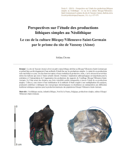
17-2019, tome 116, 4, p.657-680 - Solène Denis Perspectives sur létude des productions lithiques simples au Néolithique : le cas de la culture Blicquy/Villeneuve-Saint-Germain par le prisme du site de Vasseny (Aisne)
Perspectives sur l'étude des productions lithiques simples au Néolithique
Le cas de la culture Blicquy/Villeneuve-Saint-Germain par le prisme du site de Vasseny (Aisne)
Solène Denis
Résumé : Le site de Vasseny (Aisne) a livré un petit corpus lithique attribué au Blicquy/Villeneuve-Saint-Germain qui se prêtait bien au développement d'une méthode d'étude fine sur les productions simples. Le statut de ces productions reste mal défini à ce jour, à la fois dans leur nature et leurs modalités de production. Ainsi, c'est le niveau de savoir-faire même des tailleurs qui reste à l'heure actuelle discuté. Pourtant, l'implication anthropologique est importante pour la restitution et l'interprétation de l'organisation des productions des supports de l'outillage Blicquy/Villeneuve-Saint-Germain. En l'état actuel des données, une forte variabilité semble transparaître à travers l'étude de ces productions simples. Celles-ci, sous réserve d'une stabilisation de la méthode d'étude couplée à une multiplication des analyses, pourraient contribuer à distinguer des sous-groupes chronologiques ou identitaires en surimposition aux différentes traditions techniques repérées pour la production laminaire des populations Blicquy/Villeneuve-Saint-Germain.
Mots-clés : Néolithique ancien, industrie lithique, Nord de la France, Belgique, productions simples, culture Blicquy/Villeneuve-Saint-Germain.
Abstract: The site of Vasseny 'Dessus des Groins', located in the Aisne, is a small occupation dated to the end of the early Neolithic, Blicquy/Villeneuve-Saint-Germain culture. This culture represents the final phase of the Danubian col onisation in northern France and Belgium. At least three farmsteads were discovered on the site and 1800 flints, which form a small assemblage suitable for the study of so-called simple productions. Indeed, the status of these productions remains unclear, both their nature and the modalities of their production. Estimating the level of expertise needed to produce these flints is particularly important in this context. Uncertainties reside in the existence of very small facetted pieces in the BQY/VSG assemblages, interpreted as cores or tools according to different scholars. Furthermore, the debitage can look intentionally 'neglected' due to the simple multidirectional operations or the use of successive unipolar sequences. More recently, work conducted by Miguel Biard and Caroline Riche (Inrap) has focused on the use of flint hammerstones to produce flakes. These tools leave clumsy marks that are sometimes interpreted as maladroitness. However, the authors argue that the technical knowledge of the knappers is less rudimentary than previously thought, even though the discussion is ongoing. The anthropological implication is in this case important for the restitution and the interpretation how the Blicquy/Villeneuve-Saint-Germain production was organised.
Furthermore, Blicquy/Villeneuve-Saint-Germain's lithic production is based on a dual organisation involving blade production on the one hand and 'simple' productions on the other. This raises the question of the status of knappers in charge of these productions. Indeed, does this duality opposing laminar productions / simple productions reflect the blade knappers autonomy regarding the production of the supports of lithic tools? This disconnection between 'complex' productions requiring high levels of skill and a certain degree of artisanal specialization and domestic simple productions seems to be a model that finds success during the Middle Neolithic.
The detailed study presented here includes the development of a method that highlights the objectives and the modalities of these productions. This method uses two main elements: morphometric analysis and diacritical sketches. The morphometric analysis of the flake tools and negatives of removal of cores and facetted pieces involves comparing the dimensions of the tools to the removal negatives, with the result of several facetted pieces being isolated as it was not possible to provide the corresponding sized flakes to the flake tools. It contributes to identify two objectives of these productions. Furthermore, many of these facetted pieces bear use marks. The more marks they have, the less likely they are able to produce flakes to the needed size. Diacritical sketches were also made of the flake tools, cores and facetted pieces. This has demonstrated that the modality of production is mainly based on successive sequences of unipolar debitage. To sum up, this study has identified two simple productions. One is a flake production and the other is a facetted tool production. These two productions can be autonomous or integrated. They use a hard hammer stone and the chaînes opératoires are simple without any predetermination.
The discussion integrates comparisons with other Blicquy/Villeneuve-Saint-Germain sites where detailed studies of simple productions have been conducted. First, it must be underlined that few are available and mostly linked to the work of the Programme Collectif de Recherche 'Les caractéristiques technotypologiques et fonctionnelles du débitage d'éclat au VSG. Le cas et la place des sites hauts-normands dans le nord de la France (The techno-typological and functional characteristics of VSG knapping. The case and place of Upper Normandy sites in northern France)', led by Caroline Riche (Inrap-UMR 7055). Firstly, the comparisons suggest that the simple productions are not homogenous within the geographical area corresponding to Blicquy/Villeneuve-Saint-Germain culture. For example, in Upper-Normandy, the facetted tool production does not exist. On the contrary, laminar flake production has not been previously identified on sites in the Paris Basin or in Belgium. For the latter, the production of 'pseudo-fries' on edge flakes identified in the west part of Belgium seems specific to this region. Therefore, the nature of these simple productions seems to be different, depending on geographical and probably environmental contexts. Moreover, the operating mode of production varies within the cultural area. If recent studies have demonstrated the predominance of a unipolar method, others show a bipolar or a multidirectional organisation. Further studies that include diacritical sketches and quantification of the main patterns would in the future lead to a better overview of this possible heterogeneity of the debitage. Similarly, several studies have demonstrated the use of flint hammerstones on Upper-Normandy sites. However, this is probably not the case on every site, as it would depend on the environment and the access to flint raw materials. Continuing experimentation would create a referential for both types of mineral percussion, flint and stone. A detailed comparison of marks, including quantitative data on the frequency of the different discriminant characters, would allow a re-examination of the different archaeological series to shed light on this question and that, which underlies the level of expertise of the knappers. The study of these simple productions would benefit from a uniform method with multiple analyses in order to distinguish chronological or identity subgroups superimposed on the different technical traditions observed for the laminar production of the Blicquy/Villeneuve-Saint-Germain populations.
Keywords: Early Neolithic, lithic industry, northern France and Belgium, simple productions, Blicquy/Villeneuve- Saint-Germain culture.
16-2019, tome 116, 4, p.615-656 - Gregor Marchand, Anaïs Henin, Jorge Calvo Gomez, David Cuenca Solana, Diana Nukushina Le macro-outillage en pierre du Mésolithique atlantique : un référentiel bien daté sur lhabitat littoral de Beg-er-Vil (Quiberon, M
Le macro-outillage en pierre du Mésolithique atlantique
Un référentiel bien daté sur l???habitat littoral de Beg-er-Vil (Quiberon, Morbihan)
Grégor Marchand, Jorge Calvo Gomez, David Cuenca Solana, Anaïs Henin, Diana Nukushina
Résumé : Les macro-outils sont très peu décrits pour les industries lithiques mésolithiques du territoire français, malgré leur omniprésence dans les habitats. L'habitat côtier de Beg-er-Vil (Quiberon, Morbihan) fouillé entre 2012 et 2018 est une référence particulièrement cohérente d'un point de vue chronologique et stratigraphique pour le septième millénaire avant notre ère. Elle autorise une relecture des autres assemblages lithiques du Mésolithique atlantique, mais également des comparaisons avec les macro-outils du Néolithique récemment étudiés dans la région. Pour un total de 947 objets massifs inventoriés, émerge une série de 130 outils, dont les traces visibles à l'oeil nu ne font aucun doute et 23 outils hypothétiques nécessitant des analyses plus approfondies pour déterminer s'il s'agit de traces d'usage ou non. Neuf types d'outils ont été dégagés, hors fragments, tous divisés en un ou plusieurs sous-types. Le macro-outillage de Beg-er-Vil est très largement dominé par les percuteurs, engagés à l'évidence dans des débitages de matières minérales, mais aussi peut-être dans un concassage de matières dures animales. Suivent en nombre les galets utilisés en pièces intermédiaires très fortement percutées dans un axe longitudinal. Cet article amène à s'interroger sur l'indigence des outils massifs dans le Mésolithique de l'ouest de la France, alors que les ressources minérales adéquates sont particulièrement abondantes sur les estrans. On ne peut plus guère se réfugier derrière de possibles basculement fonctionnels vers d'autres matériaux, puisque les matières animales, bois, os ou coquilles, ne prennent pas le relai, sinon pour fournir des pioches en bois de cerf (à Téviec et Hoedic). Une large comparaison est effectuée avec d'autres zones d'Europe atlantique, à l'évidence mieux pourvues. Les enseignements en termes d'identité technique comme en termes fonctionnels peuvent en être tirés.
Mots-clés : Mésolithique, macro-outils, Bretagne, Second Mésolithique.
Abstract: Ground stone tools are rarely described for the mesolithic lithic industries of the French territory, despite their omnipresence in the dwellings. Yet elsewhere in Atlantic Europe, pebble tools sometimes play a major role in defining cultural entities, in Scotland with the Obanian, in northern Spain with the Asturian and in Portugal with the Mirian.
This obvious lack of interest in mesolithic macro-tools deprives us of crucial information on technical phylums that are evolving at a different rate from other techniques. What are the standards and practices of use of these tools compared to other material culture ranges? How have they been disseminated in the landscapes through individual or collective mobility practices? What "stylistic territories" do they help us to draw? How can we think of their very slow morpho logical evolution over time in relation to other tools? Macro-tools thus hold a particular potential for action on matter, different from other tools; discussing their uses or, unlike their non-use, thinking about human engagement with the physical world and seeking a key to understanding their being in the world.
The coastal habitat of Beg-er-Vil (Quiberon, Morbihan) excavated between 2012 and 2018 is a particularly coherent reference from a chronological and stratigraphic point of view for the seventh millennium BC. It allows a re-reading of other lithic assemblages of the Atlantic Mesolithic, but also comparisons with the Neolithic ground stone tools recently studied in the region. This coastal position has at least four implications for the availability and use of these tools: 1/ abundance of raw materials on the foreshores, 2/ exploitation of two very different ecosystems (maritime and continental), 3/ very diversified domestic activities on the habitat, 4/ need for tools to dig pits. The distribution of tools on site and the study of structures do not make it possible to highlight specific areas of activity within the habitat.
For a total of 947 massive objects inventoried, a series of 130 tools emerged, whose traces visible to the naked eye are beyond doubt and 23 hypothetical tools requiring further analysis to determine whether they have use-wear or not. There are also 470 fragments of pebbles used. The classification of the ground stone tools was based on specific criteria, the first being the type of traces visible on the surfaces, voluntary or involuntary removal, and finally the fragmentation processes in use. Nine types of tools were identified, excluding fragments, all divided into one or more subtypes. The hammers obviously dominate (64%). The intermediate elements are 8% of the entire tools, to which 54 fragments must be added and probably many longitudinally fragment. In all these cases, it should be noted that the stigma of use is relatively undeveloped when compared with equivalent Neolithic tools. There are only four tools more involved than the others: a circular hammer (type A5), two chopping-tools (D2) and a peak (D3). Concerning the types of rocks used, two of them differ considerably from the corpus, quartz for mainly active tools, as well as granite for the largest objects, whether passive or not.
This article raises questions about the paucity of ground stone tools in the Mesolithic period in western France, while suitable mineral resources are particularly abundant on foreshores. The lithic assemblages of the Early Mesolithic show a slightly broader register than those of the Late Mesolithic, all things considered. Finally, a broad comparison is made with other areas of Atlantic Europe (France, Spain, Portugal, Scotland), which are obviously better equipped. The paucity of mesolithic macro-tools in Atlantic France reflects a general organization of technical systems that do not use massive tools to interact with the rest of the physical world. It is no longer possible to take refuge behind possible functional shifts to other materials, since animal materials, antlers, bones or shells, do not take over, except to provide deer antler picks (in Téviec and Hoedic).
This first classification approach was intended to put a spotlight on a part of the mesolithic technical system that is usually left in the shadows. Our approach was intended to be functional, lato sensu, i.e. the representation of this range of tools can only be judged by integrating all the activities and functions that can be detected in the habitat, by examining combustion structures, cut tools, or organic remains. It is obvious that experimentation is now essential to determine the functions of these tools on central mass, which are not very well transformed.
Examining the technical transfers from generation to generation is difficult for the period preceding the Mesolithic. Indeed, there is still very little to say about the Upper and Late Paleolithic of Western France, especially since its maritime declination is currently inaccessible. With regard to the transformations during the Holocene, we thought we saw a possible regression of typological diversity during the Mesolithic period in Atlantic France, but we must remain very cautious due to the lack of sufficient lithic assemblages. It will be much less so if we talk about the real break with the Neolithic from the beginning, whether in the West or more generally in the North of France. New functions and much less collective mobility explain this major contrast in the use of macro-tools, but this break must also be placed in an ontological register.
The paucity of mesolithic macro-tools in Atlantic France reflects a general organization of technical systems that do not use massive tools to interact with the rest of the physical world. This absence is a cultural choice; it also reflects a discreet, obviously resilient human imprint, a way of being in the world that shapes subsequent practices.
Keywords: Mesolithic, Late Mesolithic, ground stone tools, Brittany.
15-2019, tome 116, 3, p.539-560 - Baptiste Pradier, Aung Aung Kyaw, Tin Tin Win, Anna Willis, Aude Favereau, Frédérique Valentin, T. O. Pryce Pratiques funéraires et dynamique spatiale à Oakaie 1, une nécropole à la transition du Néolithique à lÂge du
Pratiques funéraires et dynamique spatiale à Oakaie 1, une nécropole à la transition du Néolithique à l'Âge du Bronze au Myanmar (Birmanie) / Funerary practices and spatial dynamic at Oakaie 1, a burial ground at the transition of the Neolithic and Bronze Age in Myanmar (Burma)
Baptiste Pradier, Aung Aung Kyaw, Tin Tin Win, Anna Willis, Aude Favereau, Frédérique Valentin, T. O. Pryce
Résumé : En Asie du Sud-Est, la fin de la préhistoire - de l'apparition de l'agriculture à la naissance de proto-États - ne dure que de 1500 à 2000 ans. Les cimetières sont des sites essentiels pour comprendre ces changements marqués par des influences culturelles indiennes et chinoises. Le Myanmar est le seul pays d'Asie du Sud-Est avec lequel ces pays partagent une frontière terrestre. Les données archéologiques nouvellement acquises pour le Myanmar permettent d'éclairer cette période charnière. Cet article présente les résultats de l'étude de la nécropole d'Oakaie 1 (région de Sagaing), fouillée durant deux saisons entre 2014 et 2015 dans le cadre de la Mission Archéologique Française au Myanmar (MAFM). La nécropole est datée entre la fin du Néolithique et le début de l'âge du Bronze. Les 55 sépultures et 57 inhumés mis au jour permettent d'analyser l'évolution des pratiques funéraires pendant plusieurs siècles. L'organisation de l'espace sépulcral est particulière. Les fosses, organisées en rangées sont distribuées selon deux grandes orientations, N-S et NNO-SSE. Les inhumations sont individuelles ou plurielles (9 cas) et, dans un cas, un chien a été inhumé avec des humains. L'analyse taphonomique suggère l'usage de contenants périssables larges ou étroits, avec des bords montants, probablement des troncs d'arbres évidés. Les biens funéraires les plus communs sont des céramiques généralement placées près des membres inférieurs ou dans le comblement de la fosse. Des éléments de parure (perles en coquillages et en pierre, bracelets en pierre polie et en matière dure animale) étaient aussi associés aux défunts, tandis qu'une unique sépulture a fourni un objet en métal (une hache en bronze). L'usage croisé de critères variés, dont l'organisation spatiale de la nécropole, les recoupements de sépultures, les pratiques funéraires et le mobilier déposé auprès des défunts a permis d'établir que la nécropole a fonctionné durant trois phases. La première est caractérisée par 20 inhumations orientées dans un axe N-S, généralement individuelles, dotées d'un mobilier funéraire réduit constitué d'une seule céramique et de rares éléments de parure en coquillage et matière dure animale. La deuxième phase est composée de 30 sépultures orientées dans un axe NNO-SSE. Elles contiennent des inhumations individuelles et plurielles associées à des céramiques distinctes de celles rencontrées lors de la première phase et à des objets de parures, dont certains sont d'origine exotique, plus nombreux et plus fréquents. La troisième phase est représentée par une inhumation, exceptionnellement riche pour la nécropole. Le défunt était associé à 19 céramiques, une perle en pierre et une hache en bronze. Ce dépôt présente un parallèle avec des sépultures de la nécropole de Nyaung'gan située à 2,7 km de Oakaie 1. Notre analyse permet d'établir que les deux premières phases correspondent à une utilisation intermittente de la nécropole par une même population alors que la troisième marque une rupture lié à l'introduction du métal.
Abstract: In Southeast Asia, the late prehistoric period, from the appearance of farming to the rise of proto-states, lasts only 1500-2000 years, and is thus extremely brief in comparison to Europe. Cemeteries represent critical sites in the chronological and cultural understanding of these changes, stimulated by influences from both China and India. Myanmar is the only Southeast Asia nation to share terrestrial frontiers with both these vast neighbours, but in comparison even with Thailand and Viet Nam, archaeological investigation in Myanmar is in a phase of rapid expansion. As such, the late prehistoric dataset is beginning to offer opportunities for detailed and synthetic interpretations of this critical in the Sagaing Division of central Myanmar. Oakaie 1 is a well preserved cemetery at the heart of a rich archaeological area, which was investigated by the French Archaeological Mission in Myanmar (MAFM) between 2014 and 2016. As a result of these efforts, the Oakaie area has the most secure radiometric chronological sequence in Myanmar, with 52 determinations, and has been the focus of a number of advanced approaches, many of them firsts for the country. The excavation of the Oakaie 1 cemetery, during two four-week field seasons in 2014-15, lead to the exposure of 55 graves containing 57 individuals. This discovery gave us the opportunity to study the evolution of funerary practices in a single cemetery over a period of several centuries. The Oakaie 1 graves were cut in a hard volcanic tuff and filled with a more humid and brown soil, which made them extremely easy to recognize. The graves are arranged in well-defined rows, following one of two orientations, N-S or NNW-SSE. The graves are mainly single primary supine extended burials but some nine graves contain at least two individuals, and maybe more. One grave also contains the burial of a dog. The taphonomic analysis of the burials shows that most of the bodies decomposed within an open volume. The study of the constraints marked on the skeletons shows that a common type of container, a hollowed out tree trunk was probably used throughout the cemetery, with some differences in terms of narrowness. Taphonomic study of the multiple graves has failed to establish whether individuals were buried simultaneously. The main grave good is pottery, which was deposited in various places around the body, mainly on the lower limbs and during the filling of the graves. Some ornaments were found, consisting of beads, made of stone and shell, as well as bangles made of stone and animal bone. Only one grave, S15, furnished a metal artefact, a socketed bronze axe. Graves goods were quite sparse throughout the cemetery, as compared to its well-known neighbour, Nyaung'gan, with the exception of S15, which contained by far the most pottery, in addition to the sole bronze. The comprehensive study of the cemetery's spatial organization, the intercutting of the burials, the funerary practices as identified via taphonomic analysis, and the study of the grave goods lead us to propose three main phases of funerary use. The first is characterized by primary supine extended burials disposed in rows, with the graves oriented on a N-S axis. The burials were predominantly individual but three graves contained two individuals. Two further graves may also contain multiple burials. The phase one grave goods were very limited, a single pot of an almost universally homogenous form was placed during the filling of the grave. Ornaments made from shell or animal bone were rare. Two bivalve shells were found as a baby's grave good. The second phase of burials were also primary supine extended graves in clear rows but oriented on a NNW-SSE axis. The graves were mainly individual but multiple graves were nevertheless frequent, and systematically contain an adult with a child, in one case two children. The grave goods were mainly pots, deposited on the lower limbs of the individuals. The pottery assemblage could be clearly differentiated from the first phase in its style and presents an internally homogeneous group. Ornaments grave goods were more frequent and examples made from hard stone and in bangle form appear. Bivalve shell deposits were found within the grave goods of very young children, with the exception of one adult. The third burial phase is represented by a single grave containing one individual. This grave, S15, contains far more grave goods than any other in the Oakaie 1 cemetery, comprising 19 pots, one bronze axe and a stone bead. S15 represents a strong match to some of the burials at the neighbouring (2.7 km) cemetery site, Nyaung'gan. The three phases identified at Oakaie 1 could theoretically represent as many populations. However, the cultural basis of each phase is clearly inter-related and leads us to propose that the cemetery' the area that could be excavated at least - was used by the same population over cyclical periods for a substantial length of time. This model is supported not only by the taphonomic analysis but also that of the ceramics and the strontium isotope signatures. The third phase, representing the shift to the Bronze Age at around 1000 BC, cannot be evaluated in detailed due to a lack of evidence but shows that while funerary practices changed significantly, the individual is highly likely to be a descendent, culturally at least, of the two preceding phases.
14-2019, tome 116, 3, p. 515-537 - Aloïs Corona, Benjamin Van Den Bossche Un nouveau groupe funéraire du Bronze ancien aux Mureaux (Yvelines) : retour sur les pratiques funéraires franciliennes entre 2200 et 1600 av. J. C.
Un nouveau groupe funéraire du Bronze ancien aux Mureaux (Yvelines)
Retour sur les pratiques funéraires franciliennes entre 2200 et 1600 av. J.-C. / A new Early Bronze Age burial group in Les Mureaux (Yvelines): new perspectives on mortuary practices in Île-de-France between 2200 and 1600 B
Aloïs Corona, Benjamin Van den Bossche
Résumé : Localisé en bord de Seine, le site des Herbages aux Mureaux (Yvelines) a fait l'objet de deux opérations archéologiques, en 2013 et 2014. La première a permis l'exploration partielle d'un ensemble funéraire du début du Bronze ancien, d'où provient un poignard en alliage cuivreux de type Butterwick. La seconde a porté sur une occupation du Chasséen septentrional, en marge de laquelle a été mis au jour un nouvel ensemble funéraire, également daté du Bronze ancien.
Ces deux groupes comprennent respectivement trois et quatre inhumations individuelles, principalement datées par des mesures radiocarbone. Celles-ci suggèrent une utilisation assez courte des espaces funéraires considérés, située entre la fin du Bronze A1 et le début du Bronze A2.
Considérant la présence d'un artefact, dont les centres de production sont situés dans les îles britanniques, des analyses isotopiques ont été menées (87Sr/86Sr) visant à obtenir des précisions sur l'origine géographique des différents sujets étudiés. Les résultats interindividuels plaident en faveur de l'homogénéité populationnelle. Le rapport obtenu sur les sédiments environnants affiche des valeurs nettement supérieures, signes d'une probable mobilité résidentielle sans qu'il soit possible de préciser la provenance des sujets inhumés.
L'échelle locale, des parallèles évidents peuvent être établis entre les deux ensembles funéraires des Herbages. La mise en perspective de ces données fournit l'occasion d'établir un état des connaissances des pratiques funéraires propres à l'âge du Bronze ancien francilien. Les analogies relevées aux Mureaux ne vont pas dans le sens d'une quelconque normalisation des traditions funéraires régionales. Aucune règle ne semble prévaloir, que ce soit dans le traitement des défunts, la position et l'orientation des corps, la dotation funéraire, le mode d'ensevelissement ou encore dans les agencements sépulcraux. Au-delà de cette diversité, transparaît pourtant une évolution fondamentale des comportements face à la mort.
Mots-clés : sépulture individuelle, inhumation, pratique funéraire, analyse isotopique, Bronze ancien, Île-de-France.
Abstract: Located on the edge of the Seine River, the site of les Herbages in Les Mureaux (Yvelines) was the object of two preventive archaeology operations, in 2013 and 2014, in advance of the extension of industrial infrastructures used by Airbus and its subsidiary, Astrium Space Transportation. The first operation included the partial exploration of a mortuary group that yielded a Butterwick-type copper alloy dagger (Van den Bossche and Blin, 2014), from the initial stage of the Early Bronze Age. The second operation focused on an occupation from the beginning of the Chassean culture. On the edge of this occupation, a new mortuary group was discovered and dated to the Early Bronze Age as well.
Both sectors were strongly impacted by earthworks carried out in the 1960s to protect the military installations of the former Étienne Mantoux air base from potential flooding from the Seine. This work naturally affected the highest formations and sometimes reached the Protohistoric levels. It is probably responsible for the generalized leveling of the burial pits and the alterations of the exhumed osseous remains.
The two groups each contain three and four individual inhumations. Only one of the tombs contained artifacts. Most of the chronological information is therefore based on AMS radiocarbon dates realized by the University of Groningen (Netherlands) and the Beta Analytic laboratory in Miami, Florida. The dates of the mortuary group excavated in 2014 cover a relatively limited period from the middle of the 22nd century to the end of the 20th century BC. They suggest a short-term use of the mortuary space during the transition from the end of the Bronze A1 and the beginning of the Bronze A2 in Île-de-France and concur with the dates established for the mortuary group studied in 2013 (Van den Bossche and Blin, 2014).
Due to the exceptional presence of an artifact type whose production centers are located on the British Isles, isotopic analyses of the three best-preserved burials from the 2014 excavation were also realized, as well as of two inhumations exhumed in 2013. The aim was to confront the 87Sr/86Sr signal recorded in the bioapatite of the dental enamel of the individuals in question to obtain information on their geographic origin(s). The interindividual results argue in favor of a homogeneous population for the groups identified in 2013 and 2014. The signature obtained for the neighboring sediments, on the other hand, show much higher values. These significant variations between the human and local sedimentary signals probably indicate residential mobility, though it is not possible to identify the provenance of the inhumed subjects or to determine the period in their life during which this hypothetical migratory episode would have occurred.
At the local scale, clear parallels can be observed between the two mortuary groups at les Herbages. These consist of small areas covering a few dozen square meters containing a handful of slightly dispersed tombs. The mortuary practices identified have many points in common. All the burials studied correspond to primary individual inhumations contained in simple, most often large, pits. The bodies, most often in the supine position, are oriented in the east-west axis, with the head most often at east. A significant difference is seen in the artifact, which is found in only one of the burials.
Replacing these data within their broader context enables us to review our state of knowledge of the mortuary practices of the Early Bronze Age in Île-de-France. Paradoxically, the few analogies observed at Les Mureaux do not indicate any normalization of the regional mortuary traditions. Even if the available corpus is still small (38 burials distributed among 23 sites), it appears that there was no dominant rule, whether in the treatment of the deceased, the position and orientation of the bodies, the grave goods, the burial method, or the arrangements of the graves. Despite this diversity, there appears to have been a fundamental evolution of behaviors concerning death tending toward a greater focus on the individual and leading to a multiplication of small mortuary units, which is very different from the typical models from the end of the Neolithic.
Keywords: individual burial, inhumation, mortuary practices, isotopic analyses, Early Bronze Age, Paris Basin.
13-2019, tome 116, 3, p.479-513 - Benoît Sendra, Marylise Onfray, Ambre Di Pascale, Maxime Orgeval, Laurent Bruxelles - Étude d'un fossé et d'architectures en terre fondés au milieu du 3e millénaire av. J.-C. sur le plateau des Costiè
Étude d'un fossé et d'architectures en terre fondés au milieu du 3e millénaire av. J.-C. sur le plateau des Costières (Garons, Gard, France)
A study of a ditch and earth architecture founded in the middle of the 3rd millennium BC on the plateau des Costières (Garons, Gard, France)
Benoît Sendra, Marylise Onfray, Ambre Di Pascale, Maxime Orgeval, Laurent Bruxelles
Résumé : Localisées non loin du site de Puech Ferrier et de l'enclos inédit de Mitra II fouillé en 2011, les enceintes de Mitra III situé à Garons (Gard) ont fait l'objet d'une première campagne de fouille préventive en 2012. L'exploration sur une superficie de 5 000 m² a révélé la partie méridionale et une porte d'un établissement délimité par au moins deux systèmes de fossés d'enclos qui se succèdent au cours d'une période qui connait le développement du Fontbouïsse, l'impact Campaniforme et l'émergence du plein Bronze ancien (BA2), soit entre le 27e et 24e s. av. J.-C. L'article traite spécifiquement de l'étude d'un imposant fossé plus large, plus profond et de plan plus anguleux que ceux du premier système d'enceinte dont il vient condamner l'accès. Il a été observé sur près de 90 mètres linéaires et délimite le sud de l'établissement. Il présente un puissant niveau de comblement constitué d'éléments d'architectures en terre crue en connexion partielle, surmontant une couche limono-cendreuse dont le spectre anthracologique est très largement dominé par le chêne.
Sur la base des résultats de l'analyse stratigraphique, micromorphologique et une caractérisation micro et macroscopique des éléments de terre crue, il est possible de caractériser la dynamique de comblement et la nature de l'architecture en lien avec ce système de délimitation.
Mots-clés : enceinte fossoyée, Néolithique final, France, architecture en terre, technique constructive, évolution fonctionnelle des enceintes.
Abstract: The purpose of this paper is the detailed study of one of the excavations that has marked the evolution of Fontbouïsse of MITRA III located in Garons (Gard, France) whilst focussing on the development and the disappearance of enclosures in the south of France.
The site located near to a site known as Puech Ferrier, an unpublished enclosure of MITRA III excavated in 2011, was first excavated in 2012 within the framework of preventive archaeology. This exploration of a 5000 m² surface revealed the southern part and the entrance of an installation delimited by at least two ditches which succeed one another, dating
to a period between the 27th and 24th centuries BC that includes the development of the culture of Fontbouïsse, the Campaniforme (Bell Beaker) and the emergence of the early Bronze (BA2). A network of three concentric ditches, the innermost enclosure being the oldest, makes up the first enclosure, where an interruption in the ditches allows access to the site. A later much larger wider and deeper ditch cuts across the first enclosure.
The paper focusses on the study of this ditch and its fill, which is the only enclosed site dating to the Late Neolithic in the south of France. Observed over nearly 90 m, this ditch delimits the southern part of the site. It contains fragments of mudbrick over a silty ashy layer the anthracological spectrum of which contains mainly by oak. Based on the results of stratigraphic and soil micromorphology, a phased filling of the ditch can be proposed. Micro and macroscopic characterization of the earthen elements found in the ditch have specified the nature of the cob and wattle and daub and the demolished structure they came from.The findings reveal that the ditch remained open for a relatively short period of time, after which a cob structure, perhaps a wall, was installed, the base of which is preserved in a portion of the ditch. The ditch was then filled in by the destruction of another earthen and wood structure.
This architecture could have been used to strengthen the monumental aspect of the enclosure, the hypothesis being that it copied a layout observed on other Fontbuxien settlements. A violent fire subsequently destroyed this ditch-wall enclosure and a possible adjoining building. Following on from this event, the ditch was re-dug before being filled in after the site is abandoned.
The exact dating of the ditch and the destruction of the earthen wall remain imprecise.
Some elements found in the lower ditch fill date to the first phase of the Fontbouïsse culture. They stylistically refer productions from the plain of Hérault and Gard. However, the destruction of the earthen architecture is dated by radiocarbon analysis and pottery found in the upper layers and the discovery of a sherd with international style decoration gives a later dating range of between 2450 and 2250 cal. BC. This enclosure and its destruction constitute a milestone in Fontbouïsse and Late Neolithic chronology. Its foundation and destruction occur within a short space of time. The events that occurred during the history of MITRA date the
initial foundation and development of the concentric enclosures and the site's total overhaul, which happened shortly before its abandon. The entrance identified at Mitra III, the new ditch with its earthen architecture that cut across the first enclosure around 2500 cal. BC questions our knowledge of the development and disappearance of enclosures at a pivotal period (Late Neolithic-Early Bronze Age) in southern France.
Keywords: causewayed enclosure, Late Neolithic, France, earthen architecture, building technique, functional development of enclosure.
12-2019, tome 116, 3, p.455-478 - Anaïs Vignoles, Laurent Klaric, William Banks, Malvina Baumann Le Gravettien du Fourneau du Diable (Bourdeilles, Dordogne) : révision chronoculturelle des ensembles lithiques de la « Terrasse inférieure »
Le Gravettien du Fourneau du Diable (Bourdeilles, Dordogne)
Révision chronoculturelle des ensembles lithiques de la « Terrasse inférieure » / The Gravettian at Fourneau du Diable site (Bourdeilles, Dordogne): chronocultural review of the lithic assemblages from the lower terrace
Anaïs Vignoles, Laurent Klaric, William E. Banks, Malvina Baumann
Résumé : En France, le Gravettien moyen est caractérisé par deux faciès lithiques : le Noaillien, marqué par la présence de burins de Noailles, et le Rayssien, identifié par la reconnaissance de la « méthode du Raysse ». Malgré un important recouvrement géographique, le territoire d'expression du Rayssien semble plus septentrional que le Noaillien, ce qui a été à l'origine de nombreuses hypothèses. Cependant, il se peut que l'estimation de leurs aires de répartition géographique soit biaisée, puisqu???un examen de la littérature révèle une forte disparité dans le degré d'informations disponibles pour chaque site. Le site du Fourneau du Diable (Bourdeilles, Dordogne) illustre ce biais. Fouillé dans les années 1910-1930 par D. Peyrony, ce site a été successivement attribué au Gravettien ancien, au Noaillien stricto sensu et au Rayssien. La reprise récente des fouilles (dir. M. Baumann), permet de reconsidérer ces attributions et de préciser les biais induits par les méthodes de fouilles anciennes.
Notre étude consiste en un examen typo-technique de l'industrie lithique issue du sondage réalisé en 2015 sur la « Terrasse inférieure », et vise à reconnaître les différents épisodes chronoculturels identifiables dans la série. Sans surprise, Solutréen et Gravettien y sont représentés. Les pièces rapportées à ce dernier techno-complexe peuvent être attribuées à une phase indéterminée du Gravettien, au Noaillien ou bien au Rayssien. Ces deux derniers ensembles sont largement sous-représentés dans la collection Peyrony.
Cet exemple invite à considérer les données issues de fouilles anciennes avec prudence. De par la discrétion de leurs marqueurs, leur reconnaissance récente (pour le Rayssien) ou leur caractérisation insuffisante dans la région (système technique « noaillien » dans le Nord de l'Aquitaine), il apparaît important de réévaluer des collections anciennes ainsi que de reprendre des fouilles sur certains gisements-clés afin de mieux appréhender les problématiques de cette période.
Mots-clés : Fourneau du Diable, reprise de fouilles anciennes, Gravettien moyen, Noaillien, Rayssien, industrie lithique.
Abstract: In France, the Middle Gravettian (ca. 32-29 ka cal. BP) is characterized by two " facies " principally defined on the basis of their lithic industries: the Noaillian is recognized by the presence of Noailles burins and the Rayssian, which has become better recognized since the 2000s, is characterized by a particular method of reducing Raysse nuclei (formerly burins) to produce a type of armature termed the " la Picardie " bladelet. The Noaillian stratigraphically precedes the Rayssian in Northern Aquitaine archaeological sequences, and these two typo-technical traditions occupy partially overlapping territories. Whereas the Noaillian is observed primarily in southwestern France (from the Pyrenees to the southern Loire river), with extensions into Cantabrian Spain, southeastern France and Western Italy, the geographical distribution of the Rayssian extends into more northerly regions (northern Aquitaine Basin, the Centre region, Burgundy and Brittany). This has led many researchers to postulate that the Rayssian may be an adaptation to different environments than those exploited by the Noaillian. However, this view is potentially biased since a review of the published literature reveals a wide disparity in the types and quality of information available for individual archaeological sites. At Le Fourneau du Diable (Bourdeilles, Dordogne), for example, the existence of several Gravettian phases (initially " Perigordian ") has been proposed by different authors. Excavated between the 1910s-1930s by D. Peyrony, this site was successively attributed to the " Perigordian IV " (Lower Gravettian), the Lower Noaillian (Noaillian stricto sensu) and the " Recent Noaillian " (Rayssian). Recent excavations directed by M. Baumann make it possible to better evaluate these chronocultural attributions and to specify biases introduced by the excavation methods employed during the previous century.
Our study consists of a typo-technical examination of the lithic industry recovered from a test unit (1 m.) excavated during 2015 on the site's lower terrace into the back dirt from previous excavations. A review of the Peyrony collection was also carried out in order to supplement and confirm previous studies' observations. The aim here is to identify the different chronocultural episodes present in the lower terrace's deposits, as well as to compare our chronocultural attributions to those proposed previously.
The Solutrean is represented by various retouched artefacts attributable to the Upper or Final Solutrean (Laurel-leaves and shouldered points) and by debitage diagnostic of bifacial reduction (bifacial thinning flakes). The Gravettian can be divided into three groups: 1) an " unspecified " Gravettian component, represented by ubiquitous retouched elements common to most of its sub-phases (e.g., microgravettes, backed and truncated bladelets); 2) a Noaillian assemblage made up exclusively of Noailles burins and their diagnostic microlithic spalls; and 3) a discreet Rayssian assemblage, represented by a set of technical waste related to the " Raysse method " (Raysse spalls and bladelets, Raysse burin-cores, blades with " oblique lateral faceting " on the platform) and some fragments of retouched bladelets compatible with the " la Picardie " bladelet type
Comparisons of the test unit assemblage to material present in the Peyrony collection show that, in the latter, the Noaillian and the Rayssian are significantly under-represented. It is likely the result of multiple factors, such as the low archaeo-stratigraphic resolution of the Peyrony excavations, or their selection of complete, well-made and easily recognizable retouched tools at the expense of smaller tools (e.g., bladelet armatures, Noailles burins) and unretouched artifacts. The fact that the Rayssian technical system was only formally recognized years later could also have played a role in its diagnostics being overlooked by Peyrony. Unfortunately, the effects of these potential biases on assemblage composition, along with the mixing of excavated materials do not allow one to reliably discriminate most artifacts by cultural phase, nor to characterize in detail the nature of the Fourneau du Diable's Gravettian occupations. Moreover, detailed interpretations are hindered by the fact that comparisons between the Noaillian and the Rayssian are difficult since the two sub-phases are not defined on the same typo-technical basis.
The recognition of the Noaillian and the Rayssian in the Fourneau du Diable's lower terrace deposits demonstrates that attributing cultural designations to archaeological sites on the basis of tool type counts from old excavations can be affected by biases thus leading to inaccurate estimations of an archaeological phase's geographic distribution. In fact, many diagnostic artifact types have discreet characteristics that are sometimes difficult to recognize, and as a result their presence may go unrecognized in Gravettian levels at sites that were excavated with non-modern methods. Moreover, since little is known about the " Noaillian " technical system in regions outside of the Landes and the Pyrenees, it is possible that this archaeologically defined entity in fact groups together a number of discrete technical traditions that share the same form of burin (i.e., the Noailles burin).
It is therefore important that future work include systematic and critical examinations of old collections, as well as new excavations at key sites. With such work, cultural attributions of site levels will be more accurate, the geographic distributions of the Noaillian and the Rayssian will be more accurately estimated, and such data will benefit the application of certain approaches, such as ecological niche modeling.
Keywords: Fourneau du Diable, old excavations reassessment, Middle Gravettian, Noaillian, Rayssian, lithic industry.
11-2019, tome 116, 3, p.423-454 - Cyrielle Mathias, Laurence Bourguignon Une nouvelle utilisation du concept Trifacial durant une phase ancienne du Paléolithique moyen de la vallée de lIsle : le niveau 2 de Petit-Bost (Neuvic, Dordogne)
Une nouvelle utilisation du concept Trifacial durant une phase ancienne du Paléolithique moyen de la vallée de l'Isle - Le niveau 2 de Petit-Bost (Neuvic, Dordogne)
Cyrielle Mathias, Laurence Bourguignon
Résumé : La présence de trifaces au sein des assemblages lithiques fait partie des caractéristiques des séries de l'Acheuléen méridional du Sud-Ouest de la France. Le Trifacial est un concept dont les méthodes peuvent être orientées vers la production de supports, ou dans certains cas être mixtes, c'est-à-dire mêlant débitage et façonnage. Le niveau 2 de Petit-Bost (Neuvic, Dordogne), daté du MIS 9/8, livre un exemple inédit de son utilisation dans la vallée de l'Isle. Dans cet assemblage, différentes méthodes trifaciales sont présentes. Des matrices uniques de production coexistent avec des matrices présentant une phase de fonctionnalisation dans le schéma opératoire. Trois méthodes ont ainsi été identifiées : débitage strict, débitage/façonnage et débitage/confection. Selon la structure trifaciale présente (symétrique, asymétrique) une gamme d'outils diversifiés peut être produite. C'est toutefois la recherche d'outils appointés (contacts de type pointe ou bord-pointe) qui est dominante. La présence du concept Trifacial au sein d'une série de plein air d'une phase ancienne du Paléolithique moyen de Dordogne permet d'accroître nos connaissances sur ce concept encore peu reconnu dans les séries lithiques. Il permet notamment une réflexion sur l'Acheuléen méridional au sens large et les spécificités des séries du Sud-Ouest de la France au Pléistocène moyen récent.
Mots-clés : Paléolithique moyen ancien, technologie lithique, Trifacial, Acheuléen méridional, Sud-Ouest.
Abstract: The Trifacial lithic system is a concept combining flaking and shaping, mainly identified in Southwestern France, and characteristic of the Southern Acheulean. The Southern Acheulean was initially defined by F. Bordes in the lower layers of Combe-Grenal and Pech-de-l'Azé II (Dordogne). This lithic facies was considered to be different from the Acheulean from the North of France (Bordes, 1971), mainly because of the (core-like) biface morphology and the presence of flake cleavers. Since then, the initial definition of this techno-complex has been widely debated, with particular emphasis on raw material availability and a reappraisal of the presence of flake cleavers (Villa, 1981, 1983; Mourre, 2003; Mourre and Colonge, 2007; Turq et al., 2010). The last definition of this Southern Acheulean, referred to as an early Middle Palaeolithic, mentions " the absence of cleavers (sensu stricto), the presence of bifacial shaping (sensu lato) and a trifacial concept of production and/or shaping (Boëda, 1989) associated with varied core reduction methods " (Turq et al., 2010, p. 390).
Thus, the presence of Trifacial production appears to be an important criterion. Most of the time, the aim of this production is to obtain flake blanks and a tool at the same time (Boëda et al., 1990). The triface can thus be considered as a core and a tool (named combined matrix). The flakes produced are generally similar to those from algorithmic systems (SSDA).
The trifacial concept was first described by E. Boëda in levels 8 and 9 of Pech-de-l'Azé II in Dordogne (Boëda, 1989). It has since been identified in several sites in the same area, such as Barbas C'4 sup, Combe-Grenal level 59, or open-air sites such as Combe Brune 2 and 3 (Boëda et al., 1990; Turq, 1992; Chevrier, 2006; Brenet, 2011).
The site of Petit-Bost (Neuvic, Dordogne) is an open-air site in the Isle valley, excavated in 2001 during a preventive archaeology operation. This study focuses on level 2, dated to MIS 9/8 by TL, between 340 and 270 ky (Bourguignon et al., 2008). This layer yielded evidence of bifacial shaping and SSDA, Quina, on flakes and Levallois flaking. Tools on flakes are poorly represented, and consist mainly of side scrapers (some with Quina retouch). Faunal remains were not preserved and solifluction processes affect the layer. As a consequence, the strict contemporaneity of the lithic concepts is uncertain, even though some artefacts were refitted.
Here, we performed a new technological analysis, with particular focus on cores and tools. The aim was to identify the lithic concepts used and to reconstruct the reduction processes and their production goals. Shaped or retouched tools were analysed following a techno-morphological method, comprising a detailed description of edge morphologies and the relationships between supposed cutting edges and prehensile parts. This part of the analysis is based on present-day tool repositories, ethnographical data and traceological studies. It constitutes a hypothesis and a basis for reflection for further developments.
Through this analysis, an original use of the Trifacial concept in the Isle valley area was identified in level 2. Ten artefacts in local flint and chalcedony were attributed to this concept. Three methods were identified: a single production method, a flaking/shaping method (which corresponds to a combined matrix) and a flaking/retouching method (selection of a core as a blank for retouch).
The most frequent method is the combined matrix one, with six pieces. Four are considered as cores and one of these cores was subsequently retouched. Shaping/flaking processes display high variability and raw material morphologies play an important role. The functionalisation of blanks occurs during the reduction process. Most of the time, retouch is limited, and generally serves to regularise edge morphology (for both active and prehensile parts). In one case, a notch is part of the final morphology of the tool. The main objective of these tools seems to be morphology of the robust point of trifaces (high edge angles), although single linear edges can also be used in association with the point.
Two general section morphologies were identified: symmetrical triangular and asymmetrical triangular sections. This morphology may have an impact on the final tool and on the position of the prehensile part and supposed active edges.
A comparison with other trifaces published in Dordogne highlights the high variability of this concept. The poor quality or morphology (gelifract) of raw materials used in several sites, such as Combe-Grenal, was cited to explain its use (Turq, 1992). As a matter of fact, the use of this concept and its variability may be due to the initial morphology of the raw materials, but also to other factors. The sought-after tool may also influence the application of the lithic system. Moreover, this system produces a robust punctiform tool with a trihedral morphology in section, which is more difficult to obtain with bifacial shaping systems.
Almost all the known trifaces come from south-western France, but according to the literature, some also exist or may exist in other areas in the South (Chalosse area, Deux-Sèvres, Ardèche and maybe in Alpes-de-Haute-Provence). They also occur in Dordogne in sites attributed to the Southern Acheulean, but they are marginal compared to the other components of lithic assemblages. Indeed, in most of sites, there are only few trifaces. Thus, a definition of the Southern Acheulean based solely on this lithic concept does not seem relevant. Moreover, the absence of the trifacial system in assemblages with similar composition may result from taphonomic processes, site functions or activities. A more in-depth study of several former collections may enhance our understanding of the variability of this concept and links between the techno-complexes of Southern Europe during the final Middle Pleistocene.
Keywords: Early Middle Palaeolithic, lithic technology, Trifacial, Southern Acheulean, Southwestern France.
10-2019, tome 116, 2, p.317-361 - Claire MANEN, Thomas PERRIN, André Raux, Didier BINDER, François-Xavier LE BOURDONNEC, François BRIOIS, Fabien CONVERTINI, Stéphane DUBERNET, Gilles ESCALLON, Louise GOMART, Jean GUILAINE, Caroline HAMON, Sylvie PHILIBERT
Résumé : En Méditerranée occidentale, lémergence des sociétés agro-pastorales, au début du 6e millénaire avant notre ère, est désormais expliquée par un modèle de colonisation de petits groupes originaires du complexe Impressa de la péninsule italique, précédant de plusieurs siècles la phase dexpansion de la culture cardiale. Sur le littoral méditerranéen français, les gisements archéologiques qui permettent de caractériser cette étape précoce du processus de néolithisation sont encore rares et la documentation quils livrent est de valeur très inégale. La découverte dune occupation Impressa sur le site de la ZAC de la Farigoule 2, localisé à Aubord, en Languedoc méditerranéen, permet de consolider nos connaissances sur ce phénomène historique majeur. Bien que dampleur limitée, ce gisement documente linstallation pérenne dun groupe Impressa : témoignage de la pratique de lagriculture céréalière, diversité des activités artisanales, outils de potiers. Les ressources locales sont exploitées : matières premières siliceuses, terres argileuses, galets de roche tenace. Néanmoins, lapport de produits acquis à plusieurs centaines de kilomètres de distance renforce lhypothèse du déplacement pionnier de groupes humains emportant avec eux leur bagage technique, économique et culturel. Réintégrées dans le contexte du sud de la France et plus généralement de Méditerranée occidentale, ces nouvelles données permettent de réaliser un bilan des connaissances sur ces impacts Impressa précoces et douvrir la discussion sur la distribution spatiale de ces implantations pionnières, les liens de filiation avec les faciès cardiaux qui se développeront ultérieurement ainsi que sur les dynamiques spatio-temporelles de la néolithisation ouest-méditerranéenne.
Mots-clés : Néolithisation, Néolithique ancien, Méditerranée occidentale, France du Sud, Impressa, colonisation.
Abstract: Recent research into the European Neolithisation process and the development of farming communities reveals a diverse and complex cultural landscape. In the Western Mediterranean, it is now well known that the first agro-pastoral economy appears around 6000 BCE in south-eastern Italy and that part of these sites, often grouped under the generic term Impressed Ware, represent the departure point for the diffusion of the Neolithic economy. In this context, its rapid dispersal towards northern Italy and southern France is now interpreted as part of a pioneering colonization based on the use of maritime routes and preceding of several centuries the expansion of the Cardial culture. In southern France, archaeological settlements that make it possible to characterize this early stage of the Neolithisation process are still rare and do not have an equal value. The new discovery of an Impressa implantation at the site of ZAC de la Farigoule 2 (Aubord), in the Mediterranean Languedoc, gives us the opportunity to consolidate our knowledge about this major historical phenomenon. Despite its limited size, this site provides a rich set of data: domestic structures, pottery production, flint and obsidian industries, ground stone tools The technological and typological characteristics of the pottery and the flint industry can be clearly assigned to the Impressa facies (Arene Candide-Caucade-Peiro Signado style). La Farigoule 2 is therefore an undeniable testimony to the establishment of a group linked to the agro-pastoral communities of the Italian peninsula. It is not possible to discuss in length the nature of the occupation on the basis of the deposits provided by the excavation. Nevertheless, the indirect evidence of cereal farming (sickle blades), the diversity of craft activities, the domestic structures, the identification of potters' tools, all these data are consistent with the image of a permanent occupation. Local resources are exploited: siliceous raw materials, clay soils and hard rocks. However, the use of products acquired several hundred kilometres away reinforces the hypothesis of the pioneering displacement of human groups taking with them their technical, economic and cultural background. Discussed in the broader scale of southern France and western Mediterranean, these new data allow us to consider fundamental issues raised by this pioneering colonization process. Important spatial discontinuities are observed in the distribution of these settlements, although this phenomenon seems to concern the entire Western Mediterranean. Nevertheless, the discovery presented in this paper should encourage us to consider a perhaps higher density of sites. It should also lead us to question our ability to detect these settlements. Concerning the natural and cultural factors that determine the settlement patterns of these Impressa groups, they are still in discussion but the scarcity of the paleoenvironmental data (position of the shoreline, vegetal landscape) restricts argumentation. Another issue is the future of these pioneering groups and their impact on the overall Neolithisation process in the South of France and possibly in Mediterranean Spain. In a large part of Southern France, one can observe a real chronological hiatus between sites with Impressa facies and those from the Cardial. Without ruling out the possibility of a taphonomic bias, this situation could be related to the model of micro-breaks observed elsewhere in the Neolithic diffusion in the Mediterranean at different periods. Finally, the analysis of the material productions of these pioneering groups illustrates complex socio-cultural dynamics that we still need to unravel. While the temporal dynamics of the diffusion of the "Neolithic package" (farming economy, pottery, ) across the western Mediterranean seems to be well understood, the chronometric, social and cultural framework needs to be considerably refined. In this perspective, further works on this important stage of Neolithic history, particularly through the discovery of new sites, is a major challenge for future research.
Keywords: Neolithization, Early Neolithic, Western Mediterranean, Southern France, Impressa, colonization.
09-2019, tome 116, 2, p.283-316 - Vandendriessche H. et al. (2019) - Deux millénaires d'occupations mésolithiques au bord de l'Escaut à Kerkhove (Belgique) : première approche palethnographique
Résumé : La fouille récente du gisement alluvial de Kerkhove (Belgique), situé dans la vallée de lEscaut, à une vingtaine de kilomètres de la frontière française, a permis de mettre au jour 17 locus mésolithiques. Daprès les données typochronologiques et les datations absolues, ces locus datent non seulement du Mésolithique ancien, mais aussi du Mésolithique moyen et récent. La première phase doccupation de la levée alluviale, datée du 11e et 10e millénaire avant le présent (cal BP), a clairement été la plus intensive. Elle correspond à un Mésolithique ancien caractérisé par des assemblages du « groupe de Chinru », dominés par les triangles et les pointes à base retouchée. La deuxième phase doccupation, celle du Mésolithique moyen, compte trois locus et est caractérisée par de nombreuses lamelles étroites à bord abattu, et des pointes à retouche couvrante dune part, et par une exploitation de matières premières siliceuses différentes dautre part. La dernière phase doccupation date du Mésolithique récent. Elle est représentée par un seul locus qui a livré de nombreux artefacts en grès-quartzite de Wommersom, quelques trapèzes et des lamelles plus régulières. Le principal intérêt du site de Kerkhove est la possibilité détudier tous les aspects de lindustrie lithique, mais également lexploitation des matières premières siliceuses et des autres ressources naturelles dans une large perspective diachronique. En effet, hors vestiges lithiques, des quantités considérables de coquilles de noisettes carbonisées et de restes fauniques ont été récupérées. En plus de la présence dossements brûlés, des restes fauniques non brûlés sont également conservés, situation inédite pour le Mésolithique ancien, moyen et récent du nord de la Belgique. Ainsi, les ossements de sanglier et de chevreuil dominent les assemblages du Mésolithique ancien et sont associés à des restes danimaux à fourrures, tandis que les contextes du Mésolithique moyen livrent des indices fréquents de consommation de poissons sur le site.
Mots-clés : Mésolithique ancien, Mésolithique moyen, RMS, Mésolithique récent, faune, poisson, tracéologie lithique, analyse spatiale.
Abstract: 17 Mesolithic artefact loci were discovered on an alluvial levee during recent excavations at the wetland site of Kerkhove, located in the Scheldt floodplain at about 20 km from the French border. On typochronological grounds, these artefact loci are mainly dated to the Early Mesolithic, already well known from previous large-scale excavations in the lower Scheldt basin, but also to the lesser known Middle and Late Mesolithic periods. The first occupation phase proved to be the most intense and lasted from the middle of the 11th to the middle of the 10th millennium cal BP, based on a series of 19 14C-dates on single entity charred hazelnut shells. At least 9 different artefact loci belonging to this period were documented, covering either small (< 40 m2) or rather large areas (> 100 m2). The microlith compositions of most of these clusters were dominated by triangles and points with retouched base, corresponding to the regional assemblage type of the « Chinru group ». The second occupation phase, the Middle Mesolithic, was harder to define spatially, due to its location on the western edge of the excavation area and to its partial admixture with Early Mesolithic artefacts at specific locations. Nevertheless, three distinct artefact loci were discovered, characterised by the presence of numerous small backed bladelets combined with occasional points with invasive retouch on the one hand and by a different exploitation of lithic raw material resources on the other hand. Besides these more traditional clusters, several discrete concentrations of armatures were located in the low-density areas to the west of the most important Middle Mesolithic occupation zone. Unfortunately, this Middle Mesolithic occupational phase could not be directly dated by ecofacts associated with the artefact loci. However, two dates on unburnt faunal remains recovered from the colluvial deposits on the slope of the levee, indicate that this Middle Mesolithic occupation could date to as early as the second part of the 10th millennium cal BP, at the very beginning of the Middle Mesolithic period. Finally, the last occupation of the site dates to the Late Mesolithic and is only represented by one artefact locus, that contained regular Wommersom quartzite and flint bladelets associated with a few trapezes. Unfortunately, no absolute dates were obtained for this cluster to corroborate and specify its chronological position. This being said, the Kerkhove site offers the advantage, compared to previously excavated sites, that it allows us to study evolutions in lithic typology, lithic technology, tool-uses and the exploitation of lithic raw materials and other types of natural resources from a multi-period perspective. Indeed, besides lithics, considerable amounts of carbonized hazelnut shells and faunal remains were recovered, the latter consisting not only of heavily burnt bone fragments but also numerous unburnt remains. This particular feature of the site is unprecedented within the Early to Late Mesolithic of northern Belgium and allows us for the first time to reconstruct the subsistence behaviour of the Mesolithic hunter-gatherers of the Scheldt basin. Furthermore, the detailed excavation methodology applied, allows for a high-resolution intra-site analysis including not only the spatially well-defined artefact loci but also the areas in between, characterized by the occurrence of small and a low-density artefact clusters. The most interesting preliminary results consist of the striking differences between the distinct occupations phases of the sites on several levels, from the general layout and spatial organisation, over site-function, raw material procurement to the exploitation of animal and plant resources. These differences are particularly outspoken when comparing the Early and Middle Mesolithic occupation of the site. The Early Mesolithic occupation appears homogeneous and is mainly characterised by the use of Scheldt flint, the systematic presence of carbonised hazelnut shells, the almost systematic presence of hearths in the clusters and the functional organisation of space, that doesnt show contrasts between the individual clusters. Moreover, medium-sized mammals like wild boar and roe deer dominate these assemblages and they are to a lesser extent accompanied by fur-animals such as pine marten. By contrast, the layout and the general use of space of the Middle Mesolithic occupation seems to diverge completely from this picture. From this time onwards, Wommersom quartzite is imported and the use of the Scheldt flint is largely abandoned in favour of a grey-brown translucent and more fine-grained flint, probably indicating a change in the social territorial boundaries of the groups occupying the site of Kerkhove. Besides this, from a functional point of view, the clusters clearly contrast with one another and seem to form special activity areas, although it remains to be proven whether they are complementary special activity areas from one and the same larger campsite or if they are non-contemporaneous, individually functioning clusters. Furthermore, hearth features and carbonised hazelnut shells are completely absent from these artefact loci. Finally, in addition to the exploitation of wild boar, roe deer, red deer and fur animals, from the Middle Mesolithic onwards, we have indications for the consumption of freshwater fish at the site, in the form of burnt fish remains associated with the aforementioned discrete armature clusters.
Keywords: Early Mesolithic, Middle Mesolithic, RMS, Late Mesolithic, faunal remains, fish, microwear-analysis, spatial analysis.
08-2019, tome 116, 2, p.255-282 - Fabio SANTANIELLO, Stefano GRIMALDI Le Gravettien entre lItalie et la France : nouvelles données sur lindustrie lithique de lAbri Mochi (Balzi Rossi, Italie)
Résumé : A ce jour, un cadre explicatif pour comprendre les dynamiques de diffusion et de développement du Gravettien en Italie tyrrhénienne fait défaut. Les données disponibles se fondent sur des analyses typologiques qui soulignent la présence de différents faciès sans analyser les possibilités de développements parallèles ou de processus de colonisation par rapport au scénario européen. Sur cette base, nous avons analysé les données gravettiennes de Riparo Mochi (Balzi Rossi, Italie), l'une des plus importantes séquences du Paléolithique supérieur de la Méditerranée. Sa position au centre de l'arc liguro-provençal est une clé pour étudier l'apparition du Gravettien dans la péninsule. L'utilisation d'une approche techno-économique a permis de définir les territoires d'approvisionnement des matières premières et de reconnaître les adaptations technologiques au fil du temps. Ces données mettent en évidence un nouveau scénario pour le Gravettien de Riparo Mochi : a) les burins de Noailles trouvés à la base de la séquence gravettienne suggèrent que le Noaillien correspond à la première fréquentation gravettienne du site ; b) plusieurs changements techniques et comportementaux se sont produits entre le Gravettien moyen et Gravettien final. En conclusion, des comparaisons avec les données techno-économiques et paléo-environnementales du nord de la Méditerranée permettent de mieux comprendre comment les groupes noailliens se sont étendus vers le sud de l'Italie et de suggérer des nouvelles perspectives pour comprendre le développement du Gravettien.
Mots-clés : Gravettien, Noaillien, technologie lithique, territoire, mobilité, Riparo Mochi, Balzi Rossi.
Abstract: The Italian Gravettian remains rarely investigated, with about twenty known archaeological sites and available data concerning its lithic industries that mainly refer to typological analyses developed during the second half of the last century. These highlight the presence of different facies with few attempts to discuss possibilities of parallel developments or colonization processes within a European scenario. The recent studies, which are few, have focused on technological and functional analyses of the Gravettian lithic industries as well as defining the mobility strategies of these human groups. In order to collect fresh technological data and to provide an explanatory framework within which to understand the dynamics of Gravettian adaptations in Italy, we analyzed the evidences from units C and D of the Riparo Mochi (Balzi Rossi, Italy). The site, located in the center of the Liguro-Provençal arc at the Italy-France border, provides one of the most complete Middle-upper Paleolithic sequences of the Mediterranean Europe and it represents a key to study the Gravettian appearance in the peninsula. This work has demanded a punctual revision of the original field documentation (diaries, pictures, drawings), allowing the correlation of collections from the 1938-1949 excavation - previously studied by other scholars - with unpublished materials coming from the 1959 excavation. During this excavation, L. Cardini used a more standardized methodology based on 10 cm spits, which led to the excavation of the Upper Paleolithic sequence during a single campaign. The Istituto Italiano di Paleontologia Umana (Anagni, Italy) houses the lithic collection including all the artifacts from both the excavation and the sieving, still preserved in their original boxes. As there seems to have been no previous selection of the material and/or there are no apparent conservation problems indicates that this collection is the most reliable for this study. The use of a techno-economic perspective has defined technological adaptations occurred during the different Gravettian frequentations; rock-supplying crops draw from a large procurement area, roughly spanning from the Rhone valley to the Italian Apennines. Furthermore, the use of statistical analysis based on both qualitative and quantitative determinations reveals the detailed interpretation of the entire Gravettian sequence spit by spit. Finally, the materials from the base and the top of the old excavations campaigns (1938-1949) have been directly studied and compared. They highlight new perspectives relating to the Gravettian of Riparo Mochi. Firstly, Noailles burins found at the base of the Gravettian sequence suggest that the Noaillian is the first Gravettian frequentation of the site. Consequently, the presence of the ancient Gravettian previously suggested by other scholars has been re-considered. Differences between raw materials and techno-typological patterns have been interpreted as different occupational phases. The latter, also highlighted by faunal and environmental studies, can be associated to changes of the site's function within the hunter-gathers mobility. Secondly, several technical and behavioral changes occurred between the middle and final Gravettian. These relate mainly to the appearance of new lithic production at the end of the Gravettian seem the sign of variations of the social organization, which can be roughly interpreted as result of the regionalization phenomenon attested during this period in the Italian peninsula. In conclusion, a survey of available data from the north Mediterranean rim (i.e. Pyrenean area, southern France and western Italy) has been carried out, in order to evaluate the implication of our results about the Italian Gravettian within the wider perspective of a European context. We have thus been able to evaluate how the Noaillian groups spread towards Italy as well as to suggest new insights into the evolution of the Italian Gravettian.
Keywords: Gravettian, Noaillian, lithic technology, territory, mobility, Riparo Mochi, Balzi Rossi.
07-2019, tome 116, 2, p.215-254 - Alfonso RAMIREZ GALICIA - Revisiter le chantier-école de fouilles d'Arcy-sur-Cure (Yonne), 1946-1963 : essai (paléo-)ethnologique d'histoire des techniques et des pratiques de la préhistoire contempo
Résumé : Le transfert de lapproche technologique en préhistoire vers lhistoire des sciences permet de proposer une nouvelle méthode détude de la dimension ethnographique-quotidienne des pratiques scientifiques : celle des analyses des chaînes opératoires des techniques scientifiques. Parce que les opérations de fouille sinscrivent sur le sol comme un enchaînement complexe denlèvements de surfaces et de volumes issus du jeu entre la nature des gisements et les savoir-faire et les performances scientifiques des archéologues létude des techniques de fouille archéologique est parfaitement adaptée pour déceler les pratiques scientifiques à luvre.
Dans cet esprit, nous présentons une première étude de cas sur les archives du chantier-école dAndré Leroi-Gourhan à Arcy-sur-Cure (1946-1963). Limportance de ce cas réside dans le fait que : 1) il a été la source dimportants témoignages sur la complexité de la vie spirituelle et de lorganisation sociale des hommes durant la transition vers le Paléolithique supérieur ; 2) il a été un foyer dinnovation méthodologique à lorigine, notamment, des « fouilles ethnographiques »; et 3) il ny a pas eu jusquà présent une étude globale et synthétique des archives et les données ainsi préservées restent, majoritairement, inédites.
Malgré les difficultés pour reprendre les archives des fouilles anciennes, cette étude aboutit à : 1) la construction dun modèle de représentation planimétrique et 3D de lensemble des opérations de fouille pour la première campagne à la grotte du Renne (1949) ; et 2) à lanalyse microhistorique du rôle de ce chantier-école dans lhistoire la plus récente des pratiques de la préhistoire ; notamment : a) dans le jeu tendu des constructions dalliances entre les amateurs locaux et la tendance métropolitaine vers la professionnalisation de la préhistoire, lors des « Trente Glorieuses » ; et b) dans linnovation dans les techniques modernes de dissection et denregistrement des « structures dhabitat ».
Mots-clés : histoire de la préhistoire, épistémologie, techniques de fouille, André Leroi-Gourhan, grotte du Renne, chaîne opératoire, traitement bi- et tridimensionnel, ethnologie, professionnalisation.
Abstract: The analogical transferring of a technological approach used in Prehistory towards the History of sciences, is a new method for the study of the everyday-ethnographic scientific practices, which uses the analysis of operational sequences (chaînes opératoires) of scientific techniques. The study of excavation techniques is best suited to illustrate this as excavation is a complex sequence of the removal of cuts and fills, surfaces and volumes that brings into play archaeological deposits and the scientific know-how and skills of the archaeologists.
Using the archives of André Leroi-Gourhans excavation field-school at Arcy-sur-Cure (Yonne, France, 1946-1963), we aim to present a case study, which we find relevant for three reasons. Firstly, it is an important source of evidence concerning the intellectual and social complexity of humans during the transition towards the Upper Palaeolithic. Secondly, it was a locus of methodological innovation, particularly in relation to the development of excavation techniques of habitation surfaces. Thirdly, it provides an overview of the unreleased archives, the data remaining largely unpublished.
Our case study is based on the analysis of documentation relating to the first excavation campaign at the grotte du Renne during the summer of 1949. This body of work includes a series of written documents that pertain to the entire research cycle: from administrative files and personal correspondence, working papers such as hand-written field journals and preliminary campaign reports, to the final reports and drafts of scientific papers. It also contains an ensemble of visual documents such as field-sketches, stratigraphic profiles, and artistic perspectives, as well as a series of photographic takes and film recordings of the daily flow of activities on the field.
In the last three decades, the archaeological record of the grotte du Renne has been entangled in a scientific debate on the behavioural and cognitive capacities of the last Neanderthal. It represents one of the exceptional sites where fossil remains were directly linked to personal ornaments, lithic, bone, and antler technologies of Upper-Palaeolithic-look, and mammoth tusk and stone slab structures. Nevertheless, scholars question the integrity of such a correlation on the grounds of an alleged incoherence concerning the reliability of the stratigraphic levels and the 3D recording of vestiges on the living surfaces.
The answer to the question on the integrity of the archaeological record of the grotte du Renne lies beyond the simple evaluation of the collections and other data under the light of current scientific criteria. We are dealing with a corpus of data produced by a scientific worldview dating to nearly a century ago within the socio-historical context of post-Second World War France. In order to address such questions this research proposes a historical re-contextualization of the first excavation campaign at the grotte du Renne.
Reconstructing the excavation sequence (chaîne opératoire de la fouille) requires analysis of the indirect traces of the excavations technical performance recorded in the documents (e.g. a photographic take of a stratigraphic profile analysed not as a direct source of information of the sediments but as an indirect testimony of excavations installations, tools, procedures, etc.). This analysis builds up a detailed story of the excavation almost on a daily basis as well as the plan and 3D models of the entire sequence of operations. These constitute in turn the empirical source for the construction of a comprehension of the operations from the point of view of the excavators. Using this empirical basis, we are able to interpret and to define the scientific goals of the excavators as well as the methodological aims that were developed to attain them, while taking stock of the historical significance of their work within the comparative framework of the period. Effectively, the 1950s and 1960s were fundamental in revising the chrono-cultural classifications of Middle and Upper Palaeolithic lithic industries. The bataille périgordienne was brought to a head by a multiplicity of traditions originating from multiple local and foreign sources that indicated, for instance, a local development of anatomically Modern Humans from a Mousterian of Acheulean Tradition source, whilst denying the capacity of invention of Upper Palaeolithic lithic technologies to the last Neanderthal.
Our micro-historical analysis of the part played by Leroi-Gourhans field-school at Arcy-sur-Cure, underlines its role in the postulation of Neanderthal behavioural and cognitive modernity by proving his socio-cultural complexity. The development of recording techniques of habitation structures was one of the innovative aspects of Leroi-Gourhans school. The professionalization of excavation and the construction of alliances amongst local amateurs was the counterpart of Leroi-Gourhans strategy in order to construct a new and solid institutional niche for prehistoric archaeology in the academic sphere during the post War years to the 1960s, which culminated in the development of modern ethnographic excavation techniques. This was one of the unforeseen developments of the Arcy-sur-Cure experience at the excavation-field school of Pincevent (Seine-et-Marne from 1964 onwards).
Keywords: history of Prehistory, epistemology, excavation techniques, André Leroi-Gourhan, grotte du Renne, operational sequences, 2D & 3D mapping modeling, ethnology, professionalization.
Bulletin de la Société préhistorique française 2019
Cliquez sur l'article de votre choix pour accéder au résumé (Fr/En) (15 euros / article)
Actualités scientifiques - Comptes rendus sont en [ACCÈS LIBRE]
Pour accédez à l'ensemble des articles, abonnez-vous au Bulletin de la Société préhistorique française !
Si vous êtes abonnés, cliquez ici et connectez-vous
Numéro 1
[ACCÈS LIBRE] ÉDITORIAL
ARTICLES
Quentin Borderie, Gabriel Chamaux, Sebastian Kreutzer, Éric Ahmed-Delacroix, avec la collaboration de Pierre Perrichon, Nicolas Payraud, Émilie Fencke, Olivier Labat, Norbert Mercier - Occupations humaines et chronostratigraphie du gisement pléistocène d'Illiers-Combray (Eure-et-Loir, France) : de nouveaux éléments pour le SIM 5b / Palaeolithic occupation and chrono-stratigraphic context of the Pleistocene site of Illiers-Combray (France, Eure-et-Loir): new insights for the MIS-5b 7
Pascal Foucher, Cristina San Juan-Foucher, Sébastien Villotte, Priscilla Bayle, Carole Vercoutère, Catherine Ferrier - Les vestiges humains gravettiens de la grotte de Gargas (Aventignan, France) : datations 14C AMS directes et contexte chrono-culturel) / The Gravettian human remains of Gargas Cave (Aventignan, France): direct AMS radiocarbon dates and chrono-cultural context 29
Primitiva Bueno-Ramírez, Rosa Barroso-Bermejo, Rodrigo de Balbín-Behrmann - Funerary red (cinnabar versus ochre) and megalithic rituals in the central Iberian peninsula. The hypogean necropolis of Valle de las Higueras, Huecas, Toledo, Spain / Le rouge funeraire (cinabre versus ocre) et les rituels mégalithiques dans le centre de la péninsule Ibérique. La nécropole de Valle de las Higueras, Huecas, Tolède, Espagne 73
Henri Gandois, Cyril Marcigny, Cécile Le Carlier de Veslud - Le bois de l'Enfer à Saint-Sauveur- le-Vicomte (Manche, France) : un nouveau dépôt de lingots plano-convexes et quelques éléments de réflexion sur la présence d'indicateurs spatiaux au-dessus des dépôts métalliques / The bois de l'Enfer at Saint-Sauveur-le-Vicomte (Manche, France): a new deposit of bun shaped ingots, and thoughts on the presence of spatial markers of metal hoards 95
Bernard Dedet, Loïc Buffat, Magalie Kielb-Zaaraoui - Une sépulture du premier âge du Fer en moyenne vallée du Rhône : Lautagne (Valence, Drôme) / A grave of the fi rst Iron Age in the median Rhône Valley : Lautagne (Valence, Drôme) 133
[ACCÈS LIBRE] ACTUALITÉS SCIENTIFIQUES
Mathieu Langlais, Célia Fat Cheung - Le site laborien d' Auberoche (Le Change, Dordogne), collections Daleau et Daniel : anciennes fouilles, nouvelle attribution /The Laborian site of Auberoche (Le Change, Dordogne), Daleau and Daniel collections: old excavations, new attribution 155
Thomas Perrin - BDA : une Base de Données Archéologique collaborative en ligne / BDA: an online collaborative archaeological database 159
[ACCÈS LIBRE] VIE DE LA SOCIÉTÉ
Numéro 2
[Accès libre] ÉDITORIAL
ARTICLES
Fabio Santaniello, Stefano Grimaldi - Le Gravettien entre l'Italie et la France : nouvelles données sur l'industrie lithique de l'Abri Mochi (Balzi Rossi, Italie) /
Hans Vandendriessche, Colas Guéret, Kim Aluwé, Liesbeth Messiaen, Frédéric Cruz, Annelies Storme, Luc Allemeersch, Wim Van Neer, Joris Sergant, Philippe Crombé - Deux millénaires d'occupations mésolithiques au bord de l'Escaut à Kerkhove (Belgique) : première approche palethnographique / Two millennia of Mesolithic occupations on the river Scheldt at Kerkhove (Belgium): a first palethnographic approach 283
Claire Manen, Thomas Perrin, André Raux, Didier Binder, François-Xavier Le Bourdonnec, François Briois, Fabien Convertini, Stéphane Dubernet, Gilles Escallon, Louise Gomart, Jean Guilaine, Caroline Hamon, Sylvie Philibert, Alain Queffelec - Le sommet de l'iceberg ? Colonisation pionnière et néolithisation de la France méditerranéenne / The tip of the iceberg? Pioneering colonization and the Neolithisation of southern France 317
ACTUALITÉS SCIENTIFIQUES / SCIENTIFIC NEWS
Correspondance / correspondence
Découvertes récentes / recent discoveries
[Accès libre] Nicolas Samuelian, Céline Coussot, Olivier Roncin, Pierre Bodu - Une occupation aurignacienne ou du Magdalénien ancien à Arpajon (Essonne, Ile-de-France) ? La réponse de la géomorphologie et de la technologie lithique / An Aurignacian or Early Magdalenian occupation in Arpajon (Essonne, Ile-de-France)? The answer of geomorphology and lithic technology 369
[Accès libre] Johanna Recchia Quiniou, Fabien Convertini, Lorène Chesnaux, Elise Cormarèche, Vianney Forest, Nicolas Lateur, avec la collaboration d'Aurélie Ajas Plantey et Jocelyn Robbe - Premières données sur l'occupation épipaléolithique du site de Bourbouissou à Vendargues (Hérault, Occitanie) / First data from epipaleolithic remains at Bourbouissou, Vendargues (Hérault, Occitanie) 376
Résumés de thèse / thesis abstracts
[Accès libre] Adrien Delvoye (2018) - Les productions céramiques protohistoriques de l'aire mégalithique sénégambienne dans le contexte de l'Afrique de l'Ouest aux Ier et IIe millénaires de notre ère 381
[Accès libre] Julien d'Huy (2018) - Nouvelles perspectives sur l'histoire de l'Afrique : mythologies, arts rupestres et génétique 385
[Accès libre] Anne-Lyse Ravon (2017) - Originalité et développement du Paléolithique inférieur à l'extrémité occidentale de l'Eurasie : le « Colombanien » de Menez Dregan (Plouhinec, Finistère) 388
COMPTES RENDUS / REVIEWS
[Accès libre] Klaric Laurent (2018) - The Prehistoric Apprentice / L'Apprenti préhistorique, par Françoise Audouze 390
[Accès libre] Guy Emmanuel (2018) - Ce que l'art préhistorique dit de nos origines, par Elena Paillet - Man-Estier 394
[Accès libre] Visentin Davide (2018) - The Early Mesolithic in Northern Italy and Southern France, par Gregor Marchand 394
VIE DE LA SOCIÉTÉ / SPF EVENTS
[Accès libre] Hommage / Obituary : 397 - Nouveaux membres / New members : 402
Numéro 3
[Accès libre] ÉDITORIAL
ARTICLES
Cyrielle Mathias, Laurence Bourguignon - Une nouvelle utilisation du concept Trifacial durant une phase ancienne du Paléolithique moyen de la vallée de l'Isle : le niveau 2 de Petit-Bost (Neuvic, Dordogne) / The use of the Trifacial concept during the early Middle Paleolithic in the Isle valley: new example from the layer 2 of Petit-Bost (Neuvic, Dordogne) 423
Anaïs Vignoles, Laurent Klaric, William Banks, Malvina Baumann - Le Gravettien du Fourneau du Diable (Bourdeilles, Dordogne) : révision chronoculturelle des ensembles lithiques de la « Terrasse inférieure » / The Gravettian at Fourneau du Diable site (Bourdeilles, Dordogne): chronocultural review of the lithic assemblages from the lower terrace 455
Benoît Sendra, Marylise Onfray, Ambre Di Pascale, Maxime Orgeval, Laurent Bruxelles - Étude d'un fossé et d'architectures en terre fondés au milieu du 3e millénaire av. J.-C. sur le plateau des Costières (Garons, Gard, France) / A study of a ditch and earth architecture founded in the middle of the 3rd millennium BC on the plateau des Costières (Garons, Gard, France) 479
Aloïs Corona, Benjamin Van Den Bossche - Un nouveau groupe funéraire du Bronze ancien aux Mureaux (Yvelines) : retour sur les pratiques funéraires franciliennes entre 2200 et 1600 av. J.-C. / A new Early Bronze Age burial group in Les Mureaux (Yvelines): new perspectives on mortuary practices in Île-de-France between 2200 and 1600 BC 515
Baptiste Pradier, Aung Aung Kyaw, Tin Tin Win, Anna Willis, Aude Favereau, Frédérique Valentin, T. O. Pryce - Pratiques funéraires et dynamique spatiale à Oakaie 1, une nécropole à la transition du Néolithique à l'Âge du Bronze au Myanmar (Birmanie) / Funerary practices and spatial dynamic at Oakaie 1, a burial ground at the transition of the Neolithic and Bronze Age in Myanmar (Burma) 539
ACTUALITÉS SCIENTIFIQUES / SCIENTIFIC NEWS
Découvertes récentes / recent discoveries
[Accès libre] Jean-Marc Pétillon, Delphine Kuntz, Geneviève Marsan - De nouvelles dates 14C pour la faune pléistocène du gouffre d???Habarra (Arudy, Pyrénées-Atlantiques) / New radiocarbon dates for the Pleistocene fauna of the Habarra natural trap (Arudy, Pyrenees-Atlantiques) 563
Résumés de thèse / thesis abstracts
[Accès libre] Elsa Defranould (2019) - La néolithisation du sud de la France : approche de la variabilité typo-technologique des industries lithiques 567
COMPTES RENDUS / REVIEWS
[Accès libre] Bueno Ramírez Primitiva et al. (2018) - Simbolos de la muerte en la Préhistoria reciente del sur de Europa : el dolmen de Soto, Huelva, Espana, par Luc Laporte 570
[Accès libre] Bon François (2019) - Sapiens : à l'oeil nu, par Boris Valentin 572
[Accès libre] Overbeck Michael (2018) - Die Gießformen in West- und Süddeutschland (Saarland, Rheinland-Pfalz, Hessen, Baden-Württemberg, Bayern), par Léonard Dumont 573
VIE DE LA SOCIÉTÉ / SPF EVENTS
[Accès libre] Hommages / Obituaries : 577 - 29e Congrès préhistorique de France : appel à propositions de session : 595
Numéro 4
[Accès libre] ÉDITORIAL
ARTICLES
Gregor Marchand, Anaïs Henin, Jorge Calvo Gomez, David Cuenca Solana, Diana Nukushina - Le macro-outillage en pierre du Mésolithique atlantique : un référentiel bien daté sur l'habitat littoral de Beg-er-Vil (Quiberon, Morbihan) / The ground stone tools of the Atlantic Mesolithic: a reference assemblage from the coastal dwelling of Beg-er-Vil (Quiberon, Morbihan, France) 615
Bruno Boulestin - Faut-il en finir avec la sépulture collective (et sinon qu'en faire) ? / Towards the end of the collective burial? (Or else, what are we to do with it?) 705
Audrey Blanchard, Annabelle Dufournet, Geoffrey Leblé, avec la collaboration de Mohamed Sassi et Alexandre Polinski - Un ensemble funéraire du Campaniforme / Bronze ancien : le site des « Touches » à Plénée-Jugon (Côtes-d'Armor) / The funeral complex of the Beaker period / Early Bronze Age: "Les Touches" at Plénée-Jugon (Côtes-d'Armor) 725
Christophe Croutsch, Willy Tegel, Estelle Rault - Les puits de l'âge du Bronze du Parc d'Activités du Pays d'Erstein (Bas-Rhin, Alsace) : des analyses dendroarchéologiques à l'étude de l'occupation du sol / The Bronze Age water wells of the Parc d'Activités du Pays d'Erstein (Bas-Rhin, Alsace): dendroarchaeological results in the context of the study of land use 743
ACTUALITÉS SCIENTIFIQUES / SCIENTIFIC NEWS
Découvertes récentes / recent discoveries
[Accès libre] Rosalie Jallot, Jules Masson Mourey - Découverte d'une grande stèle anthropomorphe gravée en Île-de-France orientale (la Grande Maison, Chamigny, Seine-et-Marne) / Discovery of a large anthropomorphic stele engraved in eastern Île-de-France (la Grande Maison, Seine-et-Marne) 777
Résumés de thèse / thesis abstracts
[Accès libre] Lysianna Ledoux (2019) - L'ichnologie préhistorique et les traces d'activités au sein des cavités ornées : les grottes de Fontanet (Ariège) et de Cussac (Dordogne) 781
COMPTES RENDUS / REVIEWS
[Accès libre] Delage Christophe, dir. (2018) - The grotte du Placard at 150, New Considerations on an Exceptional Prehistoric Site, par Sylvain Ducasse 784
[Accès libre] Paillet Patrick (2018) - Qu'est-ce que l'art préhistorique ? L'homme et l'image au Paléolithique, par Carole Fritz 787
[Accès libre] Leesch Denise, Bullinger Jérôme, Müller Werner (2019) - Vivre en Suisse il y a 15 000 ans : le Magdalénien, par Boris Valentin 788
VIE DE LA SOCIÉTÉ / SPF EVENTS
[Accès libre] Hommages / Obituaries : 790 - Nouveaux membres / New members : 797 - Assemblée générale SPF 2020 : 798 - Séances de la SPF : 799 - 29e Congrès préhistorique de France : appel à propositions de session : 802
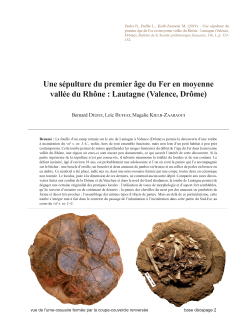
06-2019, tome 116, 1, p. 133-152 - Bernard Dedet, Loïc Buffat, Magalie Kielb-Zaaraoui - Une sépulture du premier âge du Fer en moyenne vallée du Rhône : Lautagne (Valence, Drôme)
La fouille d'un camp romain sur le site de Lautagne à Valence (Drôme) a permis la découverte d'une tombe à incinération du viie s. av. J.-C., isolée, hors de tout ensemble funéraire, mais non loin d'un petit habitat à peu près contemporain. Cette tombe permet de mieux appréhender les usages funéraires du début de l'âge du Fer dans la moyenne vallée du Rhône, une région où ceux-ci sont encore peu documentés, ce qui accroît l'intérêt de cette découverte. Si la partie supérieure de la sépulture n'est pas conservée, il subsiste néanmoins la totalité du loculus et de son contenu. Le défunt incinéré, âgé d'environ 18 ans, est probablement une adolescente si l'on en croit la parure qui l'a accompagnée sur le bûcher : une boucle d'oreille, un bracelet et deux anneaux de jambes en bronze et un collier de perles en bronze ou en ambre. Ce matériel a été placé, mêlé aux os, dans une urne-ossuaire fermée par une coupe, toutes deux en céramique non tournée. Le loculus, juste à la dimension de ces derniers, ne contenait aucun autre dépôt. Comparée aux rares découvertes faites aux confins de la Drôme et du Vaucluse et dans le nord du Gard rhodanien, la tombe de Lautagne permet de dégager une certaine originalité des pratiques locales : l'utilisation de vases de morphologie et d'aspect fort semblables, qu'ils servent d'ossuaire ou de contenant de denrées ; la parure des chevilles du mort par des anneaux ou jambelets de forme et décor très proches ; l'assemblage des mêmes types d'objets de parure. Mais au-delà de ce particularisme, cette tombe s'intègre tout à fait dans le contexte du passage de l'inhumation à l'ncinération dans cette partie du Sud-Est, au cours du viie s. av. J.-C.
The archaeological excavation of a Roman camp on the Lautagne site in Valence (Drôme) brought to light a secondary cremation grave which can be dated on the 7th century BC. This tomb is isolated from any funeral ensemble, but not far from a small habitat more or less contemporary. This discovery illustrates the burial customs of the beginning of the Iron Age in the middle valley of the Rhone, a region where these are still little documented, which increases the interest of this find. If the upper part of the burial is not preserved, however, the entire loculus and its contents remain. The deceased cremated, about 18 years old, is probably female if we believe the adornment that accompanied her on the pyre: an earring, a bracelet and two legs rings, in bronze, and a necklace of pearls in bronze or amber. This material was placed, mixed with the bones, in an ossuary urn closed by a cup, the two vases in unturned ceramics. The loculus, just the size of these, contained no other deposit. Compared to the rare discoveries made on the borders of the Drôme and Vaucluse and in the north of the Gard, Lautagne?€?s grave reveals an originality of local practices : the use of vases of morphology and aspect very similar, they serve as an ossuary or container of foodstuffs; the adornment of the ankles by rings of very similar shape and decoration; the assembly of the same types of objects. But beyond this particularism, this grave fits perfectly in the context of the passage from burial to incineration in this part of the South-East of France, during the 7th century BC.
On the banks of the Rhône, in the Gard, the Vaucluse and the south of the Drôme, as well as in the Southern Alps, the deceased are not burned but buried, as at Pont-de-Pierre 2-Nord (near Bollène) the Late Bronze Age IIIb, or Boulats (near Montélimar) and Picoulette (near Orange) in the 8th century. In the following century, while the deceased were not burned at La Bâtie (near Bollène) and la Mornasse (near Orange), cremation appeared in some tombs, such as Camper (near Bagnols-sur-Cèze), a place where burials and cremation graves meet, or Gagne-Pain (near Bollène). The deceased cremated of Lautagne is therefore, at the end of this century, in a context of coexistence of both types of body care. And in these plains of the left bank of the Rhône, during the following century, it is cremation that seems to become predominant (la Rouverette near Bollène, Malalones near Pierrelatte).
The use of an ossuary vase, as in Lautagne, is poorly informed in this region. The conditions of discovery and conservation of the tombs of Camper 2 and la Rouverette do not allow to know if the bones were placed in a vase or not. These are deposited directly in the pit at Gagné-Pain, which was a relatively minor use in cremation cemeteries of the Languedoc, where the deposit of bones in an urn dominates until the end of the 7th century, but becomes more frequent thereafter.
In Lautagne, as in the rest of the middle Rhone valley, there is a lack of information concerning the superficial part of the grave. The only documented site on this subject is that of Pont de Pierre 2-Nord, which shows the existence of a mound of earth, surrounded by a ditch, a formula also attested in the coastal plains of eastern Languedoc. Also built with earth, but supplemented by internal or peripheral structures of river pebbles, are the tumuli of the alpine valleys of the of the Durance basin. And probably it is necessary to imagine at least a simple heap of earth for these tombs of the edges of the Rhone, installed on glaciofluvial terraces or in alluvial environment.
Given the excavated surface all around her, the Lautagne?€?s grave does seem to be isolated from any funerary context.
This distinguishes it somewhat from other sites in the region, such as La Bâtie, Les Malalonnes, Gagne-Pain or Camper, which are small groupings of tombs.
Another striking fact, the union of objects provided by Lautagne?€?s tomb is found in a similar way in several other burials in this geographical areaof the middle Rhone valley, regardless of how the body is treated. This undoubtedly marks a regional custom. In this respect, it is even surprising to note the similarity of the assemblage of objects between Lautagne and the tomb 1 of La Bâtie. The urn, even though the use differs, ossuary in Lautagne, simple container for food at La Bâtie, has exactly the same shape, the same proportions and the same dimensions. In both cases are legs rings of very identical, as well as the same pearlamber . Very similar objects also in grave 1 of Ventavon tumulus 18, with the same form of urn, here also containing foodstuffs, a ring at each of the ankles of the buried dead, pearls of amber, but also of paste of glass, and a bracelet, here in lignite. This is the case again with the tomb 1 of Camper, with his lot of rings of legs. The custom of parrying the ankles of the deceased such rings seems even well fixed in the region, whether the body is cremated or not burned.
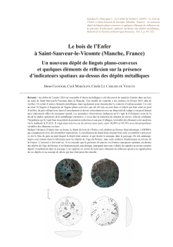
05-2019, tome 116, 1, p. 95-132 - Henri Gandois, Cyril Marcigny, Cécile Le Carlier de Veslud Le bois de lEnfer à Saint-Sauveur- le-Vicomte (Manche, France) : un nouveau dépôt de lingots plano-convexes et quelques éléments de réflexion sur la présence d
Résumé : Au début de l'année 2014 un ensemble d'objets métalliques a été découvert de manière fortuite dans un bois au nord de Saint-Sauveur-le-Vicomte dans la Manche. Une fouille de contrôle a été réalisée en février 2015 afin de vérifier s'il restait d'autres éléments métalliques mais également pour documenter le contexte d'enfouissement. Ce sont au total 18 lingots et fragments de lingots plano-convexes qui ont été mis au jour dans ce dépôt qui était situé au pied d'un bloc de grès offrant trois faces d'arrachement et dressé verticalement avec un dispositif de calage à son pied faisant ainsi clairement office de marqueur spatial. Les premières observations indiquent qu'il s'agit là d'éléments issus de la fin de la chaîne opératoire de la métallurgie extractive, c'est-à-dire la réduction de minerai de cuivre. Afin de confirmer l'hypothèse qu'il s'agit bien de produits de première réduction et non pas d'alliages, la totalité des éléments a été analysée via la méthode ICP-AES. Il s'agit dans tous les cas de cuivres assez purs, entre 98,09% et 99,74% avec des proportions variables des éléments en trace.
Malgré l'absence d'objets mis en forme, le dépôt du bois de l'Enfer a été attribué au Bronze final atlantique 3 (BFIIIb), par comparaison avec des ensembles équivalents. La localisation du dépôt dans un petit bois isolé a contribué à préserver in situ le bloc de grès au pied duquel le dépôt était enterré, et qui devait le marquer dans le paysage. De tels aménagements sont connus dans la littérature pour les dépôts de l'âge du Bronze, mais sans synthèse diachronique au niveau de la France. L'exercice a été tenté ici, et on constate que la présence de pierres ou d'autres marqueurs spatiaux au-dessus des dépôts de l'âge du Bronze n'est finalement pas anecdotique, marquant ainsi une volonté de signaler au moins certains dépôts visuellement dans le paysage. Ceci apporte en retour de nouveaux éléments de réflexion quant à la signification de ces dépôts et au concept de tabou qui leur était peut-être attaché.
At the beginning of 2014, a set of massive metal objects was fortuitously discovered in a wood north of Saint-Sauveur-le-Vicomte, Manche, Normandy. The find is located along the eastern edge of the bois de l?€?Enfer, on a small terrace just below a sandstone cliff along a north-south axis. The cliff is less than thirty meters away from the river Ouve that flows through the village. Two of the authors (H.G. & C.M.) received the recovered artefacts for identification. The artefacts were exclusively bun shaped ingots and fragments of ingots, probably from a hoard.
A small excavation undertaken in February 2015 aimed to check for other objects and to document the context of the deposit. The dating of the probable hoard remains difficult, as no other objects were found during the initial discovery and the purpose of the excavation was also to recover any other objects in order to ensure a reliable dating. The hoard was located just under a small standing stone with three detachment surfaces and a blocking device consisting of small stones at its base. The sandstone block originally a marker or a landmark probably came from the nearby cliff. However, because of the very numerous bioturbations (mainly roots), no pit limits were identified during the excavation. For the same reason, it was not possible to interpret the position of the remaining metal artifacts under the standing stone, as some underlying roots had very likely disturbed the objects.
Eighteen metal elements were discovered in this hoard, eleven in the first instance, the remaining objects during the excavation. A small element was found on the surface near the sandstone block, one in the field between the cliff and the river (most likely lost by the inventor), and finally five underneath the standing stone. Unfortunately, no other objects were unearthed, the entire hoard consisting only of ingots and ingot fragments. The size and weight of these objects vary as the heaviest ingot weighs 3,356 kg, and the lightest ingot fragment only 66 g. All the artifacts found in the hoard have common characteristics: irregular and wrinkled surfaces as well as a general appearance of great porosity, with many deep holes and hollows being visible on the complete ingots. These first observations clearly indicate that the objects come from the final stage of the extractive metallurgy chaîne opératoire, in other words: the smelting of copper ore. It should also be noted that there is no possible refitting between objects.
In order to support the hypothesis that these objects are the result of a smelting process and not alloys from a later stage of the metallurgy chaîne opératoire, all the elements were analyzed using the ICP-AES (Inductively Coupled Plasma ?€? Atomic Emission Spectroscopy) method at the University of Rennes 1 to determine their elemental composition. It was found that in all cases the artifacts were made of copper of between 98.09% and 99.74% purity, the proportions in trace elements varying from one object to another. The fact that all the artifacts are copper ore smelting products makes it possible to overcome all the difficulties associated with the combining of copper / copper alloys from different origins or with recycled metal. It is this type of artifact that is closest to the original copper ores and thus to the mines, an important factor when considering the metal artifacts of the Atlantic Bronze Age in France. As there were no other manufactured objects providing a clear typology, the dating of the hoard has not been straightforward. However, similar hoards containing only copper ingots or ingot fragments have been found elsewhere, mainly in the south of the Armorican peninsula, making the bois de l?€?Enfer hoard, the northernmost manifestation of the phenomenon. A recent excavation in a field in Kergaradec, Gouesnac?€?h, Finistère, Brittany, has led to the discovery of 3 hoards, one of them containing only ingots and ingot fragments. The other two hoards, as well as another found in the 19th century again in the same field also contained the same ingots and fragments as the ones from Normandy. The manufactured objects in these hoards date to the final stage of the Late Bronze Age, providing a dating for the ingots only hoards.
The hoard of the bois de l?€?Enfer is a particularly interesting set in more than one way. Firstly, with more than 13 kg of copper, it represents the largest set of ?€?foundry remains?€? uncovered in the Manche department. The fact that it is a hoard made up solely of bun-shaped ingots and ingots fragments is also to be noted, this type of set being particularly are. Further analyses of the ingots that focus mainly on lead isotopes, could match their signature with known ores from ancient mining districts.
The hoard was located in a small isolated wood on a terrace between a sandstone cliff and a marshy field. The field had not been ploughed which helped to preserve the sandstone block marker in situ. These markers have been recorded from time to time; however, there is no diachronic overview for France. In a study undertaken for this paper, it seems that stones or other markers placed near the hoards are far from anecdotal, and visually mark the position of some hoards within the landscape. This in turn provides new data for considering the meaning of these hoards and for reexamining their taboo status.
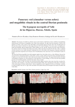
04-2019, tome 116, 1, p. 73-93 - Primitiva Bueno-Ramírez, Rosa Barroso-Bermejo, Rodrigo de Balbín-Behrmann - Funerary red (cinnabar versus ochre) and megalithic rituals in the central Iberian peninsula. The hypogean necropolis of Valle de las Higue
Abstract:
The presence of cinnabar in collective graves in the interior of the Iberia reveals a symbolic role identifying ritual practices well known in megaliths in the south of the peninsula. The data from the necropolis of Valle de las Higueras at Toledo, in the context of the Chalcolithic of the peninsula interior (from the 4th to the 3rd millennium cal BC), provide a point of reference for discussing "funerary red" in later Prehistory. The exotic source of cinnabar, probably from Almadén, adds an original aspect. While cinnabar was the "specific" funerary red of the south of the Iberia, the evidence found in Catalonia and south-eastern France reflects the major role played by the Ebro valley. Combined with the circuits for ivory, amber and gold, it underlines the role of the south in the emergence of funerary models that became particularly important across Europe in the 3rd millennium (at the same time as use of bell beakers reaches its hight).
The data from Iberian megaliths from which pigment samples have been taken, shows a clear difference between the red used for the constructional features of the tombs, in stone or earth, and the red used for bones and human figurines. Cinnabar was reserved for the latter, while walls were decorated with iron oxides. The engraved decorations associated with painting on figurines are convincing proof of the importance of dyed clothing, as well as the more than probable presence of ceremonial garments, shrouds, body paint, tatoos or masks.
Through the source of their red colour, the deceased possibly display narratives that come from their everyday life, such as the work of miners, or else their social position through clothes, tatoos and funerary body paint. On the basis of the archaeological evidence analysed here, various explanations can be suggested for the use of cinnabar: a rituality in which red plays the role of a sign of life and death with symbols that persist throughout the Iberian Neolithic and Chalcolithic.
La présence de cinabre dans les sépultures collectives du centre de la péninsule Ibérique, montre un rôle symbolique identifiant des pratiques rituelles bien connues dans les mégalithes du sud de la péninsule. Les données obtenues sur la nécropole de Valle de las Higueras à Toledo, dans le contexte du Chalcolithique de l?€?intérieur péninsulaire (dès le IVe jusqu?€?au IIIe millénaire cal BC), constituent un point de repère pour réfléchir sur le « rouge funéraire » dans la Préhistoire récente. La source exotique de cinabre, probablement d'Almadén, ajoute un élément unique. Alors que le cinabre était le rouge funéraire « spécifique » du sud de la péninsule Ibérique, les indices trouvés en Catalogne et dans le sud-est de la France témoignent du rôle majeur joué par la vallée de l?€?Èbre. S'ajoutant aux circuits de l?€?ivoire, de l?€?ambre et de l?€?or, il souligne le rôle du sud dans l?€?apparition de modèles funéraires qui, au troisième millénaire (en même temps que l'utilisation des gobelets campaniformes est à son apogée), devient particulièrement importante dans toute l'Europe.
Les informations provenant des mégalithes ibériques où des pigments ont été prélevés, montrent une nette différence entre le rouge utilisé dans les structures architectoniques des tombes, de pierre ou de terre, et le rouge utilisé pour les os et les figurines humaines. Le cinabre était réservé à ces derniers tandis que les parois sont décorées avec des oxydes du fer. Les décorations gravées associées à la peinture sur les figurines sont une preuve convaincante de la valeur des vêtements teints, ainsi que de la présence plus que probable de vêtements de cérémonie, de linceuls, de peintures corporelles, de tatouages ou de masques.
Il est possible que les défunts affichent, à travers la source de leur couleur rouge, des récits qui proviennent de leur vie quotidienne, comme le travail des mineurs, ou encore leur valeur sociale par les vêtements, les tatouages et les peintures corporelles funéraires. On peut envisager une variété d?€?explications par rapport à l?€?usage du cinabre, si on tient compte du registre archéologique ici analysé : une ritualité où le rouge joue le rôle de signe de la vie et de la mort avec des symboles qui perdurent tout au long du Néolithique et du Chalcolithique ibériques.
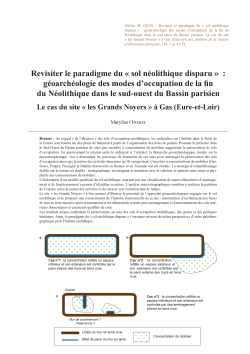
03-2019, tome 116, 1, p. 41-72 - Marylise Onfray Revisiter le paradigme du « sol néolithique disparu » : géoarchéologie des modes doccupation de la fi n du Néolithique dans le sud-ouest du Bassin parisien. Le cas du site « les Grands Noyers » à Gas (Eu
Au regard « de l'absence » des sols d'occupation néolithiques, les recherches sur l'habitat dans le Nord de la France sont basées sur des plans de bâtiment à partir de l'organisation des trous de poteau. Pourtant la présence dans le Sud-Ouest du Bassin parisien de sites peu stratifiés à concentration de mobilier suggérerait la préservation de sols d'occupation. En questionnant la relation entre le sédiment et l'artefact, la démarche géoarchéologique, fondée sur la micromorphologie, vise à déterminer les processus de formation de ces sites pour interroger la préservation des sols d'occupation ainsi que la nature des activités humaines qu'ils enregistrent. Cinq sites à concentrations de mobilier (Gas, Sours, Poupry, Pussigny et Maillé) découverts en Beauce et en Touraine ont été étudiés. La stratégie d'échantillonnage établie sur le terrain est double : stratigraphique, en intégrant la transition avec le substrat, et spatiale entre coeur et périphérie des concentrations de mobilier.
L???élaboration d'un modèle qualitatif du sol néolithique, exprimé par une classification de micro-ethnofaciès d'aménagement et de fonctionnement a permis d'identifier sa nature. L'analyse microstragraphique contribue à restituer la partition de l'espace selon la nature des activités et de retracer son évolution dans le temps.
Le site « les Grands Noyers » à Gas permet d'illustrer le potentiel de l'approche géoarchéologique engagée sur le sol néolithique et de proposer une reconstitution de l'histoire fonctionnelle de ce site : construction d'un bâtiment aux bases de mur en terre massive après terrassement et nivellement du terrain, puis aménagement et fonctionnement des sols intérieurs domestiques et extérieurs qualifiés de cour.
Les résultats acquis confirment la préservation, au sein des sols d'occupation néolithiques, des gestes et des pratiques humaines. Ainsi, le paradigme du « sol néolithique disparu » s'estompe ouvrant de riches perspectives d'ordre palethnographique pour l'habitat néolithique.
The sedentary lifestyle of Neolithic societies places the settlement at the heart of archaeological issues. In northern France, research has mainly focused on sites with negative structures, whereas the frequent presence of clusters of artefacts was not considered as a potential element of the settlement structuration. However, the archaeological floor carrying essential data does approach this research question. Historically, at the beginning of the research on early Neolithic settlements in the Aisne Valley and throughout Eastern Europe, the soil, as an archaeological entity, was not identified. Also, it was considered, except for a few isolated cases, as not preserved. Since then, this observation has been challenged and the lack of detecting floors has limited our understanding of Neolithic settlements.
The south-west of the Paris basin provides a relevant framework to investigate Neolithic soils and to question their absence. The end of the Neolithic in this region is still poorly culturally defined and building plans are largely unknown: buildings on posts of small modules and one monumental building. Nevertheless, numerous sites not stratified with artefact clusters (35 among the 79 sites identified) are discovered. In this context, where settlements are largely still poorly documented, it seems necessary to test if the cluster of artefacts constitutes a witness to the floor. We engaged an original geoarchaeological approach based on soil micromorphology to examine the sediment that contains these artefacts and thus characterise the formation processes of these archaeological layers. These elements then allow us to question ourselves on:
??? the nature of the Neolithic floor and its variability to document the construction and functioning of inhabited spaces?
??? the way in which they contribute to characterising the dynamics of occupation of sites at the end of the Neolithic period?
To answer these questions, the study material comes from five sites located in the Beauce (Sours, Gas and Poupry) and Touraine (Pussigny and Maillé) regions. The methodological approach is related to the geoarchaeology using soil micromorphology as a toolset. The strategy of sampling is twofold: stratigraphic sampling integrating all the thickness
of the stratigraphy and the transition with the substrate and associated with a spatial sampling (37 sedimentary sequences). The study of thin sections allow to identify sedimentary organisations defined as "micro-ethnofacies". Resuming the patterns introduced since the 1990s and according to the constants observed, a first qualitative model of the Neolithic floor expressed by a classification of micro-ethnofacies is proposed according to layout and functioning. Then, the phasing of the set of micro-ethnofaciès sequence from microstratigraphy analyses allows to restitute the partition of space according to the nature of the activities and trace its evolution depending on time.
To illustrate the potential of the geaoarchaeological study, we rely on the example of the "les Grands Noyers"site at Gas with a thin stratigraphy which allows to propose a reconstitution of its functional history. The establishment of the settlement is characterised by extensive earthworks activities and levelling of the field beforehand to the construction of a building whose architectural foundations are in cob. The floors of the building are regularly spread screeds and recorded a high trampling. A courtyard floor develops on the outside above a slab of earth that creates a platform. Courtyard floors are sometimes maintained which underlines a rotation in the functioning of the activities that are dedicated to it. Once the space has been abandoned, the earthen architecture, subject to temperate climatic conditions, breaks up and ended up in its collapse.
These original results confirm the preservation of human acts and practices in Neolithic floors. The identification of floors, constructed or not, and of their division in the space testifies, on the contrary, of the well conservation of the recorded information. According to the first observations, this is probably related in large part to the collapses of the cob construction or to rapid overlays such as colluvium. These results also contribute to highlight the informative potential of these thin stratified sites with clusters of artefacts which are a settlement with cob buildings and structured outdoor spaces of the courtyard type.
Soil analysis demonstrates that Neolithic settlements had a though-out project involving earthworks and levelling activities. The floors are in most cases built according to several construction techniques. The relationship between the bases of the walls and the cluster of artefacts leads to the formation of wall effects (internal and external) and the walls can therefore be considered as structuring elements of occupying grounds. The sedimentary archives are true cultural documents and the results obtained bring new palethnographic data. They emphasise an important variability between the soils which belong to a partition of the space where the floor is characterised according to the nature, the time and the organisation of the activities. For the inner space, the typical floor is a very heavily used (intense trampling) constructed floor. However, the absence in most cases of microartefacts does not make it possible to specify the nature of the activities practised, perhaps because of conservation problems or waste management. These soils are distinguished by the maintenance they show as they are regularly maintained. The typical outer floors are courtyard floors where the cluster of artefacts reflects a space frequented and maintained at an irregular pace. Here again, the rarity of microartefacts tends to limit the identification of the activities practised. The paradigm of the disappeared Neolithic soil??? is fading away, opening up rich palethnographic perspectives.
02-2019, tome 116, 1, p. 29-39 - Pascal Foucher, Cristina San Juan-Foucher, Sébastien Villotte, Priscilla Bayle, Carole Vercoutère, Catherine Ferrier - Les vestiges humains gravettiens de la grotte de Gargas (Aventignan, France) : datations 14C AMS
Résumé : La grotte de Gargas fait l'objet d'un programme de recherche depuis 2004. Cet article précise le cadre chronologique et stratigraphique des vestiges humains trouvés dans la couche d'habitat gravettien de la Galerie inférieure. Ils correspondent à une mandibule d'enfant (entre 1 et 3 ans), une clavicule gauche d'enfant (entre 1 et 7 ans), un fragment de neurocrâne, une dent monoradiculé déciduale, un fragment de clavicule (sujet immature), un fragment de côte, et à une diaphyse de fémur (sujet adulte). Les cinq premiers ont été découverts in situ, le sixième dans les remblais des fouilles anciennes ; le fragment de fémur avait été trouvé lors des fouilles d'É. Cartailhac et d'H. Breuil, en 1911 et 1913.
Au moins trois sujets semblent être représentés dans cet assemblage : un jeune enfant (mandibule), un sujet adulte (fémur), et un enfant plus âgé (dent déciduale à la racine résorbée) : seuls les deux premiers pourraient s'intégrer dans un contexte funéraire lato sensu qu'il s'agira de préciser dans les années à venir.
La mandibule et le fémur ont fait l'objet d'analyses 14C AMS directes. Les résultats sont respectivement 24 930 ± 220 BP (29500 28532 cal. BP) et 24 880 ± 140 BP (29 310-28 593 cal. BP). Puis, ces datations sont mises en perspective par rapport à celles obtenues sur les vestiges de faune consommée dans l'habitat. Si l'on considère la distribution et la concentration significative des dates, on peut définir deux séquences principales d'occupation : la première se situe entre 31 500 et 30 000 cal. BP, la seconde entre 29 500 et 28 500 cal. BP. Les dates des restes humains se placent dans la phase finale des occupations de la grotte.
The Gargas cave has been the subject of a research programme since 2004. This article focuses on the chronological and anthropobiological framework of the human remains found in the Gravettian habitat levels of the Lower Gallery. These remains are:
- a well-preserved fragment of a child mandible (GPA-11-Wb-646) found in the GPA sector, in Room I, close to the Great Wall of Hands. The coronoid process is missing, the lateral face of the condylar process is eroded, the gonial angle is broken, and the superficial external cortical bone of the lower margin of the symphyeal region is desquamated on ca. 20 mm. The age-at-death is estimated between 1 and 3 years, based on the degree of mineralization and eruption of the teeth. The mandible was found in the upper third of a Gravettian level. Its archaeological context consisted mainly of an accumulation of faunal remains (centimetric to decimetric fragments and small burnt elements, some of them with anthropogenic traces), and some elements of lithic industry (tools and debitage products in flint and quartzite), used pebbles and coloring materials;
- a fragment of a child left clavicle (GPA-11-Wb-610). The bone is preserved on 47 mm, from the lateral third of the insertion for the deltoid muscle to the middle of the M. pectoralis major attachment site. The breaks are smooth and the bone surface displays many impacts, probably due to carnivorous activity. The age-at-death it estimated to 1 to 7 years;
- an immature clavicle fragment (uncertain determination) (GPA-11-Wb); in any case, this small fragment does not correspond to the previous left clavicle;
- a small (36.0 mm length and 20.0 mm width) neurocranial fragment (GPO 05-K9a) found in the GPO area (corresponding to the former entrance). This fragment belongs to an adult or a subadult; ??? a first upper right deciduous incisor (GPO-07- K13b-1550). The crown is very worn and preserved only on 2 to 3 mm.
Three quarters of the root appear resorbed, indicating an age between 6 to 7 years old;
- a 42 mm long body fragment of a rib (GDI-2011 deblais) with grey sediment covering one extremity, and with some red linear traces on the surfaces. This bone was found in the GDI sector, within the dumps of previous excavations. The very ovoid and fairly thick section (7 by 11 mm) makes uncertain the attribution to the human species;
- a fragment of an adult left femoral diaphysis, preserved over 242 millimeters, found in the Cartailhac-Breuil collection of the "Institut de Paléontologie Humaine". The bone is broken proximally below the lesser trochanter and distally at the junction between the second and last third of the diaphysis. This human remain, discovered during the excavations of É. Cartailhac and H. Breuil between 1911 and 1913, was reported by Hugo Obermaier in his book L'Homme fossile and attributed to the "Aurignacien supérieur" (Gravettian), without further information.
At least three subjects are represented in this skeletal assemblage: a young child (the mandible), an adult individual (the femur), and an older child (the deciduous tooth with resorbed root): only the first two individuals were concerned by mortuary practices that have to be discussed in following studies.
The first five human remains were discovered in situ within the Gravetian sedimentary unit, which corresponds to a palimpsest of occupations. From a chrono-cultural point of view, and on the basis of a typo-technological analysis of the lithic industry (Noailles burins, Gravette and Vachons points) and bone industry (Isturitz-type assegai points and herbivore ribs decorated with notches), Gargas settlement is attributed to the Noaillian.
The mandible and the femur were directly dated (AMS C14 radiocarbon date). The results are respectively 24,930 ±220 BP (29500-28532 cal. BP) and 24,880 ±140 BP (29310-28593 cal. BP). These dates are compared with the chronological sequence obtained from C14 dates on the faunal remains. Considering the distribution and significant concentration of dates, two main periods of occupations can be identified: the first one is between 31,500 and 30,000 cal. years BP, the second between 29,500 and 28,500 cal. years BP. The direct dates of the human remains place them in the final phase of the occupation of the cave.
The presence of human remains in the Gravettian occupation levels of Gargas, at the foot of the decorated walls, brings new perspectives for studies on the relationship between mortuary practices, settlement and art. We were able to highlight in Room I, where two thirds of the handprints are concentrated, the interpenetration of a ???domestic??? and a ???symbolic??? space. The taphonomical context of the human remains, isolated and without anatomical connection, sometimes covered with a thin calcite layer, suggests surface deposits that have undergone post-depositional mechanical disturbances altering the original disposition and thus making difficult to interpret their funeral context.
01-2019, tome 116, 1, p. 7-28 - Quentin Borderie, Gabriel Chamaux, Sebastian Kreutzer, Éric Ahmed-Delacroix, avec la collaboration de Pierre Perrichon, Nicolas Payraud, Émilie Fencke, Olivier Labat, Norbert Mercier Occupations humaines et chronostratigr
Résumé :
Cinq opérations de diagnostic successives, conduites à Illiers-Combray de 2012 à 2015 par le Service d'archéologie du département d'Eure-et-Loir, ont permis l'identification de vestiges paléolithiques compris dans une séquence limoneuse de plateau, sur une aire de plus de 100 ha, fouillé manuellement sur 60 m². La découverte de ce site vient enrichir les connaissances sur le Paléolithique moyen du Centre de la France, encore très peu documenté, et ajouter un jalon manquant pour le stade isotopique 5b dans le Nord de la France.
Les découvertes ont été faites grâce au creusement de 453 sondages, d'une profondeur allant jusqu'à 7 m, jusqu'au substratum rocheux, tous les 25 m à 50 m. Les vestiges lithiques sont présents à une profondeur comprise entre 0,70 m et 2 m, répartis sur l'ensemble de l'aire, isolés ou concentrés en plusieurs dizaines de pièces. Les vestiges organiques ne sont pas conservés, du fait de l'acidité des sédiments. La séquence pléistocène est bien représentée sur la majorité du plateau. Elle se caractérise notamment par le développement de sols lessivés, la présence de pseudomorphoses de fentes de gel, ainsi que de fosses pléistocènes de déracinement d'arbre. L'approche géoarchéologique combine des analyses sédimentologiques, micromorphologiques et des datations OSL et post-IR IRSL sur limon loessiques et TL sur artefacts chauffés.
Les premiers résultats confirment l'intérêt du site. La séquence limoneuse présente trois cycles glaciaire-interglaciaire, dont les plus récents couvrent le Saalien, l'Éémien et le Weichsélien. La série lithique regroupe 931 pièces, dont la majorité a été identifiée dans un même horizon argilo-limoneux riche en concrétions ferro-manganiques. L'aspect très frais des vestiges et la présence de nombreux remontages et raccords témoignent de la bonne préservation des niveaux archéologiques. L'analyse de ce mobilier suggère la concomitance de plusieurs chaînes opératoires de débitage, orientées vers la production d'éclats, de lames et de pointes. Une chaîne opératoire de façonnage est également attestée par la présence de bifaces. L'outillage sur éclat est faiblement représenté. Il se compose principalement de racloirs et de quelques pièces sommairement retouchées.
Au regard des données déjà collectées lors des diagnostics, il semble que la fouille de ce gisement pourrait constituer un jalon important pour la connaissance du Paléolithique moyen. La localisation de ce site, à la charnière entre les bassins versants de la Seine et de la Loire, viendrait avantageusement documenter un secteur clef pour la compréhension de la paléogéographie culturelle des populations néandertaliennes.
Between 2012 and 2015, five successive archaeological campaigns were led by the Department of archaeology of Eure-et-Loir, on the Illiers-Combray plateau, 1 km to the east of the river Loir. Middle Palaeolithic remains were discovered in a Pleistocene loess-palaeosoils sequence, extending over an area of more than 10 km?. This Early Weichselian site constitutes a major discovery, due to the good preservation of the artefacts and the sparse data in the south-west of the Paris basin. During the archaeological survey, trenches were dug down to the bedrock every 25 m to 50 m, which revealed lithic remains over the entire research area, while neither bones nor organic remains were preserved due to the low pH value of the soils. The geoarchaeological approach combines sedimentology, micromorphology and luminescence dating (OSL, post-IR IRSL, TL) of sediments and burned flint artefacts.
Lithic artefacts were found isolated or in clusters of dozens of pieces at a depth comprised between 0.70 m and 2 m. Three main sectors were identified. The sector n° 1, situated to the north-east of the town, comprises of 59 lithic artefacts in small clusters of about 10 pieces per square meter over an area of 4500 m? area. The sector n° 2, 500 m to the south, delivered 261 artefacts spread over an area of 3.6 ha. The third sector, covering an area of 0.4 km?, is the largest of the three sectors and is located to the south-east of the two other areas. 186 lithic artefacts were found in this area. The Pleistocene loess-palaeosoil sequence is homogeneous and well preserved on the plateau. It covers at least three glacial-interglacial cycles (Saalian, Eemian and Wechselian) and can be divided into 15 units. At the base, the Saalian strata (unit 11 to 15) are above the ?€?argile à silex?€? tertiary formation (unit 16). The OSL age of the unit 11 is 218.6 ± 49.6 ky. Saalian strata are marked by huge ice wedges and hydromorphy. The Eemian strata show a well preserved pseudomorph of an ancient tree windthrow (unit 9) located in a luvisol (unit 8 and 10). OSL dating of the unit 10 gives 121.0 ± 15.7 ky. The Early Weichselian strata are comprised of three units 7.1, 7.2 and 7.3. The majority of the artefacts is contained in the unit 7b, which is rich in ferro-manganic nodules. However, some artefacts were also found in the 7a and 7c units, as well as in the ice wedges which cut through the Early Weichselian strata. The top of the sequence is characterised by decarbonated loess deposits in which a luvisol has developed. The lithic material is in excellent condition and numerous refi ttings testify a good preservation within the archaeologi- cal layers. The analysis of these remains suggests a concomitance of several operating production chains, to manufac- ture fl akes, blades and points as well as an operating chain for bifacial shaping. The identifi ed production methods are convergent unipolar, parallel unipolar, Levallois and discoid debitage. However, tools made out of fl akes are rare. They consist of side scrappers and retouched artefacts. Two burned artefacts from unit 7.2 were dated by TL at 88.9 ± 6.9 ky and 89.7 ± 6.9 ky, which place the lithic industry in the MIS 5b. The preliminary results show that the site constitutes a new reference for the Pleistocene and the Middle Palaeolithic of the Centre and the North of France, in addition to the reconstruction of the palaeoenvironmental and archaeological history of this area. Finally, the extensive excavation could become important in reconstructing Middle Palaeolithic history, since the site itself is located on the divide between the watersheds of the Seine and the Loire and, thus, in a key area for understanding the cultural palaeogeography of the Neanderthal populations.
Coordonnées
Pôle éditorial de la MSH Mondes
(Maison de l'archéologie et de l'éthnologie)
Boite 41
21 allée de l'Université
F-92023 Nanterre cedex - FRANCE