Cliquez sur la photo pour zoomer
Prix : 15,00 €TTC
16-2020, tome 117, 4, p. 673-707 - Monney J. Interactions symboliques en milieu insulaire : les roches gravées précolombiennes de Guadeloupe et leur relation au paysage
Les roches gravées précolombiennes de Guadeloupe et leur relation au paysage
Julien Monney
Résumé :
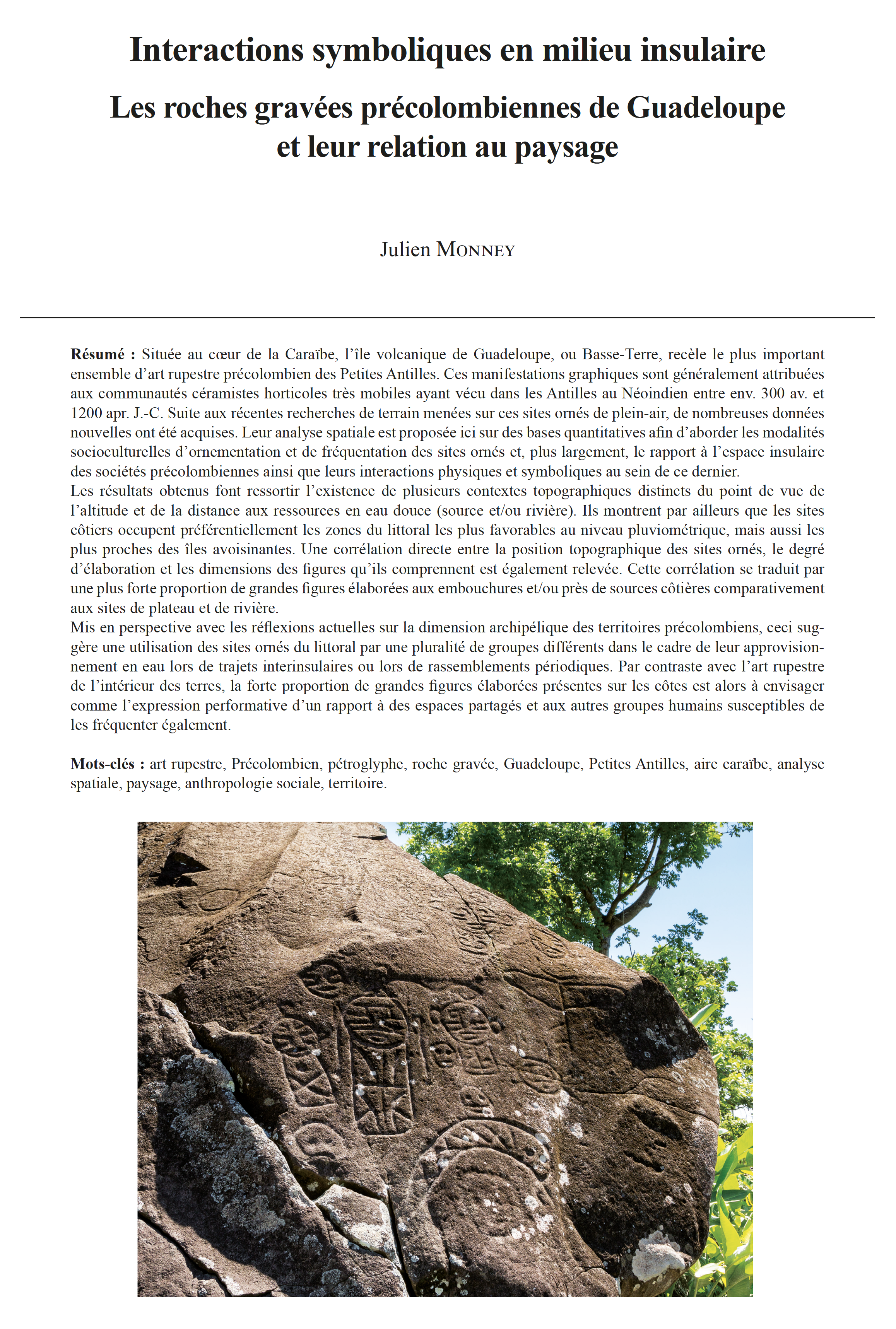
Située au coeur de la Caraïbe, l'île volcanique de Guadeloupe, ou Basse-Terre, recèle le plus important ensemble d'art rupestre précolombien des Petites Antilles. Ces manifestations graphiques sont généralement attribuées aux communautés céramistes horticoles très mobiles ayant vécu dans les Antilles au Néoindien entre env. 300 av. et 1200 apr. J.-C. Suite aux récentes recherches de terrain menées sur ces sites ornés de plein-air, de nombreuses données nouvelles ont été acquises. Leur analyse spatiale est proposée ici sur des bases quantitatives afin d'aborder les modalités socioculturelles d'ornementation et de fréquentation des sites ornés et, plus largement, le rapport à l'espace insulaire des sociétés précolombiennes ainsi que leurs interactions physiques et symboliques au sein de ce dernier.
Les résultats obtenus font ressortir l'existence de plusieurs contextes topographiques distincts du point de vue de l'altitude et de la distance aux ressources en eau douce (source et/ou rivière). Ils montrent par ailleurs que les sites côtiers occupent préférentiellement les zones du littoral les plus favorables au niveau pluviométrique, mais aussi les plus proches des îles avoisinantes. Une corrélation directe entre la position topographique des sites ornés, le degré d'élaboration et les dimensions des figures qu'ils comprennent est également relevée. Cette corrélation se traduit par une plus forte proportion de grandes figures élaborées aux embouchures et/ou près de sources côtières comparativement aux sites de plateau et de rivière.
Mis en perspective avec les réflexions actuelles sur la dimension archipélique des territoires précolombiens, ceci suggère une utilisation des sites ornés du littoral par une pluralité de groupes différents dans le cadre de leur approvisionnement en eau lors de trajets interinsulaires ou lors de rassemblements périodiques. Par contraste avec l'art rupestre de l'intérieur des terres, la forte proportion de grandes figures élaborées présentes sur les côtes est alors à envisager comme l'expression performative d'un rapport à des espaces partagés et aux autres groupes humains susceptibles de les fréquenter également.
Mots-clés : art rupestre, Précolombien, pétroglyphe, roche gravée, Guadeloupe, Petites Antilles, aire caraïbe, analyse spatiale, paysage, anthropologie sociale, territoire.
Abstract:
Located in the heart of the Caribbean, the volcanic island of Guadeloupe, or Basse-Terre, presents the most important concentration of pre-Columbian rock art in the Lesser Antilles. Comprising as many graphic entities as all the Lesser Antilles together, it is sometimes considered to be the only island, which by the number and complexity of its rock art, can stand comparison with Puerto Rico and the Greater Antilles in general. This rock art is attributed to the Ceramic Age societies that lived in the region between approx. 300 BC and 1200 AD. Following extensive field research recently carried out on these open-air rock art sites, a great deal of new data has been acquired. A spatial analysis of these data is proposed here on the basis of quantitative methods in order to address the sociocultural conditions of rock art and sites uses. The physical and symbolic relationships between the pre-Columbian societies and their geographical environment is addressed.
The results show that in Guadeloupe there are several distinct topographic contexts in terms of elevation and distance to freshwater resources (spring and/or river): 1: River mouth and/or coastal spring, 2: River, 3: Plateau. They also show that coastal sites (type 1) preferentially occupy the portions of the coastline that are most favorable in terms of rainfall rates, but also the closest to the following islands.
At the southern end of the island, the sites complex of Trois-Rivières and, to a lesser extent, the rock art sites on the east coast, are located along the shoreline closest to Les Saintes and Dominica islands to the south, and to Marie-Galante Island to the east. This portion of the coastline receives the highest amount of rainfall. The river system of the area also proves to be the most dense and stable of Guadeloupe Island. In fact, the recent volcanic rocks in the southern part of Guadeloupe Island in general constitute freshwater reservoirs that ensure great stability of water flows, even in periods of low water levels or drought.
A very comparable case is observed at the other end of the island. The only rock art site identified there so far - La Ramée - is less than 5 km away from the nearest point to the next island (Montserrat). It is also located precisely in the coastal area receiving the highest annual rainfall rate in northern Guadeloupe. In terms of rainfall, this area constitutes a small but significant local maximum. Coming from Montserrat, it is the first area of high rainfall encountered when one follows the coastline from the closest point of landing.
Thus, when taking into account the "highest coastal rainfall rates", "stability of water resources" and "minimum distance to neighboring islands", the sector that emerges first matches with the highest concentration of rock art, namely the southeastern coast of the island. To a lesser extent, the second sector to emerge is the northern end of the island where at least one site is known.
A direct correlation between the topographical environment of the rock art and its dimensions and complexity index is also to be noted. This results in a higher proportion of large elaborate figures at river mouths and/or in close proximity to coastal springs, and a higher frequency of small simple figures in the hinterland, be it on plateaus or, more markedly, along rivers. The very high concentration of rock art in Trois-Rivières - which comprises 92.2% of all the engraved rocks on the island and 85% of the rock art - plays here a major role. However, the same applies to the other rock art sites on the island outside this exceptional concentration.
In view of the topographic and morphometric differences existing between the rock art sites, the possibility of different sociocultural contexts and even different times of production and use as well as different motivations must be taken into account.
The presence of rock art on the coasts of Guadeloupe Island, and in particular the presence of monumental rock art at its southeastern end, is discussed in terms of seafaring, multi-islands territories and accessibility of freshwater resources for groups passing through to other islands. From this point of view, the density of rock art, the large dimensions and high degree of complexity of the figures observed in the mouth and/or coastal spring sites (type 1) is probably a consequence of the frequentation of these sites by a plurality of human groups taking advantage of the same resource, whether alternately during inter-island journeys or simultaneously during episodic gatherings. The highest proportion of large elaborate figures present on the coasts would then be the graphic expression of a relationship to shared places and to the other groups likely to frequent them as well. Ethnoarchaeological models show in fact that the interface zones between groups are likely to generate an open resurgence of symbolic expressions, especially when resources are scattered in an inhomogeneous and sporadic way over the territory or in the case of aggregation sites.
The existence of rock art sites further inland (types 2, 3, 4) raises the question of their articulation with the coastal sites (type 1). In the current state of research, two possibilities are theoretically conceivable. Either the sites on the plateaus were part of the same rock art complex as the coastal sites and had different but complementary uses; all the human groups frequenting the coast having then an equivalent collective or individual access to inland sites (hypothesis A). Or the inland sites constituted independent rock art complexes, distinct from the coastal areas both in terms of uses and users; this may imply a temporal dimension (hypothesis B).
In the absence of batey and/or of large rock structures to support the existence of ceremonial centers indicating intercommunity uses, the engraved rocks found on the plateaus are compatibles with private practices. Linked with the nearby presence on the plateaus of archaeological remains left by resident groups semi-permanently settled at a distance from the coast, it could then suggest the creation of rock art on the outskirts of the settlements or in garden areas. Nevertheless, the underlying motivations or symbolism associated with such practices (horticultural or other) still remains to be defined. These different results obtained on the basis of a spatial analysis of rock art in Guadeloupe Island thus contribute to current debates on the definition of territories in the Caribbean insular context.
Keywords: Pre-Columbian archaeology, rock art, petroglyph, Guadeloupe, Lesser Antilles, Caribbean Islands, spatial analysis, landscape, social anthropology, territory.
Autres articles de "Bulletin de la Société préhistorique française 2020"
15-2020, tome 117, 4, p. 641-671- Berranger M., Bauvais S. Changements sociétaux et évolution de l'économie du fer du Hallstatt D à La Tène D dans le Nord-Est de la France
Changements sociétaux et évolution de l'économie du fer du Hallstatt D à La Tène D dans le Nord-Est de la France
Marion Berranger, Sylvain Bauvais
Résumé :
Les âges du Fer en Europe nord-occidentale voient la diffusion et l'adoption progressive du fer, puis une succession d'innovations majeures dans les techniques de sa production. Les procédés de fabrication d'objet se démocratisent, tandis que la consommation des objets s'intensifie et gagne l'ensemble des strates sociales. La maîtrise des productions métallurgiques est considérée de manière récurrente comme un des moteurs de l'émergence des centres de pouvoirs. Nous proposons d'analyser ce postulat à l'aune d'un bilan renouvelé de nos connaissances sur la métallurgie du fer en prenant en compte un large espace correspondant au Nord-Est de la France actuelle. Cela inclut les zones où se manifestent de manière ostentatoire les élites du premier et du début du second âge du Fer, puis l'armement et l'art celtique florissant de La Tène moyenne. Pour la fin de l'âge du Fer, cet espace est également caractérisé par l'émergence de nouvelles formes de manifestations urbaines.
A travers une grille de lecture structurée, composée de critères descriptifs issus de la littérature (Brun et al., 2006 ; Roux, 2000 ; Costin, 1991), nous proposons d'étudier les formes d'organisation des productions sidérurgiques et leur évolution au cours des âges du Fer. Il est ainsi possible de constater les trajectoires différentes suivies par les activités de réduction et de forgeage tout au long de cette période. Elles se développent durant le Hallstatt D - La Tène A sous contrôle des élites. Cela mobilise, pour les activités de production de fer brut des savoir-faire simples, alors que les productions en forge documentent au contraire la maîtrise de techniques complexes évoquant un art de cours. A la fin des âges du Fer, les élites conservent leur emprise sur les moyens de production de centres de réduction fortement structurés, alors qu'à l'inverse, en forge, l'élargissement de la gamme des savoir-faire et la multiplicité des modes d'organisation permettent de reconnaître un artisanat maître de ses débouchés.
Mots-clés : âges du Fer, métallurgie du fer, organisation des productions, spécialisation artisanale, Nord-Est de la France.
Abstract: The Iron Ages in north-western Europe saw the gradual spread and adoption of iron, followed by a succession of major innovations in its production techniques. Object manufacturing processes became more democratic, while the consumption of objects intensified and reached all social strata. The control of metallurgy is repeatedly seen as one of the driving forces behind the emergence of power centres. We propose to analyse this postulate in the light of a renewed assessment of our knowledge of iron metallurgy in a large area in north-eastern France. This includes the areas where the elites of the late Hallstatt and early La Tène, show their ostentation in their weaponry and the flourishing Celtic art of middle La Tène period. At the end of the Iron Age, new forms of the ???proto-state??? phenomenon and the first urban centres characterise this area.
During Hallstatt D - La Tène A, most workshops can be classified according to very variable levels of production in relation to the smelting process. Ethnographic comparisons allow us to characterise their activities that range from a seasonal production by farmer-ironmakers to meet specific needs, to a large-scale production intended to supply medium- or long-distance markets. Several major production areas have been identified for this period: in the Mancelle region, in Puisaye and in the Berry region around Meunet-Planches (Indre).
In contrast to the reducing of iron ore, the processing of transforming metal into objects is more broadly and evenly distributed. However, during Hallstatt D / La Tène A, a very surprising symmetry is visible between the smelting and forging activities. The smelting is located at the western edge of the north alpine area and in the western peripheral regions, whereas forging activities are mostly carried out in the north-alpine area. This particularity of the Hallstatt D - La Tène A is noteworthy as until the Roman period, the distribution of forging sites is uniform throughout northern France.
The collapse of the princely residences and the emergence of simple chieftaincies do not seem to have led to a reorganization of the production of raw metal. Smelting workshops continue to exist and develop in the same areas, indicating that the old exchange networks continued to exist. Nevertheless, sporadic small-scale production either decreased or disappeared. In the case of forging activities, the development of ???craft farms??? and open agglomerations led to a sharp increase in production.
Major changes take place during La Tène D. Smelting activities take place in centres where a new smelting technique develops. Work units become more structured and standardized, while there is little or no evidence of one-off production. The advent of the oppida with their artisanal districts marks a new increase in the volume of objects being produced. Forging activities are standardized with large quantities of waste. The functional interdependence between workshops on the same site is repeatedly highlighted. Indeed, the fact that some workshops acquire raw masses of metal while others work with highly purified metal implies that the former provide the latter with at least part of their raw material.
Based on this thematic and chronological review, we propose to study the organisation of iron and steel production and their evolution during the Iron Age within a framework that uses descriptive criteria taken from previous studies in order to observe the evolution of smelting and forging during this period. These activities develop during the Hallstatt D - La Tène A as a "corvée" under the control of the elite. However, smelting process is simple, whereas forging requires proficiency and the mastering of expert techniques. This may be one of the possible explanations for the symmetrical spatial distribution of forging and smelting during Hallstatt D - La Tène A. Forging activities, which required much more know-how than smelting, were under a more direct control by the elites, who thus acquired glory and wealth. Raw metal is controlled through the control of exchange networks. During La Tène D, the production context evolves very differently for smelting and forging. Gallic elites still predominately control smelting, which leads to increased specialisation and a regrouping of the workshops. Conversely, the broadening of the range of skills and the multiplicity of organizational modes (ranging from "dispersed workshop" to "community specialization" and less commonly "retained workshop") in forging led to its recognition as a craft and the control of its own outlets.
Keywords: Iron Age, Iron metallurgy, production organisation, craft specialisation, North-Eastern France.
14-2020, tome 117, 4, p. 619-639 - Brunet V., Dupart O., Lefebvre A. (2020) Présentation et intégration régionale des sépultures campaniformes de Trémery « ZAC de la Fontaine-des-Saints » site 19 (Moselle)
Présentation et intégration régionale des sépultures campaniformes de Trémery « ZAC de la Fontaine-des-Saints » site 19 (Moselle)
Véronique Brunet, Olivia Dupart, Arnaud Lefebvre
avec la collaboration de Nicolas Cayol, Marie-France André, Ève Boitard-Bidaut, Jacky Dolata, Soraya Siafi
Résumé :
Le site de Trémery a été fouillé dans le cadre de l'archéologie préventive, en 1999 et porté seulement aujourd'hui à la connaissance de la communauté scientifique. Plusieurs phases d'occupation du Rubané au premier âge du Fer ont été reconnues sur l'emprise ; la période la mieux documentée est représentée par un groupe composé de quatre sépultures campaniformes. Trois ont été dégagées lors de la fouille, la quatrième au cours du diagnostic. Les quatre sont concentrées sur une superficie d'environ 500 m2. Bien que très arasée, la morphologie des tombes montre des fosses le plus souvent rectangulaires aux angles arrondis. Leur état de conservation est médiocre et ne permet pas de reconnaître l'existence d'un éventuel aménagement externe. Aucune norme dans l'agencement des corps n'est identifiée avec certitude, faute de diagnose sexuelle fiable. Deux inhumés étaient accompagnés de mobilier. La sépulture dégagée au cours du diagnostic livre un poignard, élément faisant également partie des tombes de l'étape la plus ancienne ; en revanche le vase qu'elle contenait et les éléments de son décor la placent dans le Campaniforme moyen. L'un des inhumés dégagés lors de la fouille contient le squelette d'un individu adulte accompagné d'un riche mobilier, à savoir un gobelet de style mixte associé à un briquet et neuf pointes de flèche à pédoncule et à ailerons, éléments représentatifs d'une phase ancienne du Campaniforme, ce que confirme la datation radiocarbone. Les armatures à pédoncule et à ailerons relèvent quant à elles de la sphère occidentale du Campaniforme. Ce type d'assemblage et l'accumulation d'armatures sont inhabituels. Enfin, un fragment de pyrite de fer associé à ces éléments évoque un ensemble de « nécessaire à feu ». L'analyse des résidus déposés sur les deux faces du briquet mettent en évidence la présence de restes organiques minéralisés et oxydés qui correspondent à des fragments osseux et à des restes d'aulne. Les restes de bois ne semblent pas correspondre à un système d'emmanchement mais pourraient être soit les vestiges d'un fût de flèche, soit ceux d'un contenant pour le « nécessaire à feu ».
Mots-clés : groupement, inhumation, Campaniforme, mobilier funéraire, vase, briquet, armature de flèche, nécessaire à feu.
Abstract:
Site 19 Trémery ZAC de la Fontaine-des-Saints, which lies 14 km north-east of Metz, was excavated in 1999. The site is located on a slope on the right bank of the river Moselle.
The site produced several occupation phases, dating from the Early Neolithic to the Early Iron Age and a group of four Bell Beaker graves, one of which was discovered during trial trenching. The burials are located in an area of around 500 m2 on the western edge of the site. A pit and a post-hole near the graves also produced residual finds dating to the Bell Beaker culture, possibly indicating other activities on the site during this period.
The grave pits are generally of rectangular shape with rounded corners. As the pits are not very well preserved due to truncation, it was not possible to observe any of the burials??? external features. They contain single primary inhumations burials, in varying positions and with different grave goods. The state of bone preservation ruled out reliable sex diagnosis.
The first burial discovered during trial-trenching contained an individual of unknown sex and age accompanied by a dagger made from local Secondary flint, a fragment of a retouched flake and two flakes, as well as a decorated vessel with a sinuous profile. While the dagger is a feature of early Bell Beaker burials, the incised pottery decoration, with its tripartite organisation, can be dated to the middle Bell Beaker period.
Two of the graves discovered during excavation produced no finds. They contain the remains of individuals of indeterminate sex, an adult in extended position on the back (2113), a young adult lying on the right side (2154).
The third burial (2105) is that of an adult with a flat-based beaker of mixed style, decorated with comb-impressed hatched bands bordered by cord impressions. Nine barbed-and-tanged arrowheads, typical of the western Bell Beaker area, were found on and around the body. They are made from a Cretaceous flint that could be from the Senonian outcrops in the Champagne area. Some of the blanks are Kombewa flakes. Three arrowheads grouped on the west side of the pit indicate a dismantled quiver, with the dispersion of the other arrowheads probably taking place after the burial. Lastly, a strike-a-light and a piece with an abrupt retouch were located under the thorax. A fragment of iron pyrite associated with these elements suggests that they made up a fire-lighting kit. The analysis of residues identified on the two sides of the strike-a-light reveals the presence of mineralised and oxidised organic matter consisting of bone fragments and traces of alder. The wood is apparently not from a hafting system, but could either be the remains of an arrow shaft or a container for the fire-lighting kit.
The burial discovered during the trial trenching is later than the other three, due to the decoration style of its pottery. The radiocarbon dates from the three burials found during the excavation phase place them in the earliest Bell Beaker period, 2700 ??? 2450 BC. According to the chronological system established by L. Salanova, this grave group can be dated to stage 2 of the final Neolithic of Northern France (early Bell Beaker). During this early phase, the graves are mostly individual inhumations, which are isolated or loosely clustered, with no particular layout of the pit, nor preferential organisation in the position and orientation of the body. The grave group at Trémery clearly fits this model. The date obtained for grave 2105 is one of the earliest in the Paris Basin, 2582 - 2472 BC cal. (96% probability) or 2697 - 2455 BC cal. (94% probability). The characteristics of the grave-goods, previously observed in early Bell Beaker contexts, seem coherent with this radiocarbon date. This type of assemblage and the accumulation of arrowheads are nevertheless unusual, with few comparable examples in the region.
Keywords: Bell Beaker, burial, grave goods, vessel, lighter, arrowhead.
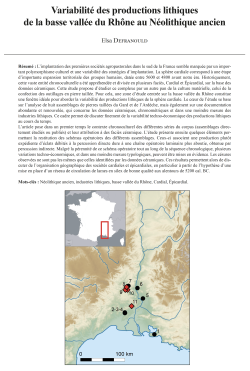
13-2020, tome 117, 4, p. 583-617 - Defranould E.- Variabilité des productions lithiques de la basse vallée du Rhône au Néolithique ancien
Variabilité des productions lithiques de la basse vallée du Rhône au Néolithique ancien
Elsa Defranould
Résumé :
L'implantation des premières sociétés agropastorales dans le sud de la France semble marquée par un important polymorphisme culturel et une variabilité des stratégies d'implantation. La sphère cardiale correspond à une étape d'importante expansion territoriale des groupes humains, datée entre 5600 et 4800 avant notre ère. Historiquement, cette vaste entité chronoculturelle a été appréhendée et divisée en plusieurs faciès, Cardial et Épicardial, sur la base des données céramiques. Cette étude propose d'étudier ce complexe par un autre pan de la culture matérielle, celui de la confection des outillages en pierre taillée. Pour cela, une zone d'étude centrée sur la basse vallée du Rhône constitue une fenêtre idéale pour aborder la variabilité des productions lithiques de la sphère cardiale. Le coeur de l'étude se base sur l'analyse de huit assemblages de pierres taillées du Gard et de l'Ardèche, mais également sur une documentation abondante et renouvelée, qui concerne les données céramiques, chronométriques et dans une moindre mesure des industries lithiques. Ce cadre permet de discuter finement de la variabilité techno-économique des productions lithiques au cours du temps.
L'article pose dans un premier temps le contexte chronoculturel des différentes séries du corpus (assemblages directement étudiés ou publiés) et leur attribution à des faciès céramique. L'étude présente ensuite quelques éléments permettant la restitution des schémas opératoires des différents assemblages. Ceux-ci associent une production plutôt expédiente d'éclats débités à la percussion directe dure à une chaîne opératoire laminaire plus aboutie, obtenue par percussion indirecte. Malgré la pérennité de ce schéma opératoire tout au long de la séquence chronologique, plusieurs variations techno-économiques, et dans une moindre mesure typologiques, peuvent être mises en évidence. Les césures observées ne sont pas les mêmes que celles identifiées par les données céramiques. Ces résultats permettent alors de discuter de l'organisation géographique des sociétés cardiales et épicardiales, en particulier à partir de l'hypothèse d'une mise en place d'un réseau de circulation de lames en silex de bonne qualité aux alentours de 5200 cal. BC.
Mots-clés : Néolithique ancien, industries lithiques, basse vallée du Rhône, Cardial, Épicardial.
Abstract:
The establishment of the first agro-pastoral societies in Southern France seems to be marked by significant cultural polymorphism as well as variability in establishment strategies. The Early Neolithic of the South Mediterranean is generally divided into three distinct entities, the Impressa, the Cardial and the Epicardial, mainly defined on the basis of ceramic production. The Cardial sphere, the subject of this article, corresponds to a stage of important territorial expansion of human groups, dated between 5600 and 4800 BC cal. Historically, this vast chronocultural entity has been understood and divided into several facies, Cardial and Epicardial, on the basis of ceramic data. The objective of this paper is to propose a new data synthesis regarding the evolution of the cardial complex in the lower Rhone Valley. It is based on lithic industry, generally less mobilised than ceramic data for chronocultural syntheses. This work is a part of a PhD thesis defended in 2019 (Defranould, 2019).
A study area centred on the lower Rhone Valley provides an ideal window to examine the variability of lithic production in the cardial sphere. It covers the departments of Bouches-du-Rhône, Gard, Ardèche, Vaucluse and Drôme (fig. 1). For this region, documentation concerning ceramic, chronometric and to a lesser extent lithic data is abundant. This framework allows us to discuss in detail the techno-economic variability of lithic production over time. A total of eight lithic assemblages were directly studied: Montclus rockshelter layer 5, layer 4, layer 3, layer 2 (Montclus, Gard) ; Ronze rockshelter, sets 1 and 2 (Orgnac-l'Aven, Ardèche); Taï (Remoulins, Gard) and Aigle cave (Méjannes-le-Clap, Gard). They can be compared with other published series: Font-des-Pigeons rockshelter (Chateauneuf-lès-Martigues, Bouches du Rhône, Binder et al., 2017 ; Binder, 1987), Mas de Vignoles X (Nîmes, Gard; Perrin et al., 2014), Roussillonne (Nîmes, Gard; ibid.), Mas Neuf (Nîmes, Gard ; ibid.), Baratin (Courthézon, Vaucluse ; Binder, 1998, Gassin and Binder, 2004, Sénépart, 2009), Petites Bâties (Lamotte-du-Rhône, Vaucluse ; Binder et al., 2002, Binder, 1998) and Oullins rockshelter (Le Garn, Gard ; Binder, 1998 ; Roudil, 1987). Together, they constitute our study corpus.
The article first presents the chronocultural context of the different assemblages of the corpus (assemblages directly studied or published), their chronological arrangement and their attribution to ceramic facies (part 2; fig. 2). Then, the study presents important features of lithic productions of different collections: techno-economical aspects, restitution of different 'chaînes opératoires', aims of 'débitages', etc. In spite of the geological constraints that induce minor differences in raw material acquisition strategies, the same 'schéma opératoire' is identified on all sites. It combines a rather expedient flake's production by direct hard percussion on the local resources (tertiary chert and quartz) with a more elaborate laminar production obtained by indirect percussion, mainly on good cretaceous chert (fig. 11).
Finally the paper points at the fact that, despite the permanence of this 'schéma opératoire' throughout the chronological sequence, several techno-economic and, to a lesser extent, typological variations can be identified (table 12). Thus, several elements allow us to introduce a chronological gradient in the variability of the assemblages: the emergence of a circulation network of blades in Cretaceous blond chert, the increase in the size of laminar supports and arrowhead, and possibly the decrease in flat retouches on the arrowhead over time. The caesura observed are not the same as those identified through ceramic data. Unlike to ceramic data, there is not one way of producing or retouching lithic tools that is specific to Cardial and another that would be specific to Epicardial. This reaffirms an important kinship between these two entities. In the end, this study sheds new light to discuss the geographical organisation of Cardial and Epicardial societies, in particular based on the hypothesis of a good quality chert blade circulation network around 5200 BC cal.
Keywords: Early Neolithic, lithic industries, lower Rhône Valley, Cardial, Epicardial.
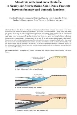
12-2020, tome 117, 4, p. 547-581 - Peschaux C., Deseine A., Leduc C., Le Jeune Y., Marquebielle B., Valentin B., Valentin F. (2020) - Mesolithic settlement on la Haute-Île in Neuilly-sur-Marne (Seine-Saint-Denis, France)
Mesolithic settlement on la Haute-Île in Neuilly-sur-Marne (Seine-Saint-Denis, France): between funerary and domestic functions
Caroline Peschaux, Alexandre Deseine, Charlotte Leduc, Yann Le Jeune, Benjamin Marquebielle, Boris Valentin, Frédérique Valentin
Abstract:
The site of la Haute-Île in Neuilly-sur-Marne (Seine-Saint-Denis) is located in a meander of the Marne where a Holocene paleosoil is preserved over a surface of 3 400 m2, on the paleobank of a former island. This paleo-soil contains the remains of several Mesolithic occupations (as well as some sparse remains from the Neolithic and Protohistoric periods). The site was partially excavated as part of preventive (2000-2004), then programmed operations (2011-2015), which revealed, for the Mesolithic: on one hand, a group of graves (four, for the moment), which represent the fourth known cemetery in France for this period; and, on the other hand, abundant remains (lithic industry, fauna, osseous industry) indicating the presence of several successive domestic occupations. Radiocarbon dates reveal that the necropolis is older than the domestic remains, indicating several phases of site use during the Mesolithic, with, first of all, a mainly funerary use towards the middle of the seventh millennium before our era (transition between the first and second Mesolithic), followed by several domestic occupations during the sixth millennium (second Mesolithic i.e., late and final Mesolithic).
Keywords: Mesolithic, 'cumulative soils', graves, ornaments, lithic industry, fauna, osseous industry, Paris basin, France.
Résumé :
Le site de la Haute-Île à Neuilly-sur-Marne (Seine-Saint-Denis) se trouve sur la rive droite de la Marne, au sein d'un méandre situé à 15 kilomètres en amont de Paris (fig. 1). L'important potentiel archéologique a été mis en évidence à partir de 1999 lors des opérations préventives liées à l'aménagement de ce terrain en parc urbain. Ces premiers travaux ont révélé que le méandre correspond à une ancienne île conservant un paléosol holocène au niveau de sa paléoberge-est (fig. 1). Partiellement fouillé dans un cadre préventif (2000-2004) puis programmé (2011-2015), ce paléosol, dont l'extension est estimée à 3 400 m2 (fig. 3), contient les trois espaces typiques de bord de rivière : berge, rive (en partie organique) et chenal (fig. 2). Sur la berge, seul espace pour l'instant fouillé, les occupations sont regroupées au sein d'une même unité de sol complexe correspondant à des « sols cumulés ». Ce niveau est très riche en matériel archéologique accumulé avec peu d'apport sédimentaire et d'importants phénomènes de pédogénèse. Des études géostatistiques (par projection altitudinale de l'ensemble des artefacts et écofacts) ont néanmoins permis de repérer que cette couche conserve une microstratigraphie composée d'au moins deux niveaux « fantômes » (fig. 4). Bien que livrant des témoins fugaces d'occupations néolithiques et protohistoriques, ces « sols cumulés » sont surtout riches en vestiges mésolithiques avec des témoins d'activités funéraires et domestiques.
Les sépultures mésolithiques de la Haute-Île sont pour l???instant au nombre de quatre (fig. 6, 7, 8 et 9). Réparties sur une surface minimale de 120 m2 (fig. 5), elles consistent en des inhumations primaires et individuelles réalisées dans de très petites fosses (aux contours ovalaires de moins d'un mètre de diamètre et aux profils en U à fonds plats). Les corps sont tous fortement contractés (tête inclinée avec les membres inférieurs et supérieurs repliés sur le torse) mais ils ont été déposés de façon peu normalisée (fig. 11) : en position redressée avec le buste vertical (sépultures 2 et 4), ou bien sur le dos (sépulture 1) ou encore sur le ventre (sépulture 3). La décomposition en espace vide ainsi que des effets de paroi ou de contrainte conduisent à formuler l'hypothèse de contenants funéraires souples et périssables, autrement dit d'une préparation des corps avant inhumation. A ce stade, la présence d'objets de parure n'est attestée que dans la sépulture 3 et ils se composent de coquillages fossiles et subactuels découverts en petite quantité à proximité du crâne, du bassin et du coude gauche (fig. 10). Les datations radiocarbone (AMS) obtenues placent les sépultures de la Haute-Île durant le 7e millénaire avant notre ère, soit à la transition entre le premier et le second Mésolithique (tabl. 4 ; fig. 18). Avec les découvertes de La Vergne en Charente-Maritime et celles des îles bretonnes d'Hoëdic et Téviec, le groupement de sépultures de la Haute-Île constitue la quatrième nécropole mésolithique connue sur le territoire français. Les pratiques funéraires particulières décrites à la Haute-Île se retrouvent sur plusieurs autres sépultures isolées du Bassin parisien, principalement attribuées au premier Mésolithique (tabl. 5), ce qui inscrit la nécropole de la Haute-Île au sein d'un possible modèle régional.
Parmi les vestiges mis au jour dans les « sols cumulés », une grande partie peut être rattachée au Mésolithique. Sur les 7 000 éléments d'industrie lithique, la très grande majorité des pièces attribuables se rapporte à cette période (tabl. 1). Seulement une trentaine d???éléments appartient au premier Mésolithique (composante A parmi les armatures) tandis que le reste est attribué au second Mésolithique (composantes B, C et D ; fig. 12 et 13). Les composantes B et C peuvent être rapprochées du Mésolithique récent. Elles se distinguent l'une de l'autre par des critères typologiques (respectivement trapèzes rectangles à base souvent concave versus trapèzes plus longs à base décalée) ainsi que métriques (lamelles étroites et minces versus lamelles plus larges et plus épaisses) ou lithologiques (usage principal de silex d'âge Mésozoïque versus Cénozoïque) et même spatiaux (répartition relativement dissociée : fig. 14 et 15). La composante D, peu nombreuse, se rapporte plutôt au Mésolithique final et se compose de pointes de Sonchamp, de trapèzes asymétriques et de triangles scalènes. Parmi les 17 000 restes de faune, les espèces sauvages dominent largement (tabl. 2 ; fig. 16) avec du sanglier (34,3 % du NRD), du cerf (22,8 % du NRD), du chevreuil (15,1 % du NRD) et de l???aurochs (5,5 % du NRD). Les taxons domestiques (b?uf, caprinés et équidés) sont en revanche très peu représentés (1,3 % du NRD) et rappellent la présence d???occupations discrètes postérieures au Mésolithique. Les sept mesures radiocarbone réalisées sur la faune sauvage se situent toutes dans la même fourchette chronologique (tabl. 4 ; fig. 18) : durant le 6e millénaire avant notre ère, soit au cours du second Mésolithique. Les stratégies d'acquisition et d'exploitation identifiées correspondent à une chasse majoritaire aux ongulés terrestres sauvages avec traitement des carcasses et consommation in situ (à l'exception peut-être de l'aurochs dont certaines parties squelettiques ont pu être exportées ailleurs). La présence du castor, de la
loutre et de poissons témoigne de l'exploitation du milieu aquatique mais celle-ci paraît être minoritaire. Des fragments de poinçons en os, des canines de suidés refendues et des métapodes de cerf et de chevreuil travaillés signalent la présence d'une industrie en matières dures animales dont une partie au moins pourrait être prudemment rattachée au Mésolithique (tabl. 3 ; fig. 17). L'attribution à cette période de l'essentiel sinon de la totalité de la faune sauvage ainsi que de l'industrie lithique abondante et variée indique une occupation fréquente et répétée de la paléoberge-est de la Haute-Île durant le second Mésolithique. La nature du mobilier découvert (outils et armatures lithiques, restes de chasse et de boucherie, possibles pièces d'industrie en matières dures animales) indique sans conteste des occupations à caractère domestique. A ce titre, le site de la Haute-Île constitue un nouveau gisement de référence, car c'est le seul qui soit multiphasé en Île-de-France pour le second Mésolithique, les témoins de cette période étant de surcroît encore rares à plus large échelle dans le Bassin parisien.
Les datations radiocarbone laissent penser que la nécropole pourrait être plus ancienne que les occupations domestiques, ce qui conduit à formuler l'hypothèse que l'occupation humaine mésolithique de la Haute-Île s'est déroulée en plusieurs moments avec, tout d'abord, une occupation à fonction principalement funéraire durant le 7e millénaire avant notre ère, suivie de plusieurs installations successives à vocation domestique durant le 6e millénaire. A ce stade de la fouille, les sépultures ne paraissent pas être en lien avec un habitat. Si elle se confirme, une telle implantation des structures funéraires à l'écart des lieux d'habitation correspond à une situation courante dans le Mésolithique régional, ce qui renvoie peut-être à une conception particulière de l'espace à cette période. Cette succession de fonctions à la Haute-Île pourrait indiquer que la nature funéraire du lieu a pu être rapidement oubliée ou négligée, peut-être à l'occasion des bouleversements de diverses natures qui ont marqué le passage du premier au second Mésolithique, mais il est également possible que les populations du second Mésolithique se soient volontairement installées sur un lieu ayant gardé une forte charge symbolique. Il faut noter par ailleurs que la paléoberge-est fut un lieu particulièrement attractif durant tout le Mésolithique, en étant à l'abri des crues, avec une bonne visibilité et un accès facile à la rivière.
Mots-clés : Mésolithique, « sols cumulés », sépultures, parures, industrie lithique, faune, industrie osseuse, Bassin parisien, France.
11-2020, tome 117, 3, p. 461-500 - A. Caraglio - Une approche des dynamiques d'implantation des habitats à la fin du Néolithique provençal.
Une approche des dynamiques d'implantation des habitats à la fin du Néolithique provençal
Agnès Caraglio
Résumé : L'espace provençal du 3e millénaire av. n. è. laisse entrevoir un certain nombre d'éléments qui mettent en scène la complexité archéologique de la fin du Néolithique. En Provence, le travail de J. Cauliez a ouvert la voie à un cadre chronoculturel plus robuste et tissé une trame plus diversifiée des composantes céramiques de la fin du Néolithique. Cependant, les dernières analyses des vestiges archéologiques liés à ces contextes requièrent à notre sens une étude complémentaire fondée sur les logiques d'implantation des sites d'habitat afin de mieux saisir l???ensemble des mécanismes socio-culturels émergeant à l'aube de l'âge du Bronze. Grâce à la mise en place d'une base de données relationnelle couplée à un système d'information géographique, il a été possible de générer de nouvelles informations spatiales sur un corpus de sites du Néolithique final provençal (260 gisements appartenant strictement au Néolithique final, et respectivement, 8, 19, 29 et 7 gisements attribués aux 4 horizons définis par J. Cauliez). Ainsi, après des analyses statistiques multivariées exploratoires sur les données spatiales, il a été possible de caractériser finement les implantations de chacun des gisements étudiés à l'échelle de la Provence et de dégager des tendances principales dans les choix d'installation de ces populations à partir du milieu du 3e millénaire av. n. è.
Mots-clés : 3e millénaire av. n. è., sites domestiques, Provence, topographie, SIG, analyses multivariées.
Abstract: The Provence area in the 3rd millennium BCE can be characterized by a number of materials studies that highlight its archaeological complexity and a significant variability in the range of landscape zones settled. The work done by J. Cauliez (2010, 2011) provided a more structured chrono-cultural framework and a more diversified background to the ceramic components of the Late Neolithic in Provence. Therefore, this study utilizes the quadripartite chronological sub-division Cauliez defined (horizon 1: 3400-2900/2850 BCE; horizon 2: 2900/2850-2600/2550 BCE; horizon 3: 2600/2550-2400/2350 BCE; and horizon 4: 2400/2350-1950 BCE). One of the problems that this chronological division does not resolve is the crucial issue of the Bell Beaker event which overlaps with the various local traditions during horizons 3-4. Here, the sites with Bell Beaker pottery and associated materials will not be analysed separately.
The site corpus includes, on one hand, 260 strictly Late Neolithic sites, and on the other, settlements belonging to the four Late Neolithic horizons (horizon 1: 8 sites; horizon 2: 19 sites; horizon 3: 29 sites; horizon 4: 7 sites). General assessment of these domestic sites, and the establishment of associated deposit typologies has been observed previously (Caraglio, 2015, 2016b), and will not be addressed here. However, this paper presents the final latest analysis of these sites, which involved an in-depth study of settlement patterns in the Provençal landscape to better comprehend the emerging social and cultural mechanisms operating at the dawn of the Bronze Age.
New spatial data was generated from the georeferenced sites in the corpus through the creation of a relational database integrated with GIS (Geographic Information System). Through a combination of statistical exploratory and multivariate analysis of the spatial data, precise characterization of the topographic location of each site in Provence has been possible, as well as the identification of significant trends regarding topographical settlement preferences during the 3rd millennium BCE. Three Multiple Correspondence Analyses have been conducted on the archaeological corpus, with a fifth analysis being undertaken as a control, on sites randomly generated through GIS, using five location variables (altitude, slope degree, relief variation, topography and slope orientation). For the Multiple Correspondence Analysis, geocultural landscape units, geology and chrono-cultural phases have been included as comparative variables, but as they cannot be interpreted reliably, they have not been incorporated into the final analyses in order to reduce potential distortion of the results.
Although we cannot propose narrowly defined location typologies, the results show the great variability in settlement location choice in Provence during the second half of the 3rd millennium BCE. Thus, in the Late Neolithic, populations seem to favour sites on plains or hillsides, around 150 m and up to 300 m in altitude, on flat or medium slopes, with average topographic variations and orientations to the east or south. Despite the relatively small number of sites known, the populations of horizons 1 and 4 (respectively 8 and 7 sites) seem to favour very diversified settlement areas, while those of horizons 2 and 3 (respectively 19 and 29 sites) would gather in very low areas, below 150 m in height. The deposits of horizon 2 were found mainly in the Vaucluse plains or the slightly sloping areas of Lower Provence quaternary. From horizon 2 onwards, exposure to the east tends to become more widespread. Locations during horizon 3 appear to show a dichotomy or complementarity between very conspicuous areas (steep slopes, significant topographical variations, minor prominences) and more geographically indistinct areas (weak or flat slopes, weak or non-existent topographical variations, plains), between Lower Provence and the Provençal coastal Plains, and on Marine Quaternary, Jurassic-Cretaceous or Miocene-Pliocene soils.
Despite some limitations, both the spatial analyses presented here and a precedent case study in the Lubéron area (Caraglio, 2016a) demonstrate both slight oscillations in settlement choices and permanence of land management at the end of the Neolithic. The global trends could be the result of specific voluntary and cultural choices, but the great variability of the Provençal landscapes should not be underestimated. We therefore believe that they are not due to chance, but indicate changes in settlement choices at the end of the Provençal Neolithic and that the spatial variables studied had a structuring role in the distribution of habitation. The results tend to illustrate the occupation of all ecosystems. This raises the question as to whether these different groups were forced to settle everywhere space was available due to the most ecologically favourable areas being densely settled already? Generally speaking, it is between the 29th and 24th centuries BCE, and most markedly during horizon 3 parallel to the development of the Bell Beaker, that the number of known sites seems to increase significantly. As such, it would be unsurprising if this illustrates the conquest of all the available ???economic niches??? (Higgs, 1975) by these Late Neolithic groups. These results would tend to justify the notion of a ???full world??? (Farina et al., 2003), perceptible through a denser population, greater stability, an evolution of agricultural land management and an interweaving of the socio-economic and symbolic spheres at the beginning of the Bronze Age.
Keywords: 3rd millennium BCE, domestic sites, Provence, topography, GIS, multivariate analyses.
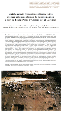
10-2020, tome 117, 3, p. 409-460 - M. Langlais et al. - Variations socio-économiques et temporalités des occupations de plein air du Laborien ancien à Port-de-Penne (Penne d'Agenais, Lot-et-Garonne)
Variations socio-économiques et temporalités des occupations de plein air du Laborien ancien à Port-de-Penne (Penne d'Agenais, Lot-et-Garonne)
Mathieu Langlais, Vincent Delvigne, Jérémie Jacquier, Aude Chevallier, Benjamin Marquebielle, Solange Rigaud, Luc Detrain, André Morala, Célia Fat Cheung
Résumé : Dans le cadre de la réévaluation du Laborien, ensemble chronoculturel daté autour de 12 500-11 000 cal BP et calé stratigraphiquement entre l'Azilien récent et le Mésolithique sauveterrien, l'étude interdisciplinaire menée sur le site de plein air de Port-de-Penne est l'occasion de soulever des questions autour des variations socio-économiques et fonctionnelles des sites durant cette période. Vingt-cinq ans après les travaux menés sur le terrain et un premier réexamen du matériel pour la séance SPF de Bordeaux en 2012 (Langlais, Naudinot, Peresani, org.), une nouvelle équipe s'est réunie afin de croiser l'approche « pétro-techno-typo-fonctionnelle » des restes lithiques avec l???étude archéozoologique des restes de faune, d'industrie osseuse et de quelques coquillages. Les archives et les enregistrements de terrain ont permis de réaliser des projections sur un plan vertical - précisant ainsi l'archéoséquence - et sur un plan horizontal pour appréhender l???organisation spatiale des vestiges. Ce travail a permis de souligner la succession de deux unités archéostratigraphiques (ou UA) présentant une homogénéité culturelle, notamment dans la structuration de l'espace domestique (autour d'un foyer bilobé et de structures secondaires). Les datations radiocarbone appuient l'hypothèse d'une attribution au Laborien ancien des deux UA, livrant par ailleurs des morphotypes identiques de pointes à dos (type Malaurie), et une identité technique sur les productions laminaires. Du point de vue pétroarchéologique, l'UA ancienne indique un comportement pionnier avec une importation massive de silicites allochtones (Charentes, ouest du Périgord) tandis que l???UA récente se distingue par un resserrement de l'approvisionnement sur des matériaux régionaux (vallées du Lot et de la Dordogne). Les données techno-économiques des équipements lithiques croisées aux analyses des vestiges fauniques illustrent une parenté des occupants successifs tout en soulignant des variations fines (part d'armatures impactées, taux de recyclage des couteaux en outils d'extrémité, activités principales et secondaires...). Confrontées au modèle classique d'opposition « résidentiel vs logistique » des sites, les données obtenues sur Port-de-Penne permettent de relativiser ce débat en montrant une imbrication et des variations dans les comportements socio-économiques mais également dans la temporalité des occupations.
Mots-clés : Paléolithique final, Laborien, Bassin aquitain, plein air, approche pétro-techno-typo-fonctionnelle, organisation spatiale, variations socio-économiques, temporalités, pionnier.
Abstract: For the past decade, the reevaluation of the Laborian, a chronocultural ensemble dated around 12,500- 11,000 cal BP and stratigraphically located between the Late Azilian and the Mesolithic Sauveterrian, has made it possible to revitalize the research of the Final Paleolithic, during the Pleistocene-Holocene transition. Several works have thus been carried out in recent years on cave and shelter sites, such as Peyrazet in the Lot, the Cuze de Sainte-Anastasie in the Cantal, Auberoche or the Pont d???Ambon in the Dordogne, etc. Fewer open-air sites are to be found in the Aquitaine Basin, and this is even rarer for the Laborian. We can thus mention the Manirac deposits (E. Ducassé excavations) in the Gers, Angoulême (excavations recently carried out by M. Biard) and Port-de-Penne (L. Detrain excavations). The interdisciplinary study conducted at the Port-de-Penne outdoor site is an opportunity to raise questions about the socio-economic and functional variations of the sites during this period. Twenty-five years after the field work and an initial review of the material for the SPF session in Bordeaux in 2012 (Langlais, Naudinot, Peresani, org.), a new team has come together to cross-reference the ???petro-technno-typo-functional??? approaches to lithic remains with the zooarchaeological study of faunal remains. The field archives have made it possible to produce vertical projections that specify the archaeosequence of the site with two main units, recent and ancient, separated by an interface level. Radiocarbon dating supports the hypothesis of attributing the two occupations to the Ancient Laborian (narrowed in time), providing identical morphotypes of Malaurie-type backed points and a technical identity on the blades production. From the point of view of the spatial organization of the remains within these two occupations, several elements are worth noting. This work has made it possible to highlight the succession of two occupations with a cultural kinship, particularly in the structuring of domestic space (around a two-lobed hearth and secondary structures). This type of home remains unknown for the moment (except perhaps at Champ-Chalatras, excavated by J.-F. Pasty) but it is likely that a specific function was assigned to them. The two occupations present differences in terms of spatial extension and one can question the number of domestic units in the upper occupation, but the taphonomic conditions and the impact of a medieval tile kiln installation was not entirely without consequence. The recent occupation also delivered elements of bone industry and shell ornaments. From the petroarchaeological point of view, the ancient occupation indicates a pioneering behavior with a massive importation of allochthonous silicites (Charentes, West Périgord) while the recent occupation is characterized by a tightening on regional materials (Lot and Dordogne valleys). The techno-typical-functional data compared to the fauna data illustrate a technical kinship of the successive groups while highlighting fine variations (share of impacted reinforcements, recycling rate of knives into end tools, main and secondary activities...). Confronted with the classic ???residential vs. logistical??? opposition model, the data obtained from Port-de-Penne allow us to put this debate into perspective by showing an overlap and variations in socio-economic behaviour but also in the temporality of occupations. The two occupations of Port-de-Penne thus provide valuable evidence for the same type of site organized around specific households, suggesting a regional anchoring and a consolidation of cultural networks for the recent occupation.
Keywords: Final Palaeolithic, Laborian, Aquitain Basin, open air, petro-techno-typo-functional approach, spatial organization, socio-economic variations, temporalities, pioneer.
09-2020, tome 117, 3, p. 391-408 - J.-M. Pétillon, D. Sacchi, P. Cattelain Un propulseur androgyne magdalénien dans la grotte Gazel (Sallèles-Cabardès, Aude) : comparaisons et commentaires
Un propulseur androgyne magdalénien dans la grotte Gazel (Sallèles-Cabardès, Aude)
Comparaisons et commentaires
Jean-Marc Pétillon, Dominique Sacchi, Pierre Cattelain
Résumé : La révision de lindustrie osseuse de la grotte Gazel a permis didentifier, dans un ensemble attribué à la seconde moitié du Magdalénien moyen, un type dinstrument dont on connaissait seulement deux ou trois exemplaires dans le Paléolithique récent européen : un fragment de propulseur androgyne (ou type 1, « à gouttière et éperon ») façonné en bois de renne. Typologiquement très différent des autres propulseurs issus du même site, cet objet présente en revanche de fortes similarités avec les propulseurs androgynes découverts à Laugerie-Basse et au Flageolet II. Son identification permet détendre laire de répartition de ce type du Périgord jusquà la Montagne Noire, attestant de contacts lointains, et de lancrer chronologiquement dans le Magdalénien moyen récent. Les propulseurs de type 1 représentent ainsi une nouvelle manifestation de linventivité technique qui se déploie au Magdalénien moyen récent dans le domaine de larmement. Le propulseur de Gazel affiche une taille réduite par rapport à ses équivalents de Laugerie-Basse et du Flageolet II et lidée selon laquelle nous aurions affaire à un propulseur denfant paraît recevable.
Mots-clés : arme, chasse, Gazel, industrie osseuse, Isturitz, Laugerie-Basse, le Flageolet II, Magdalénien, Paléolithique récent, propulseur.
Abstract: Although the spearthrower is an iconic weapon of the European Upper Paleolithic, only 115 unquestionable specimens are known to date, their number increases rather slowly and many of them have no precise chronological and cultural context. For this reason, each discovery of a new specimen is important, especially when it belongs to a poorly documented type and comes from a precise archeological context. The spearthrower presented in this paper comes from the Gazel cave, the largest and best documented Magdalenian site in the Mediterranean Midi, excavated between 1977 and 1994. The Magdalenian levels of Gazel yielded more than 12,000 lithic artefacts, 1,000 pieces of worked bone and antler, 200 personal ornaments, and a very rich faunal record dominated by reindeer, snow hare and horse, complemented by ptarmigan and chough. The characteristics of the industries, and a series of 4 radiocarbon dates by AMS, reliably place the Magdalenian occupation of Gazel in the Late Middle Magdalenian (LMM, ca. 17.5-17 cal ka BP).
The fragment of antler spearthrower was found at the bottom of layer 7 (fig. 1-4). It is 57 mm long, 13 mm wide and 9.5 m thick, with a curved profile in the distal part. Its upper side shows a longitudinal gutter, 5 mm wide and 1 mm deep, ending in a short spur (fig. 5). The presence of this gutter and spur system to hold the projectile in place is characteristic of type 1 spearthrowersi.e., mixed type or androgynous spearthrowers, as opposed to male and female types. The upper face is decorated with 4 longitudinal striae and the morphology of the proximal fracture suggests breakage during use.
Layer 7 yielded 6 other objects that can unquestionably, probably or possibly classified as fragments of antler spearthrowers (fig. 6). Two specimens belong to type 3 (decorated with an herbivore fore-end, usually a horse, integrated in to the general shape of the shaft) and one can be related to type 4 (decorated with an in the round figure, or ronde-bosse, protruding from the shaft). The material, dimensions and morphology of the last 3 objects are compatible with an identification as spearthrower fragments, without certainty. None is typologically or morphologically compatible with the androgynous specimen.
Outside the specimen from Gazel, only 3 androgynous spearthrowers are known in the European Upper Paleolithic. The specimen from Isturitz (fig. 7) dates to the LMM but is morphologically very different from the object found at Gazel, and its identification as spearthrower remains debated. Conversely, the specimen from Laugerie-Basse (fig. 8-9), found in the 1860s and deprived of any precise archeological context, is very similar to the object from Gazel: it was made from an antler tine, shows a gutter and spur system, has a curved profile in the distal part, and is decorated with striae. The specimen from Le Flageolet II (fig. 10) was found out of context but very probably comes from layer IX, which is 14C-dated to the Middle Magdalenian (probably the LMM according to its lithic industries). Made of bone, it is also very similar to the Gazel and Laugerie-Basse specimens: it has a gutter and spur system, a slightly curved distal profile, and a decoration mostly made of carved incisions.
While type 1 spearthrowers had no precise chronological attribution so far, the identification of the androgynous spearthrower from Gazel firmly places this type within the LMM, between 17.5 and 17 cal ka BP according to the 14C data from layer 7. This discovery also extends the distribution area of type 1 spearthrowers outside the Périgord to the Montagne Noire, thus adding to the list of evidence for long-distance contacts in this region during the Magdalenian.
The attribution of type 1 spearthrowers to the LMM reinforces the idea that this period constitutes, at the scale of the whole Magdalenian, the peak of technical and stylistic variation for this type of weapon. It is yet another example of the technical inventiveness visible in weapon design during this period, and which represents the culmination of a long-term trend starting in the beginning of the Magdalenian.
The specimen from Gazel shows small dimensions compared to the ones from Laugerie-Basse and Le Flageolet II (fig. 11). These unusually small dimensions are also found on a few specimens belonging to other types of Magdalenian spearthrowers. The hypothesis that these miniature weapons were made for children is admissible but cannot be ascertained.
Keywords: Gazel, hunting, Isturitz, Late Paleolithic, Laugerie-Basse, le Flageolet II, Magdalenian, osseous industry, spearthrower, weapon.
08-2020, tome 117, 2, p. 303-331 - Juan F. GIBAJA, Berta MORELL, Araceli MARTIN-COLLIGA, F. Xavier OMS, Patricia MARTIN-RODRIGUEZ, Millán MOZOTA, Alba MASCLANS-LATORRE, Gerard REMOLINS, Francisco J. SANTOS, Stephanie DUBOSCQ, María FONTANALS-COLL, M. O
Tombes à dalles néolithiques (cistes et chambres) du nord-est de la péninsule Ibérique : une vision historiographique et chronologique
Juan F. Gibaja, Berta Morell, Araceli Martín-Cólliga, F. Xavier Oms, Patricia Martín-Rodríguez, Millán Mozota, Alba Masclans-Latorre, Gerard Remolins, Francisco J. Santos, Stephanie Duboscq, María Fontanals-Coll, Mónica Oliva, Diego López-Onaindía, Niccolò Mazzucco, M. Eulàlia Subirà
Résumé : Les sépultures à dalles néolithiques sont connues depuis le début du xxe siècle, tout particulièrement grâce au travail débuté par J. Vilaró et poursuivi par M. Cura, J. Castany et Ll. Guerrero. Cependant, elles ont reçu de la part des archéologues moins d'attention que d'autres structures funéraires (même si elles sont souvent mentionnées dans la littérature archéologique), ce qui est surprenant. En effet, les tombes découvertes sont nombreuses, ainsi que les parallèles avec d'autres manifestations néolithiques contemporaines ou proches dans le temps du sud de la France, du nord de l'Italie ou de la Suisse.
Il s'est donc avéré nécessaire d'effectuer une série d'analyses pour améliorer nos connaissances à leur sujet. La faible visibilité de ces tombes (ou l'absence de visibilité), leur mauvais état de conservation, le manque de prospections et les dégradations dues aux remaniements des sols des zones agropastorales dans lesquels elles se trouvent, peuvent être les causes du nombre peu élevé de découvertes réalisées ces dernières décennies.
L'objectif de cet article est de présenter les derniers résultats obtenus par notre équipe de chercheurs réunie autour de l'étude de ces tombes. Nous présenterons l'état de la question sur leur historiographie, ainsi que les caractéristiques qui les définissent, en partant des structures pour arriver aux personnes inhumées et au mobilier funéraire associé.
Il est important d'insister sur l'existence de nouvelles datations radiocarbone et sur les analyses statistiques effectuées, car elles nous ont permis d'évaluer la distribution chronologique des tombes et leur durée d'utilisation. Jusqu'à la réalisation de ce programme de datation, la chronologie des sépultures à dalles était assez incertaine en raison du nombre restreint de dates, dont certaines obtenues à partir d'échantillons de longue durée de vie. Ces données ont servi de trait d'union pour établir des liens avec d'autres manifestations funéraires du néolithique d'Europe centrale et occidentale.
Mots-clés : Néolithique, nord-est de la péninsule Ibérique, tombes à dalles, Solsonià, radiocarbone, analyses statistiques.
Neolithic burials built with stone slabs (stone cists and chambers) in the northeast of the Iberian Peninsula: historiography, new data and chronological contextualization
Abstract: Even though stone slab burials are well known in archaeological literature since the beginning of the 20th century (mostly thanks to J. Vilaró, then M. Cura, J. Castany and Ll. Guerrero), they have been largely overlooked during this last decade. Even so, numerous graves have been discovered with parallels with other contemporary - or sub-contemporary- Neolithic burials in southern France, northern Italy or Switzerland.
The scarce or null visibility of the burials, their deficient state of conservation, the lack of surveying projects and the alterations caused by soil movements in agro-pastoral areas can be the reason for the few discoveries of this kind of burial during the last few years.
Neolithic communities selected specific spaces and territories to bury their dead and in particular at locations between 589 m and 747 m above sea level. They used stone slabs to build two types of tombs: (1) cistas, which are cist tombs, buried and sealed tightly by the four slabs that make up the sides and the top. They can be accessed by moving the upper slab (vertical access); (2) megalithic chambers whose fundamental difference is that they are accessed from the side (horizontal access). There is an additional 20% of graves in a poor state of preservation that could not be classified.
There is little osteological information as many of the graves were excavated several decades ago. Frequently a substantial part of the skeleton was not collected or the appropriate techniques were not used for optimal data recording. Most graves contain only one individual, occasionally two, and rarely three or more. The majority are adult males, but due to the poor excavation procedures described above and the loss of certain remains over time, because of the changes and transfers of the archaeological material between museums, this information is unreliable.
The aim of this paper is to present the latest work carried out on the burials by a large team of scholars. We will describe the characteristics that define these burials (from the typology of the structures and buried individuals to the type of grave goods) and our analysis of these characteristics. This includes the study of the dental morphology that has allowed us to determine that the Neolithic communities of the interior of Catalonia had a greater affinity with those of southern France and perhaps even a common origin. In addition, the recent advances in biomolecular techniques (?13C and ?15N isotope analysis) have given access to information on diet, which mainly consisted of vegetables (cereals) and, in some cases, animal proteins. This contradicts the initial idea that the economy of these groups in the interior of Catalonia relied on animal husbandry.
We have made important advances in the study of the grave goods with research into the geographic origin of the raw materials used to make the bone, malacological and lithic tools and ornaments, the technical systems implemented during their preparation and the tools??? use-wear before being deposited in the burial. The lithic raw materials are comprised of flint from south-eastern France and the Ebro Basin, variscite from the Gavà Mines and ornaments made with various marine species originating in the Mediterranean coast. This demonstrates the wide and complex network of inter-group contacts that existed at this time. As for the function of lithic and bone tools (knapped and polished), they show us that Neolithic societies had a double attitude when selecting grave goods: while some tools are unused and appear to have been prepared to be deposited ex profeso together, others were chosen among previously used tools. These objects show traces of use but were maintained in a perfect state of use. The tools include flint blades for harvesting (cutting) cereals or scraping hide, geometric unused microlithic projectiles, polished axes for wood and hide work, and bone awls for the transformation of soft materials. We still have to determine the function of the schist awls, which may have come from workshops located in the Pyrenees. From an experimental perspective, the current hypothesis is that they were probably used as projectile points.
Finally, we will present the available radiocarbon dates as well as the statistical analysis regarding their chronological distribution and duration. Before our dating program, the chronology of stone slabs burials was based on a small number of dates, some of which were obtained from "long life" samples. Today we know that this type of burial was in use for between 510 and 865 years, during the period 4230-4000 cal. BC and 3490-3180 cal. BC. This indicates that these funerary practices were largely contemporary with others in Catalonia (located in the territories near the Mediterranean coast), as well as in France, Italy and Switzerland.
Within the framework of this ongoing project, we aim to work on the more recently excavated burials (it is the case of Camp de la Bruna), as well as undertaking new analysis aimed at discovering the origin of certain tools and ornaments. Our priority will be to initiate a series of Zooms analyses to determine the species of bone used to make the numerous tools found in these graves.
Keywords: Neolithic, Northeast of the Iberian Peninsula, stone slabs burials, Solsonià, radiocarbon dates, statistical analysis.
07-2020, tome 117, 2, p. 273-302 - Jules MASSON MOUREY, André DANNA, Adrien REGGIO, Ludovic BELLOT-GURLET, Samuel VAN WILLIGEN, Céline PARIS Les stèles anthropomorphes de la Bastidonne (Trets, Bouches-du-Rhône) et leur contexte
du Néolithique moy
Les stèles anthropomorphes de la Bastidonne (Trets, Bouches-du-Rhône) et leur contexte du Néolithique moyen
Jules Masson Mourey, André D?€?Anna, Adrien Reggio, Ludovic Bellot-Gurlet, Samuel Van Willigen, Céline Paris
Résumé : La plaine de Trets, en limite orientale des Bouches-du-Rhône, recèle un grand nombre de sites néolithiques. Dans les années 1870, après un labour, celui de la Bastidonne livra un très abondant mobilier archéologique ainsi que quinze fragments de stèles décorées. L?€?ensemble des vestiges était mêlé à de possibles restes de crémations mais il règne depuis toujours une grande confusion quant à la position exacte des fragments de stèles au moment de la découverte. D?€?autres plus petits fragments ont été récoltés par la suite. Bien qu?€?elles constituent le plus riche regroupement connu dans le Sud-Est de la France, les stèles néolithiques de la Bastidonne n?€?ont que rarement fait l?€?objet de descriptions systématiques dans leur contexte. Réalisées dans un calcaire local, elles étaient de forme trapézoïdale ou triangulaire et ne mesuraient pas plus de quelques dizaines de centimètres de haut. Les fragments affichent un décor géométrique gravé et sculpté. La représentation schématique du visage se limite dans la plupart des cas à une plage creuse et lisse, subrectangulaire. En outre, d?€?importantes traces de pigment rouge ont été décelées dès la fin du XIXe siècle. Celles-ci ne présentent pas d?€?organisation particulière et l?€?ensemble de la face décorée de même que les chants devaient être ainsi badigeonnés. Les récentes analyses ont montré qu?€?il s?€?agit de cinabre. Le mobilier lithique récolté à la Bastidonne ainsi qu?€?à Sainte-Catherine ?€? une station située à moins d?€?un kilomètre et qui a pu appartenir au même ensemble ?€? doit être attribué à une étape récente du Néolithique moyen. Si l?€?on ajoute à cela les dates radiocarbones d?€?une nouvelle découverte dans les Alpes-de-Haute-Provence, les stèles de la Bastidonne, comme l?€?ensemble des quelques cinquante stèles ou fragments de stèles du sous-groupe provençal à chevrons, apparaissent comme l?€?une des plus anciennes manifestations d?€?art statuaire anthropomorphe de Méditerranée occidentale, entre 3900 et 3600 av. J.-C. environ.
Mots-clés : Provence, Néolithique moyen, stèles anthropomorphes, cinabre, obsidienne.
The anthropomorphic stelae of la Bastidonne (Trets, Bouches-du-Rhône) and their context of the Middle Neolithic
Abstract: The Trets plain is located in the south-east of France, on the eastern border of Bouches-du-Rhône department. The entire plain contains a large number of Neolithic sites. La Bastidonne was discovered in the 1870s by Joseph Maneille, after the ploughing of a small vineyard located on the plateau at an altitude of 270 m, which brought to light abundant archaeological artifacts (lithic and pottery, now mostly lost), including several fragments of decorated stelae (fifteen according to the oldest publications, of which eleven are currently kept at the Musée d?€?archéologie nationale of Saint-Germain-en-Laye). This discovery follows that of eight Provençal stelae of la Puagère (Sénas, Bouches-du-Rhône) in 1838. At la Bastidonne, the fragments were found mixed with the remains of possible cremations (ashes and burnt ?€?human?€? bones). However, there has always been confusion as to their exact position as the author of the discovery considered that they had come from a ?€?destroyed dolmen?€?. Max Escalon de Fonton found smaller fragments of stelae in 1954, during the excavation of a burial to the south-east of the site, then again by André D?€?Anna in 1977-1978. The twenty-first fragment, the discovery of which is not documented, is kept by the Société d?€?études et de recherches de la haute vallée de l'Arc. Although the fragments make up the most important collection of Neolithic stelae known in the south of France, the stelae of la Bastidonne have only rarely been put into context. Made from a local limestone, which is tender, fine and chalky, the stelae, intended to be seen in an upright position (placed in the ground) and measuring no more than a few dozen centimetres high, were originally trapezoidal or triangular with a flat rectangular section. Engravings of complex geometric shapes (chevrons, ?€?fishbone?€? motifs, triangles and rhombuses) cover the stelae, with a smooth sub-rectangular hollow in the middle representing a schematic face. The eyes, nose and mouth are absent in most cases, but the shoulders and the upper part of the bust are sometimes depicted. Traces of red dye were also detected on several fragments in the late 19th century. Four other Provençal stelae, from Le Beaucet and Gargas, in the Vaucluse were also found to have traces of the same dye cinnabar (HgS) or mercury sulphide, which is rare in its natural form. Although it has not been possible to determine the origin of the pigment, Spain and Italy provide several examples of its use in funerary contexts dating to the 5th and the 3rd millennium BC. The remaining traces of cinnabar on the la Bastidonne stelae though not organised show that at least the engraved face and the edges were completely covered.
The lithic artifacts unearthed in the mid-1950s and late 1970s at la Bastidonne as well as at Sainte-Catherine ?€? a site located less than 1 km away probably belonging to the same group ?€? are dated to the Middle Neolithic, first half of the 4th millennium BC. Bedoulian flint from Vaucluse (which has been heated or not) is the dominant raw material and Sardinian obsidian (Mount Arci) is also present in small quantities. The assemblage comprises of several dozen geometric bitroncatures, the blades of polished axes made from a green stone from the Alps and beads. The burial excavated by Max Escalon de Fonton has provided characteristic pottery forms (carenated cups, keeled bowls, etc.). Despite their non-stratigraphic position, the stelae of la Bastidonne, like all the fifty stelae or fragments of stelae belonging to the Provençal subgroup B (duranciennes stelae or stelae with chevrons) and dating to between 3900 and 3600 BC, appear as some of the oldest examples of anthropomorphic statuary in the southeast of France and the western Mediterranean. The radiocarbon dates of a new discovery in the Alpes-de-Haute-Provence seem to confirm this. The stelae were probably intended to be displayed in small or large groups; their link to the funerary context has not as yet been fully established.
Keywords: Provence, Middle Neolithic, anthropomorphic stelae, cinnabar, obsidian.
06-2020, tome 117, 2, p. 233-272 - Florian COUDERC, Pierre-Yves MILCENT, Manon VALLEE, Jean-François PASTY, Matthieu POUX avec les contributions de Philippe ALIX, Bertrand DOUSTEYSSIER, Sylvain MADER, Antoine MEIRAUD, Frédéric SURMELY Un édifice circul
Un édifice circulaire monumental du Néolithique moyen sur le plateau de Corent (Puy-de-Dôme, France) et son contexte archéologique
Florian Couderc, Pierre-Yves Milcent, Manon Vallée, Jean-François Pasty, Matthieu Poux avec les contributions de Philippe Alix, Bertrand Dousteyssier, Sylvain Mader, Antoine Meiraud, Frédéric Surmely
Résumé : ?€ partir des résultats obtenus lors de la fouille partielle d?€?un édifice monumental durant la campagne programmée menée en 2018 sur le plateau de Corent, cet article propose de faire le point sur les bâtiments circulaires néolithiques de type Auneau et l?€?état des connaissances relatif aux occupations du plateau durant le Néolithique. Corent est connu depuis le xixe siècle pour ses nombreux vestiges datant du Néolithique à l?€?époque romaine. Depuis 2001, des fouilles programmées ont permis d?€?étudier des vestiges archéologiques sur près de 3 ha. Une fenêtre de fouille a été ouverte dans le quart nord-est d?€?une tranchée circulaire repérée en prospection aérienne. Cette anomalie avait été interprétée dans un premier temps comme les vestiges d?€?un monument funéraire protohistorique. La fouille a rendu caduque cette hypothèse et permis de reconnaître un édifice circulaire monumental de 20 m de diamètre, rattachable au type d?€?Auneau, et bâti sur des poteaux disjoints installés dans des tranchées de fondation ; une tranchée de refend décentrée et à interruption centrale divise l?€?intérieur du cercle en deux parties inégales. Une datation radiocarbone sur charbon (4336 - 4076 cal BC) et le mobilier permettent d?€?attribuer l?€?édifice au Chasséen ancien méridional. Cette découverte sur le plateau de Corent est remarquable pour la région car les rares bâtiments néolithiques fouillés en Auvergne jusqu?€?à présent ne présentent pas ce type de plan. Elle n?€?est pas isolée puisqu?€?un cliché aérien révèle un autre édifice circulaire de type Auneau aux Martres-de-Veyre, en contrebas du plateau de Corent, au bord de l?€?Allier, peut-être dans une enceinte. Pour des exemples fouillés, il faut chercher des éléments de comparaison (une trentaine de bâtiments connus) dans la moitié nord de la France ?€? Bassin parisien et ses marges occidentales ?€? mais les édifices de Corent et des Martres-de-Veyre étendent désormais nettement vers le sud cette distribution. Par ailleurs, l?€?édifice de Corent n?€?est pas isolé sur le plateau. Outre du mobilier erratique et quelques structures du Néolithique moyen et final, les tronçons d?€?une enceinte à triple palissade de poteaux non jointifs ont été mis au jour à plusieurs reprises. Ces découvertes témoignent du statut particulier qu?€?avait le site de Corent au Néolithique moyen et de la complexité des habitats et des modalités d?€?occupation territoriale des sociétés de cette époque en basse Auvergne. Plus largement, elle révèle une fois de plus la situation charnière de cette région d?€?un point de vue culturel.
Mots-clés : Auvergne, Corent, France, Néolithique moyen, enceinte de hauteur, architecture, édifice circulaire du type d?€?Auneau, palissade.
A Middle Neolithic large circular building on the Corent plateau (Puy-de-Dôme) and its archaeological context
Abstract: The aim of this paper is to present the preliminary results relating to the Neolithic occupation unearthed during the excavations carried out in 2018 on the Corent Plateau and to replace this discovery in its archaeological context. The archaeological significance of the Corent plateau is known since the 19th century with abundant remains dating from the Neolithic to the Roman period. Neolithic artefacts such as stone axes or flint tools were found during early surveys, but the first important remains, a collective burial containing at least 44 bodies and pottery vessels dating to the Late Neolithic, was discovered in 1969 in the stone quarry on the south slope of the plateau. Neolithic artefacts and part of three parallel palisades were also found in 1992 and 1993 when V. Guichard carried out test trenching in the late Iron Age sanctuary on the lower part of the Corent plateau. During M. Poux?€?s excavations from 2001 on the Iron Age sanctuary, Neolithic artefacts and other sections of these palisades were uncovered and excavations in 2017, revealed their SE-NW orientation. From 2001 to 2016, P.-Y. Milcent and M. Poux excavated Bronze Age and Iron Age settlements over nearly 3 hectares, Neolithic features and artefacts were also discovered. Following on from this, a new research program was set up in 2018 to excavate a circular enclosure previously detected by aerial survey and located 140 meters north of the Iron Age sanctuary. The enclosure was initially thought to be the demarcation ditch of a large Bronze Age or Early Iron Age burial ; however the subsequent excavation of its north-east quarter revealed a large circular feature 20 meters in diameter (227m2 of internal surface area) dating to the Middle Neolithic. The feature is enclosed by a peripheral ditch 1.10 to 1,30 m wide and 0.70 m deep, dug into the basalt. Massive basalt blocks in the ditch mark probable postholes spaced between 1.40 and 2 m apart. The ditch also has an entrance to the east. Two slit trenches divide the enclosed area into two unequal parts (1/3 and 2/3 of the area) and form a second entrance on the eastern side aligned with the first. Large posts maintained by massive blocks (up to 0.80 m wide) and supporting a wooden structure probably stood in the enlarged cuts at the ends of the slit trenches on either side of the entrance. Little is known of what this building was used for as the archaeological levels above the bedrock were completely destroyed by modern ploughing. Pottery sherds and flints dating to the Chasséen Middle Neolithic were discovered in the top of the fill.
The Corent building constitutes a rare discovery for the area, as the few Neolithic buildings found in Auvergne do not have this type of plan. It belongs to a very particular group of circular buildings well known in Northern France called the Auneau type, mainly found in the Paris Basin and its western margins. The building at Corent is the most southerly example known of this type. Auneau type circular buildings of are interpreted as dwellings, but their size and their monumentality could suggest other functions such as collective activities. In terms of floor space, Corent?€?s circular building is the second largest known. Moreover, it is not the only Neolithic feature found on the Plateau. In addition to erratic artefacts and some features, the several sections of a triple-palisade enclosure of non-jointed posts dating to the Middle Neolithic period have been uncovered during various campaigns since 1993. It seems likely that the building and the triple palisade are part of the same ensemble, as a similar organisation exists at Le Goulet in the Orne, where two large circular buildings were built inside a large fenced enclosure with many interruptions. Even though many Middle Neolithic sites have been found in Basse-Auvergne thanks to preventive archaeology, the large building and palisade at Corent are unusual. Corent constitutes an important site during the Bronze Age with its metal hoards and dense settlement and at the end of the Iron Age where political and religious activities took place. Its importance seems in part due to its topographic location and the proximity of fertile soils and trade routes and the plateau of Corent may have played a similar role in territorial organisation during the Middle Neolithic. These discoveries testify to its particular status during the Middle Neolithic in Basse-Auvergne.
Keywords: Auvergne, Corent, France, Middle Neolithic, hillfort, architecture, Auneau type circular building, hilltop, palisade.
05-2020, tome 117, 2, p. 209-232 -François-Xavier CHAUVIERE, Marc-Antoine KAESER Du Bout-du-Monde (Les Eyzies, Dordogne, France)
jusquà Neuchâtel (Suisse) : itinéraire et nature dune collection dart mobilier paléolithique (collection Vogt,
Du Bout-du-Monde (Les Eyzies, Dordogne, France) jusqu?€?à Neuchâtel (Suisse) : itinéraire et nature d?€?une collection d?€?art mobilier paléolithique (collection Vogt, Laténium)
François-Xavier Chauvière, Marc-Antoine Kaeser
Résumé : La collection Vogt du Laténium (Neuchâtel, Suisse) comprend six pièces d?€?art mobilier paléolithique, gravées et/ou sculptées, totalement ou partiellement inédites. Ce matériel archéologique provient de l?€?abri-sous-roche du Bout-du-Monde (Les Eyzies, Dordogne, France), fouillé entre 1908 et 1910 par un dénommé Lucas, instituteur-adjoint aux Eyzies, puis en 1945 par Denis Peyrony (1869-1954), qui en a établi la stratigraphie et l?€?archéoséquence. Si la présence de la phase moyenne du Magdalénien n?€?est que possible, en revanche, les stades supérieur et final du Magdalénien, ainsi que l?€?Azilien, sont bien attestés. La collection Vogt comprend un bâton percé en bois de renne, un fragment de scapula de cheval, un fragment de mandibule et une portion diaphysaire de tibia de renne, une hémi-côte façonnée du type « spatule en os », et un galet calcaire. Une gravure sur plaquette de schiste, connue uniquement par un relevé d?€?Henri Breuil et non localisée, complète l?€?inventaire. Les tracés paléolithiques renvoient à des images de bison, renne, cheval, poisson et félin (?). Une attribution plus ancienne que le Magdalénien moyen pour cet art mobilier non localisé dans la stratigraphie du gisement n?€?est pas envisagée. La question d?€?une chronologie plus basse que le Magdalénien supérieur (Azilien) est laissée ouverte, dans l?€?attente de datation directe du matériel organique.
Si Lucas a vendu, dès la fin de ses fouilles, le matériel du Bout-du-Monde à Otto Hauser (1874-1932), ces pièces ont ensuite été acquises par un « amateur suisse » qui semble bien être Emil Vogt (1906-1974), figure notable de la préhistoire européenne du xxe siècle, avant d?€?être finalement revendues en 1991 par ses héritiers et acquises pour le Laténium. Cet ensemble est représentatif de la dynamique des transferts d?€?antiquités préhistoriques entre la Suisse et la France, depuis le milieu du xixe siècle. Caractérisées par une exportation généralisée de matériaux palafittiques suisses, les stratégies d?€?acquisition des collectionneurs sont contrebalancées, pour l?€?essentiel, en Suisse, par l?€?importation ciblée de vestiges archéologiques issus des sites de référence paléolithiques du Périgord, notamment des pièces d?€?art mobilier.
Mots-clés : art mobilier, industrie osseuse, histoire des collections, Magdalénien moyen, Magdalénien supérieur, Azilien.
From Le Bout-du-Monde (Les Eyzies, Dordogne, France) to Neuchâtel (Switzerland): itinerary and nature of a palaeolithic portable art collection (Vogt collection, Laténium)
Abstract: The Vogt collection of the Laténium (Neuchâtel, Switzerland) includes six pieces of engraved and/or sculpted Paleolithic portable art, either completely unpublished or only published in part. These finds come from Le Bout-du-Monde rock shelter (Les Eyzies, Dordogne, France), which was excavated between 1908 and 1910 by a certain Lucas, an assistant teacher at Les Eyzies and subsequently in 1945 by Denis Peyrony (1869-1954), who recorded the archaeo-sequence and the stratigraphy of the site. The stratigraphy was made up of four sedimentary layers, numbered from A to D from top to bottom (D- earth and scree : 0.40 m thick; C- river sands containing archaeological material: 0.30 m thick; B- Dry calcareous scree from the desquamation of the shelter walls, with fluvial sands: 0.50 cm thick; A- fluvial sands, with some calcareous scree with blunt edges. In this level, Peyrony reported the presence of a reindeer antler: 1.55 m thick) and the bedrock. While there is a possible presence of the Middle phase of the Magdalenian, the Upper and Final stages of the Magdalenian, as well as the Azilian, are, on the other hand, well documented and used by most authors to date the artefacts unearthed at Le Bout-du-Monde.
The Vogt collection consists of a collection of different objects. A broken perforated baton made of reindeer antler (Rangifer tarandus) engraved with five bison heads in left profile and a stallion horse seen in right profile. A fragment of horse scapula (Equus caballus) engraved with a horse?€?s head in right profile used the spongy tissue of the bone to depict the animal's mane. A reindeer in left profile appears on a fragment of reindeer (Rangifer tarandus) right mandible. A one end of a hemi-rib from an animal larger than a reindeer is engraved and sculpted in the shape of a fish tail, perhaps from the salmon family. Moreover, there is a diaphysis portion of reindeer (Rangifer tarandus) tibia, engraved with a multitude of non-figurative drawings, made prior to the probable figuration of a feline. A limestone pebble depicts a deer with a disproportionate body (a female), next to which a fawn appears in a sitting position. Comparing these objects with the unpublished records made by Henri Breuil (1877-1961) and kept in the central library of the Muséum national d'histoire naturelle of Paris (Breuil iconographic collection) shows that the engraved and sculpted artefacts have been well preserved. However, the surfaces of certain objects such as the broken perforated baton made from reindeer antler have deteriorated, as some marks seem to have disappeared over time. Finally, a schist plate engraved with the left profile of a bison is only known by a tracing by Henri Breuil.
There is no information on the stratigraphic and spatial position of the archaeological material in the rock-shelter. However, it does not seem to date earlier than the Middle Magdalenian. Pending the direct dating of the organic supports, the question of a date earlier than the Upper Magdalenian (Azilian) is left open.
The research conducted on the Vogt collection has traced the path of these objects from their discovery at the beginning of the 20th century to their acquisition for the Laténium. While Lucas sold Le Bout-du-Monde material immediately after their discovery to Otto Hauser (1874-1932), they were then acquired by a "Swiss amateur" who seems to be Emil Vogt (1906-1974), a prominent figure in 20th century European prehistory, before being finally sold by his heirs in 1991. The journey of the Palaeolithic portable art of the Vogt collection is replaced in the historical context of the constitution of the Latenium collections, and more broadly within the dynamics of the transfer of prehistoric antiquities between Switzerland and France, which started in the middle of the 19th century. This historical analysis highlights the scientific motives behind the collectors' acquisition, characterised by a widespread export of Swiss lake-dwelling materials, partly counterbalanced by the targeted import into Switzerland of archaeological remains from Palaeolithic reference sites of the Périgord, including pieces of portable art.
Keywords: portable art, bone industry, history of collections, Middle Magdalenian, Upper Magdalenian, Azilian.
![[ACCES LIBRE] BSPF2020-1](https://www.prehistoire.org/offres/file_inline_src/515/515_imgM_300320_085659.jpg)
Coordonnées
Pôle éditorial de la MSH Mondes
(Maison de l'archéologie et de l'éthnologie)
Boite 41
21 allée de l'Université
F-92023 Nanterre cedex - FRANCE